Wednesday, July 27, 2005

Flying the Front


Various shots of the front, shot from the plane

Environmental air transport company EcoFlight of Aspen, Colo., busily lifted Montana decision makers and media above the Rocky Mountain Front, the Bob Marshall Wilderness Area and Canada’s Pincher Creek natural gas fields Tuesday and Wednesday.
“We're trying to increase the awareness about the immense ecological and social values of the Front with key decision makers, citizens and the general public,” said Jennifer Ferenstein, The Wilderness Society official coordinating the flights.
She was working with a coalition that includes the Montana Wildlife Federation, Montana Wilderness Association, the society, and the Friends of the Rocky Mountain Front.
Among those who flew with EcoFlight included Secretary of State Brad Johnson, State Auditor John Morrison, Mark Simonich, Johnson's chief policy adviser, Steve Doherty, Great Falls lawyer who chairs the Montana Department of Fish, Wildlife and Parks, Mike Volesky, natural resources adviser on the governor’s staff, Great Falls Mayor Randy Gray and John Tester, Montana Senate President from Big Sandy.
Bruce Gordon, pilot and Echo Fight CEO
Morrison and Tester are both Democratic candidates for the U.S. Senate seat held by three-term incumbent Conrad Burns. Burns and his staff have been offered flights later.
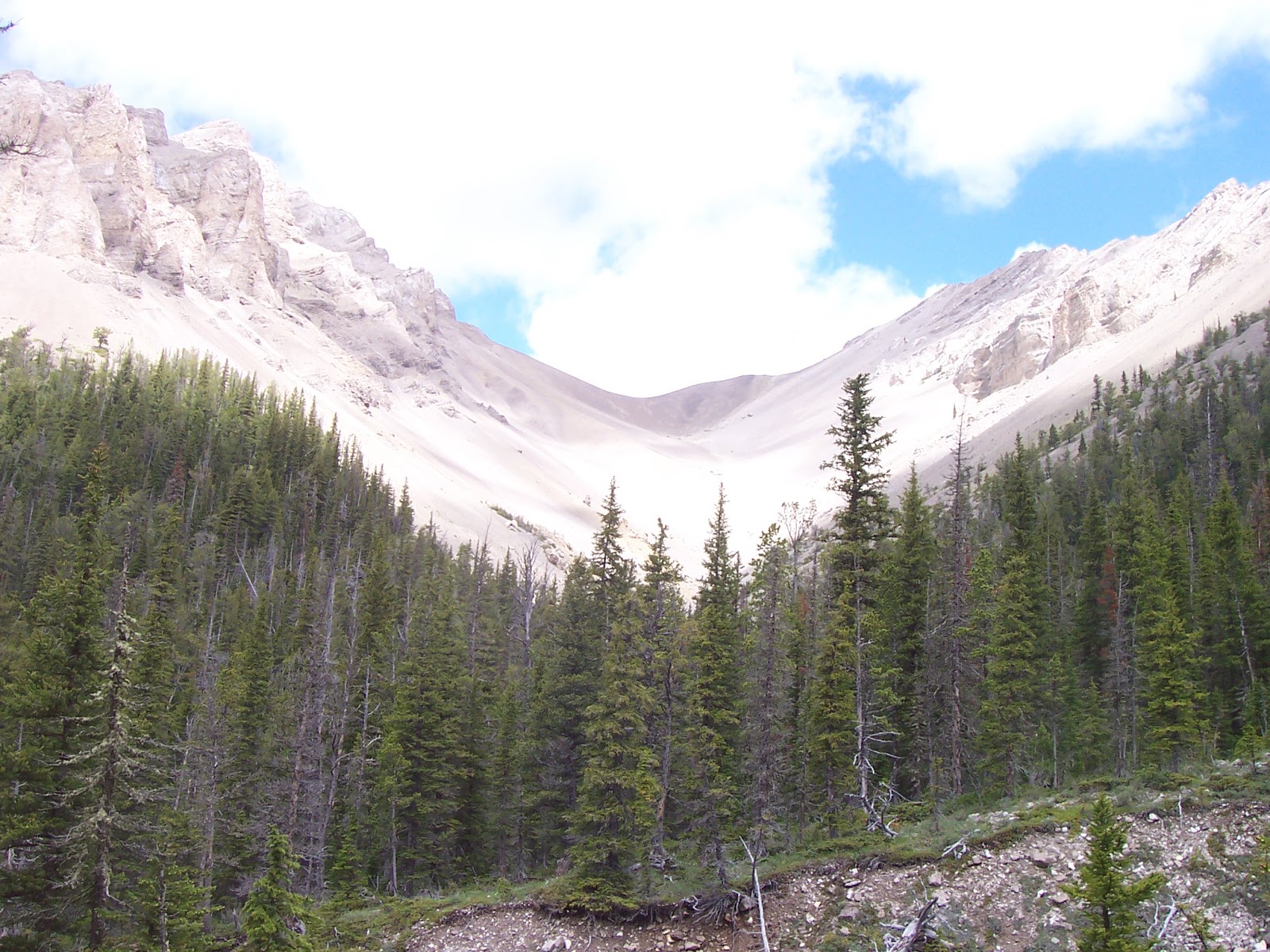
The Front has been controversial for years because of its suspected natural gas resources. It has been ruled off limits for exploration by the Lewis and Clark National Forest and is being studied by the Bush Administration, which could reverse the ban.
On the plane with me was Gene Sentz, the Choteau school teacher who is the push behind the citizen-based Friends of the Rocky Mountain Front, which opposes exploration and development of oil and gas there. He has brought numerous officials and media to the area to extol its natural beauty and wilderness qualities which he believes would be destroyed by such development.
The first Wednesday flight included a video-photographer working on a Public Broadcasting System film on the area. Tuesday’s flight included a Great Falls television crew.
The five-seat Cessna, single propeller plane took off from Choteau Airport at 6 a.m., and for an hour smoothly plied the sky under EcoFlight president and pilot Bruce Gordon from the South Fork of Teton Creek north to the Swift Dam area and as far back as the North Fork of the Sun River. Other flights went as far north as Pincher Creek where Canadians have developed their oil and gas reserves in their version of the Front.
Features in the Bob Marshall like Pentagon and Silvertip peaks, North Wall, Rocky Mountain peak and the northern part of the Front could clearly be seen in the muted shadows of sunrise. Passengers were awed by the upthrust limestone peaks, reefs, and parallel valleys.
Special attention was paid to the Blindhorse Creek area, in the Choteau peak area, where a Canadian exploration company has staked potential well sites.
Sentz said the plane was rented from EcoFlight under a grant and contributions from individuals. He seemed pleased by the response to the flights.

Monday, July 25, 2005

Glacier Mountaineering Society week

GMS group comes off top of Mount Grinnell

On top of Elk Calf peak in Badger Two Med, looking toward Glacier Park
Mark Hertenstein works his way down to Iceberg Lake from Iceberg Notch

I spent the last week enjoying the companionship of fellow climbers at Glacier National Park during the annual Glacier Mountaineering Society’s gathering.
Throughout the week skilled leaders took climbers on many of the classic routes detailed in the late J. Gordon Edwards’ “A Climber’s Guide to Glacier National Park,” (Falcon).
I did seven climbs and traverses, four of which I had done previously, but satisfying, nonetheless: Grinnell Mountain, Lone Walker peak, Mount Reynolds Grand Traverse (which I led), the Ptarmigan Traverse with descent through the Iceberg Notch, and Divide Mountain. During one of my “rest” days I also climbed Elk Calf and Flattop mountains in nearby Badger-Two Medicine Wilderness Study Area of the Lewis and Clark National Forest.
It was also a time to commemorate Edwards’ life. He died a year ago during the week, stricken with a heart attack at age 84 on Divide Mountain.
He was celebrated in a memorial event at the St. Mary Visitor’s Center.
That was a lot of activity over 7-days. It was very windy most of the week, but sunny and warm, too.
It is hard to pick out which of the trips was most spectacular. Each has its own special beauty.
· The views from Grinnell peak, located at the head of the Swiftcurrent valley at Many Glacier, were exceptional. You are able to look directly down on Grinnell Lake and Glacier, some 3,000 feet below. Our route was from the Loop on the Going to the Sun Highway, up to Granite Park Chalet, to the Grinnell Overlook, and across ledges to the summit ridge. We followed a herd of bighorn rams across the ledges between the Grinnell Overlook and the summit ridge. On the way down we got out our ice axes and used them on three large snowfields that hang off the ridgeline.
Coming off Lone Walker peak
· Lone Walker peak is located at the head of Upper Two Medicine Lake. We took the boat across Middle Two Medicine Lake, hiked to Upper Two Med, put on out water shoes and walked the shoreline to the base of the mountain where we traversed scree to a goat trail to a saddle between Lone Walker and Helen peaks. We scrambled the north ridge to the summit cliffs-cap about 700 feet below the top. We then took a route through the cliffs, many Class 4, to the top. It would have been easier to traverse to a west ridge, but our route was very interesting and thrilling. We scrambled down through these cliffs, returning to the boat dock at nearly 10 p.m., a long and exhausting day!
GMS group comes off Mount Reynolds on Grand Traverse
· Mount Reynolds Grand Traverse. We were honored to have Jane Edwards, a distinguished climber and the daughter of Gordon, join us on this classic route that follows the diagonal goat trail across the face of the mountain, some 700 feet below the summit. Jane recalled stories of other climbs on this route, which she describes as her father’s favorite. One such was with a National Geographic Society photographer who dropped his film canister while lunching in a notch where it swings to the east face and down. Gordon surprised the photographer by retrieving it. That canister contained the photo that appeared on the cover of the Society’s book on the Continental Divide. Fifteen of the 16 climbers who started out reached the top. We got soaked by rain on the way down. Along the way we saw many mountain goats which provided many photo ops.
Here I am on Ptarmigan goat trail above Helen Lake
· Ptarmigan Traverse with descent through Iceberg Notch. Of all the hikes I’ve taken in the park, I consider this my favorite, the most scenic and most thrilling. It involves hiking to Ptarmigan Tunnel, leaving the trail at the tunnel and climbing on the ridgeline above it to the north where it meets a narrow goat trail that hangs in the cliffs for some four miles to Ahern Pass, where a snowfield plugs the pass and must be carefully negotiated (preferably with ice axe and crampons). Then it is a 700 foot ascent to the Iceberg Notch on the Garden Wall between Iceberg Peak and the B-7 Pillar. It is 2,000 foot straight down to Iceberg Lake on cliffs and ledges, and finally the trail and the 6 miles back to the trailhead. I was accompanied by Mark Hertenstein and Bill Labunetz of Great Falls. Hertenstein was our able route finder. Views all the way are exceptional. The goat trail hangs high above the Helen Lake Basin a couple of thousand feet below. We could watch mountain goats playing on the trail ahead of us at various points, and in the cliffs above us. We counted about 30 goats along the traverse. There are tremendous views of Mounts Merritt and Ipasha with their outstanding glaciers. I wish I could find a better word than “thrilling” to describe how it felt to negotiate this tiny trail, knowing that a slip could send you plunging thousands of feet over the cliffs. The sight of Iceberg Lake far below you from the notch is unsettling as well when you realize that’s your destination. The most frightening part of the trip for me was crossing the snowfield at Ahern Pass. I did it with an ice axe, but recommend having crampons as well for safety reasons. It took me 45 minutes to cross this field, post holing with the axe all the way. I think a slip on this field without proper self arrest would be fatal.
· Divide Mountain. This is a wonderful way to say goodbye to the park after a special week. Hertenstein and I scrambled this limestone sentinel at the park’s St. Mary entrance before noon after a heavy breakfast at the Park CafĂ©. The climb is just under 2,000 feet and passes by an interesting old octagonal lookout, long out of use. There are exceptional views of St. Mary Lake, and the heart of the park’s east side.
Mark Hertenstein on Divide Mountain near the Octagonal ranger station

Friday, July 15, 2005

Hike summer kicks into gear

A rock outcropping on way to Anaconda Hill on CD Trail

Atop Anaconda Hill, surrounded by alpine flowers

Renshaw Lake in Front from near top of Renshaw Mountain

A selfie on Renshaw
It’s high summer and the time to kick the hiking into high gear.
I was able to get out for a couple of mid-week jaunts, one was a Montana Wilderness Association hike on the Continental Divide Trail; the other, a solo trip in the Rocky Mountain Front at Benchmark outside Augusta.
It was a pleasure to take part in a trip led by Helena’s Andy Kukolax, who for years has conducted MWA hikes. He’s doing some 16 this summer for MWA. He is a gentle and knowledgeable leader who knows his territory.
He took us up Anaconda Hill (elevation: 7,152 feet) off the Continental Divide Trail a couple of miles south of Rogers Pass. We bushwhacked up Chambers Gulch to the trail and then followed it, getting off it to bag Anaconda Hill. The CD trail is wide and grassy with occasional outcroppings of red and green mudstone in this stretch, which allows fantastic views of the Blackfoot Valley, the Rocky Mountain Front, and Red Mountain in the Scapegoat Wilderness, which dominates the northwestern horizon. It is the highest point in the Bob Marshall Wilderness Complex at over 9,400 feet.
Even though this has been a good beargrass year, I was surprised to see how profuse it was along the CD trail and in the forest on the west side of the mountains. The hillsides were also covered in a couple of different kinds of buckwheat flowers, and we even saw some bitterroots on the top of Anaconda Hill.
From the top of the mountain we were able to view the nearby Anaconda Co. Mike Horse mine complex below us, which has been an environmental disaster at the head of the Blackfoot River (the river that ‘ran through it’). Some of the area on the hike in its lower reaches has been picked over by prospectors and miners.
Although it was in the 90s in Great Falls and Helena, our group enjoyed temperatures in the mid-70s and a nice, cool breeze to keep us ventilated.
All along the CD Trail we saw evidence of very active bears that had been turning over rocks and rooting underneath them. There were numerous piles of bear scat, particularly on Anaconda Hill.
Andy carried with him a copy of his book, “Ultralight Wildflowers Guide to the Central Montana Central Rocky Mountains.” This shirt-pocket-sized book, printed on waterproof paper is very handy and helpful, particularly in this year of spectacular flowers. The book is available from Andy or from Amazon.com.
I was thankful that Andy feels comfortable to take his groups bushwhacking. We saw territory that those confined to trails will never see. We covered about 9 miles and an elevation gain of just under 2,000 feet.
Because the weather cooled off some on Thursday, I went back out again, this time to retrace a backpack trip I had taken 20 years ago in the Front.
My goal was to see if I could get to Renshaw Lake and back comfortably in a day hike, taking Benchmark Creek trail up and Fairview Creek trail back, encircling Renshaw Mountain.
I was on trail at 10:15 a.m., and back to my car by 5:15 p.m., some 7 hours later, after hiking an estimated 16 miles and gaining 2,700 feet.
It’s funny how after 20 years your mind plays tricks on you. While I remembered the lake pretty well, I had forgotten much about the hike.
Benchmark Creek was more wooded and shaded than I had remembered it, although there were several stretches in a tight limestone canyon. Fairview Creek was more open and offered better mountain views than I had recalled.
So, I was most satisfied with the hike.
The Benchmark Creek Trail is a quick way to get up to the top of Renshaw Mountain, but since I had climbed that before, I aimed instead for a prominent (8,012 feet) unnamed peak just to the west and above Renshaw Lake. It was a 500 foot scramble from the trail and a great place to have lunch. I had views of the Front, the Bob Marshall and Scapegoat Wilderness Areas and the lake below.
The lake is an emerald gem that sits at 6,500 feet in a heavily wooded basin between this unnamed peak and Sheep Shed Mountain to the east. Sheep Shed would be easy to climb from here.
Creek crossings are a constant on this trip, but none unreasonable. Despite the wet year, I was able to cross all the creeks without getting my feet wet.
Reaching the lake is particularly satisfying because there aren’t many high mountain lakes in the Rocky Mountain Front. This was cool and shaded and would have made a wonderful camp. I recall pulling big cutthroat trout from its water years ago.
The hike is really a traverse around Renshaw Mountain, a large, flat block of limestone that dominates the horizon, particularly when you are on the eastern front of it.
This is horse country and I caution other hikers that the trail is wide in spots and chewed up in others.
The horses from the dude ranches along the Benchmark Road have set down so many trails that it was difficult to pick out the right trail.
On the way back I missed the cutoff trail that traveled through above the road and wound up walking the last mile and a half on the road itself back to my car.
Nonetheless, this is a lovely, if strenuous hike and one I’d recommend.

Sunday, July 10, 2005

Through the Sluice Boxes

Katie on one of the many crossings

Through the train trestle

Reenie and Bruce Rohrer

Katie takes a bath
Sluice Boxes State Park may be the best kept outdoors secret in the Great Falls area.
Yes, the teen-age party and cliff-jumping crowd may be clued in, but somehow those looking for a spectacular day hike in the area somehow forget about it.
The park is a narrow strip that covers awesome limestone canyons and emerald Belt Creek, 32 miles east and south of Great Falls on U.S. 89.
There are no designated hiking trails, but unofficial trails braid its canyon bottom and along its west slope.
The easiest way to get from one end at Riceville to where the bridge crosses Belt Creek on the Logging Creek Road, is to follow the former bed of a railroad track.
A narrow gauge railroad train used to ply this canyon from Great Falls to Neihart where ore cars would be loaded from the mines there and hauled back to Great Falls for smelting.
The 1953 flood tore out the trestles and by the early 1970s the canyon had pretty much been reclaimed by hikers and fishermen.
Those hiking the area see the remains of the old railroad; many ties are intact along the trail; there’s an impressive tunnel to walk through; concrete supports are still in place; and intricate rockwork shores up many crossings.
Around every corner there’s something interesting to see, from the limestone spires to the twisting creek, to an architecturally interesting double-topped limekiln at the mining ghost town of Albright. There are a number of intact buildings, ore cars and iron rail at Albright.
Depending on which route you hike through, there are between five and 15 crossings. Some of them can be quite deep.
On our trip Saturday the water was as high as I’ve seen it in the past dozen years. It went waist deep on several crossings.
I’d advise waiting a couple of weeks for the water to recede before doing this hike.
I wouldn’t discourage fishermen from hitting either the Riceville or Logging Creek Road bridge areas and wading up the creek from either of those ends.
There are two pretty good access points from the north: Riceville and about two miles up the Riceville Road from the bridge to a well-marked parking area. I like this higher-up starting point. It approaches Belt Creek from a limestone canyon from the east and is on a trail about 100 feet above the creek. At the beginning of the hike there is a little waterfall.
Approaching the park from the South means taking the long, gravel road from Stockett or taking U.S. 89 to the Logging Creek Road, which drops significantly to Belt Creek and is rutted and rocky and one-track in several spots.
To hike through, you’ll need to ferry a car to your end point, but well worth the effort.

Monday, July 04, 2005

Poia, Scarface, Morningstar mountains

Approaching Scarface

On the way to Scarface

Coming off Scarface, heading to Morningstar
Since I first heard it, I’ve been taken with the Blackfeet legend of Poia, a story analogous to the Christian redemption story of Jesus.
Walter McClintock, for whom a Glacier Park mountain is named, first recorded the story in his book, “The Old North Trail,” after spending a winter with the Blackfeet in the early 20th century.
Poia is the son of the Blackfeet God Morningstar and Blackfeet maiden Feather Woman. He is afflicted with a facial scar given him by the all-powerful Sun-God Napi for a transgression by his mother, and thus, his nickname, “Scarface.” He and his mother are banished back to earth. The legend tells of Poia’s journey back to the Napi, who removes his scar and sends him back to earth to teach the Blackfeet the Sun Dance.
McClintock was so impressed with the legend that he invited American composer Arthur Nevin to the Blackfeet camps, which resulted in the opera, “Poia” that premiered in Pittsburgh in 1907 and was last performed in Berlin in 1910.
The Great Falls Symphony took on staging the opera as the centerpiece of the “Explore the Big Sky” celebration of the bicentennial of the Lewis and Clark Expedition through Great Falls, a national “signature” event.
Because I was so excited by the legend and the thought of the opera performed here, I set out to climb Poia and Scarface mountains in the Badger-Two Medicine Wilderness Area, south of Glacier Park.
Two years ago I did Poia (elevation: 8,274 feet), and last fall Scarface (elevation: 8,282 feet).
These mountains are adjacent to one another in a drainage off Small Creek in the Badger-Two accessible from the North Fork of Birch Creek out of Swift Reservoir west of Dupuyer.
That third mountain in this “cluster” is Morningstar peak (elevation: 8,376 feet).
Last weekend, I had my heart set on climbing Morningstar in advance of Sunday’s performance of the opera “Poia.”
It is on a ridgeline that drops off 700 feet from Scarface.
When I was on Scarface last fall I studied this ridgeline and estimated that it would be possible to climb Scarface and then Morningstar in a daytrip from Great Falls.
I failed to do that last fall because the days are short in October and I ran out of daylight and had to turn back after Scarface.
Hertenstein had been wondering if it was possible to climb all three peaks in a day. I thought not because of the tremendous amount of elevation one would have to drop and then regain to get each of the mountains. I didn’t think one day would be enough.
On Saturday I was proven wrong!
We did all three mountains despite strong winds and occasional rain showers. We even had a few moments of snow showers on the top of Morningstar.
From my earlier hikes I had discovered a great elk trail high above the west slope of Small Creek that led through dense timber to tremendous meadows just below the ridgeline. Small Creek is about 4-1/2 miles up the North Fork of Birch Creek Trail No. 121 from Swift Reservoir.
That elk trail eventually leads to an open basin framed by the Scarface ridge on the west and the Poia ridge on the east.
To climb Scarface, follow the basin below the ridge nearly to its end and scramble up a low point. Once on the ridge you’ll see three “peaks.” The middle peak is the high point. The first time I did this I climbed all three just to make sure I bagged the named summit.
It is a simple scramble up scree to Scarface.
On top Morningstar finally comes into view.
The ridgeline down to it is a tad gnarly, but doable if care is taken.
On the valley floor between the three peaks
While doing it we could look back across the base of the three peaks and could see a low saddle between the false east summit of Scarface and Poia.
At that point we decided to go for that saddle to climb Poia, which would put a perfect cap on our day.
It meant descending Morningstar some 1,300 feet to the basin below and then climbing about 500 feet back to that saddle and another 700 feet to the top of Poia.
The descent was through easy scree down Morningstar’s south ridge and onto a carpet of alpine flowers. The hike up to the saddle was easier than I had expected but involved some side hilling.
Then it was a slog through the limestone scree to the top of Poia!
One unusual side story about our time on Poia was that while we were taking a break, Hertenstein laid down his pack in what we thought was a sheltered area, and the wind lifted it up and sent it down the mountain’s face, never to be seen again.
The views from all three mountains are remarkable. The Badger-Two Medicine, Bob Marshall, Rocky Mountain Front and Glacier Park peaks are all highly visible.
What are impressive are the high-above-timber-line peaks of the Badger-Two. There’s a lifetime of trips in this area.
Our hike began at 8:22 a.m., and we returned to our car at 8:45 p.m.
Oh, the opera!
What a wonderful performance, a perfect complement to a perfect mountain climbing trip.

Atop Poia

Down the valley from Poia top

Sunday, July 03, 2005

An expressway to the 'Bob'

Looking down from Werner

My solo extra lite camp

The Front at its best
I like to think of the West Fork of the Teton River area as my “expressway” into the Bob Marshall Wilderness.
This is where only a single mile of hiking can deliver you into wilderness solitude.
Such was the case earlier this week when I decided to complete a couple of trips I started in the past.
One was a hike up the entire East Fork of the Teton Trail No. 108 to the pass and climb Mount Werner (elevation: 8,090 feet). The other was to see where the North Fork of the Teton Trail No. 107 might take me. It led me over a pass and down into the South Fork of the Birch Creek country where I climbed Bum Shot Mountain (elevation: 7,544 feet), remote from any starting point.
I had been focusing on these hikes more intensely since last winter after I rented the Forest Service West Fork administrative cabin. We made it up the East Fork a ways on cross-country skis and turned back. I was concerned that since it led to a pass above Blackleaf Canyon it might be avalanche-prone. My hike on Wednesday dispelled that concern. It looks as though this would be a great winter route, although I’m not too sure about potential avalanche hazard on the Blackleaf side, where there are steeper walls tighter in on the trail.
The hike follows the East Fork to its source below Werner. The East Fork is hemmed in by forest most of the way. High limestone headwalls and spires crown these forests. Columbine is in season along the floors and slopes.
Werner is actually three separate 300-350 foot bumps on a ridgeline above the pass. It is a 2,400-foot climb from the trailhead to these bumps.
My original plan was to backpack a loop up the North Fork, around Old Man of the Hills Mountain, across the backside of Volcano Reef, and down the East Fork.
However, it had been raining steadily in Great Falls and I figured I could still salvage the trip by car camping at the West Fork campground.
When I finished the East Fork-Werner climb, however, I realized that it would be a mistake to camp with the cars and sprinted back to my car, repacked my backpack and went back to where the East Fork dumps into the North Fork and set up my backpack camp ---- an 18 minute, 1-mile walk from the car.
That set me up nicely for the second day of hiking, completing the North Fork trail.
Bum Shot Mountain
In years past I had hiked this trail only about three miles in, as far as Bruce Creek where it picks up Trail No. 152 to Corrugate Ridge on its way to the South Fork of Birch Creek.
As with the East Fork trail the day before, I wondered if there would be good cross country ski possibilities from the West Fork cabin to the trail’s end.
Another possibility I had in mind was to drop over to the Birch Creek side and climb Bum Shot Mountain.
The hike up the North Fork was more of the same --- mostly in deep forest with the creek in hearing distance and with little elevation gain for the first several miles. There were exceptional mountain views in meadows where tributary streams flowed into the creek. Nanny Creek was one such place, about 4 miles in. I think this would be primo backpack spot, with views of Mount Patrick Gass.
Not long after Nanny Creek the trail starts gaining elevation and then begins to switchback to the Birch Creek divide. On these switchbacks Bloody Hill, which sits just north of Patrick Gass comes into view. It is a classically beautiful peak with a high cirque east face. I figured out that it could be climbed from that Birch Creek divide along a timbered ridgeline. Later, I realized that I could have used a ridgeline from Bum Shot Mountain to climb it and return to the pass and North Fork trail. That’s for another trip.
I was no in the headwaters of Phone Creek, a main tributary of the South Fork of Birch Creek, and began losing elevation quickly on my way to the foot of Bum Shot. In about a mile and a half I reached a crossing of the creek and at that point decided to climb the mountain, reaching it by way shooting for a saddle adjacent to the mountain just above this crossing. I climbed nearly 1,300 feet to reach the top of this limestone peak, which is a very narrow ridge, some 2 miles long.
The ridge to the peak ascended and fell, but the views from the top were well worth the effort. Immediately to the east was Bennie Hill, which I climbed last August. Behind that on the horizon was gleaming white Walling Reef. I could see Patrick Gass and the ridge to Bloody Hill to the southwest. To the southeast a massive, unnamed ridge stretches the length of the trail from the East Fork to Bennie Hill and is higher than any of the unnamed peaks immediately around it. To the north were the high peaks of Birch Creek: Crooked, Drewyer (Droulliard), Field, Richmond, Sentinel, Morningstar, Poia, Scarface on into Glacier Park.
I bushwhacked down off the peak’s north end off an east-sloping ridge to Phone Creek, and hauled back to my camp, about 9 miles south.
Every time I enter the Bob Marshall Area, I realize how incredible and huge it is, and the great number of lifetimes it would take to see it all!