Monday, May 31, 2021

Another week's worth: Devil's Glen, Pioneer Ridge exploratory, Muddy Creek Falls

 
The Elk meadows adjacent to Pioneer Ridge in Little Belts

The Falls Creek Falls, with some snow above it


Dearborn River Devil's Glen

Lupine in the Muddy Creek valley, one of my favorite wildflowers

Muddy Creek Falls 

In the Muddy Creek canyon, Gordon Whirry makes his frigid way across

 I returned to three old favorites this week --- the Dearborn Canyon's Devil's Glen, and an exploratory on the Pioneer Ridge in the Little Belt Mountains just east of the Belt Creek Ranger Station, and Muddy Creek Falls on the Rocky Mountain Front.

The weather has been almost summer-like --- clear skies, light breezes and warm temperatures.  Hard to believe that we've cross country skied on this week in previous years.

I can't help myself wondering about the mindset that would provoke all the private property protectiveness (selfishness) in the Dearborn Canyon beneath magnificent Steamboat Mountain.

There are now hard-fought narrow easements into the Dearborn Canyon and the Falls Creek tributary. 

The posted land signs and fences are numerous and obnoxious in this area, where landowners whose land abuts the public land.  These landowners benefit copiously from their access to the public lands, but are stingy when it comes to public access to public lands.

Yes, they have granted a very narrow strip to Devil's Glen and now there's a more generous right of way to Falls Creek in the past year thanks to the Rocky Mountain Elk Foundation.  Falls Creek had been closed to public access for many years previous to that.

This is the area where a landowner was murdered by a neighbor in a property dispute.

On hilltops high above Falls Creek are cabins, and along the now closed road to the Dearborn, are large cabins and lots of posted and no trespass signs that keep hikers to the thin strip that parallels that road.

I hiked both Devil's Glen and then to the Falls Creek Falls --- both easily done in a day hike. I wanted to see the spring runoff churn on the Dearborn and over the Falls Creek Falls, and was not disappointed.  On the Devil's Glen portion I checked out the climber's informal trail up Steamboat and was surprised to see how improved it is.  I suspect the students from the nearby Wilderness Bible Camp have been hammering it.

The following day I wandered back into the Little Belts and old-favorite Pioneer Ridge, reversing my route from a couple of weeks, going up the trail and back down through the grassy elk meadows.  There was very little snow and no ticks.  I did a little exploring, going beyond the 7,000 feet high point where I usually stop.  I found a pair of binoculars that appear to have been left by a hunter last year in the meadows.  There were gorgeous wildflowers throughout the hike, particularly bluebells.  The trail crew had still not been through, so I had to wade my way through and around a considerable number of deadfalls.

The week's capstone hike had to be Muddy Creek Falls, an off-trail trek west of Bynum below Mount Werner. 

This hike is spectacular all the way, on a route that follows the rocky  stream-bed, which is dry for nearly a mile.

The falls are located in a deep Zion Park-like canyon, which still had some snow in it.

The canyon is narrow enough that it is impossible to navigate it to a view of the falls without getting your feet wet in the water, made even colder by the snowmelt.

What makes this area so special is that it has been reclaimed from extensive natural gas exploration and even production ---- there's still an old well pipe visible adjacent to the stream and old production roads now being reclaimed by nature.

The development has been halted and this area is a favorite of grizzlies.

Despite a gorgeous day we saw only one other (very odd) party of two backpackers going to the site, which may be the most spectacular on the Front.

It had been several years since I've done this trip and I was surprised to see the erosion that has created high banks on the creek.  The old "trail" had disappeared to the erosion in many spots.

After enjoying a leisurely lunch at the base of the falls we left the canyon on the north side of the creek, ascending in the rock, climbing about 400 feet, looking for a ridge line before descending to the floor again where we got great views of the cliffs to the south and the greening of the hillside as the aspen has begun leafing out. 

Then we turned back uphill and grabbed a lower ridge, which we walked out.

I was delighted by the flowering of the lupine, one of my favorite wildflowers.  There were numerous arrowleaf blooms as well.


Wednesday, May 19, 2021

Snowstorm approaches ending a week of real Spring weather --- Lime Gulch again, Glacier, Highwoods, Sluice Boxes

The Sluice Boxes State Park

Mike and Camille on Lime Ridge

Katie on Sun Point on St. Mary's Lake in Glaicer

Windy Point in Highwood Mountains

 I'm writing this as we prepare for a blast of winter after a week of glorious spring weather, with temperatures that had reached into the 80s.

This past week we returned with friends to the Lime Gulch Ridge in the Rocky Mountain Front, hiked the Sun Point to St. Mary's Falls shoreline trail in Glacier Park, did the Thain Creek-Briggs Loop that included Windy Point Peak in the Highwoods, a strolled a couple of miles in the Little Belts in Sluice Boxes State Park.

It was all so glorious.

Many of the Spring alpine flowers were in bloom, the aspen are leafing and the ticks are out.

I'm battling vein disease in my lower legs --- the valves that pump the blood back to the heart from my feet aren't working, causing blood to pool, causing the legs to be tired and achy.  The vein specialist has me in compression socks that help some.  I'll be wearing these until August when I expect he'll inject the failing veins with a chemical that will shut them down, redirecting the blood.  He said it could be a combination of overuse, age or heredity.  I find it downright scary.  It has made me loggy, not wanting to do much.  When I exercise the doc says the calves pump the blood upward.  He said keep active.

This started in February.

The Lime Ridge hike redux was really fun in the company of Mike Dannells and Camille Consolvo.  We found fresh grizzly tracks on the hike.

We did Glacier on a Sunday, which was probably a mistake, because this part had been opened to the public only the day before and it was a weekend, attracting a sizeable crowd, particularly at St. Mary's Falls. We were impressed by the massive amount of work trail crews had done clearing away the winter deadfall, much of it blowdown from a forest fire.

The upper reaches of the Highwood Mountains still have tons of snow, but the lower elevations, below 6,000 feet, were clear.  It was fun to go up Windy Point Peak for a 360 look at Central Montana.  I drank from a mountain spring, enjoyed wildflowers and even saw a beaver in a pond on Briggs Creek.

Sluice Boxes is a real Great Falls area treasure.  Belt Creek is running a bit muddy and high from spring runoff.  I bumped into three other parties enjoying this hike through towering limestone cliffs, including a young Mom with her six-month old baby.

Friday, May 14, 2021

Lime Gulch ridge walk


 Lime Gulch is a gorgeous, if often ignored Rocky Mountain Front destination.

It is located just up the Willow-Beaver Creek Road from the Girl Scouts' Camp Scoutana.

There's a well-marked trailhead sign for Trail No. 267 on the Helena Lewis and Clark National Forest.

We wound up there on Wednesday because we were looking for a place to hike on the Front after a major snowstorm.  I figured with its south and west facing slopes it would have scant snow, and that turned out to be the case.

While I have made several other trips to this gulch, it had been 16 years since I last walked the high ridge flanking the east side of it.

I didn't remember much about that trip, taken during an extremely open 2005 winter day in February.

What was interesting about our hike Wednesday was the ease with which we could reach the ridge line, and a discovery (for me) that there is another wonderful trail that travels above the bottom-hugging Lime Gulch Trail.

We parked at the trailhead and walked roughly half of a mile to where the trail turns north up the gulch.  Instead of following it, we continued toward that east ridge and after jumping across a small stream found a good path that zig-zagged to the top of the ridge, just opposite the McCarty Hill cliffs.

It was about a mile and a 600 feet elevation gain to the ridge line.

The views on this open hike were immediately remarkable --- of McCarty, the wall on the west side of Lime Gulch and Fairview Mountain beyond.

The long walk across the top of the ridge was typical Sawtooth Range hiking, jumbled limestone. 

There's still good snow in the Scapegoat and Bob Marshall wilderness areas, which are visible from this ridge.  We were also entertained by views of mountains like Castle Reef and Sawtooth, from aspects to which we aren't accustomed.

We hit small patches of snow.  At one of them near our lunch stop we noticed numerous grizzly bear tracks.  We practiced our bear spray quick draw at this point.

We walked north along the entire ridge, descending steeply to the Cut Reef trail, which connects to the Lime Gulch Trail.

We crossed a large snow field and my inclination was to head straight down the gulch along the bottom as I've done on other occasions.  My partners had other ideas, spying a high and well used trail above that which weaves in out of the trees and through snow patches. We found snowshoe tracks.

We followed the trail all the way out to where it joined the creek bottom not far from the trailhead.  It is not marked and you wouldn't know it was there, unlike the trail that runs up Lime Gulch bottom.

I'd have to say that I liked this high trail better than the 267 bottom trail.  I suspect it is an old hunter's trail that the Forest Service is not maintaining.

With the discovery of the good trail up the east ridge and the high trail above Lime Gulch this trip was a great exploratory venture.

My GPS showed an 8.1 miles hike with a gain and loss of more than 2,500 feet of elevation. Our high point was 7,485 feet, although Mark Hertenstein recorded 7,500 feet on his GPS.

Gordon Whirry imposed our route in purple over an earlier hike up Trail 267 in black to show the relationship of the upper and lower Lime Gulch Trails


My GPS recording of the trip


Saturday, May 08, 2021

Warm weather arrives: Pioneer Ridge loop; both sides of Rogers Pass

Rodgers Peak looking south

Red Mountain, high point in Bob Marshall complex


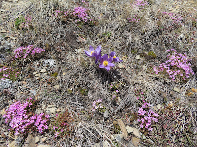
A Pasqueflower in a Douglasia bloom

The first of the glacier lilies

Old friends Gene and Linda Sentz

 Glacier lilies are a sure harbinger of good hiking weather and they were out Thursday as I tested myself by hiking to the ridge lines on both sides of Rogers Pass on the Continental Divide Trail.

On Tuesday I did a similar hike, this time a favorite loop in the Little Belts from the Pioneer Ridge starting near the Belt Creek Ranger Station.

They are roughly similar in distance and elevation gain.

The Little Belts have more snow, particularly on north-facing slopes.

There are more flowers at Rogers Pass,

Both are hikes which I use to tone my conditioning.

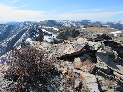
At Rogers Pass park the car at the pass sign near the stair steps.  Look across the road and a little to the left and you'll see a snowmelt stream.  There's a prominent ridgeline to the left of the stream.  Start up steeply.  There are quite a few deadfalls for the first couple hundred yards, but they give way to grass and rock which you can follow all the way to the top of Rodgers Peak, some 1,500 feet and 1.15 miles above you.  There are two patches of trees beyond the deadfall, but it is easy to work your way through them.  I chose this route because it was clear of snow, while the Continental Divide Trail is still covered. The payoff are exceptional 360 degree views.  Mount Powell, the highest point in the Flint Creek Range is visible to the southwest above Deer Lodge; west, Red Mountain, the highest peak in the Scapegoat and Bob Marshall complex raises its snow-covered flanks to 9,411 feet. There were displays of Douglasia alpine flowers, as well as Pasque flower. It took me just under an hour to the top without pushing it, but I was also practicing a new breathing technique that distracted me.  I've been reading John Nestor's, "Breath," about avoiding mouth-breathing, and found sucking air and exhaling through the nostrils very difficult.

Once back at the pass, the stair-steps lead to the Continental Divide Trail.  I had spied this trail to the ridgeline from Rodgers Peak and figured a route around the snow.  The trail is covered with it.  At a bend in the designated trail just above the large, colorful outcropping, I left the trail and entered the grass, which I stayed in to the ridge. While still on the trail I was treated to an encounter with Linda Sentz, who was photographing flowers.  Her husband, Gene, was above her sitting on the higher outcropping above the grass, enjoying the views.  It was a delight to visit with these Choteau hikers.  There were also lots of wildflowers out on this side of the pass, including the beginnings of a glacier lily bloom, a real treat to the eyes.

There weren't nearly as many flowers out on my Little Belts hike, one of my favorites when I don't have much time.  There is a lot of deadfall here, too, particularly on the first quarter-mile of the Pioneer Ridge Trail and on the abandoned Forest Service Trail atop the ridgeline.  There was a ton of snow below that ridgeline, which I skirted by staying on top.Combined, I had covered 4.1 miles and gained more than 2,100 feet.

Pioneer Ridge Loop


Rogers Pass ---- both sides


Sunday, May 02, 2021

Putting up the skis, Priest Butte, Mount Sentinel and Wagner Basin loop

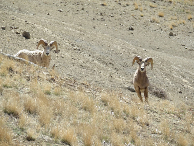
Two curious bighorn rams didn't seem fazed by us in Wagner Basin

Gordon Whirry on Wagner Basin ridge line

The incomparable Castle Reef scenery

Bighorn ewes pose for us
My official 73rd birthday photo on Priest Butte


Exploring Priest Butte gullies

 It was a busy Spring week with my last ski of the season in the Little Belts to a Priest Butte hike above Freezout Lake on my 73rd birthday, followed by a drive to Missoula for my annual climb of Mount Sentinel, to a spectacular Wagner Basin loop hike in the Sun River Canyon where we saw some 30 bighorn sheep and alpine wildflower displays.

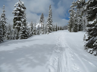
There was new snow in the Little Belts up high on April 26, but it was wet and heavy, making tele turns tough.  I called it quits after climbing up the Golden Goose run.

My last ski of the season on heavy, wet snow on Showdown

It was the second time I've done Priest Butte this Spring, this time led by my wife, Katie, for Wayne's Wednesday Walks.  Our small group of five enjoyed the 360 degree views under sunny skies and a breeze. It was Wayne Phillips' first time up this landmark and he loved the hoodoos, the fossilized dinosaur tracks, the rocks left by the Indigenous people pointing toward the distant Sweetgrass Hills to the north and east, and the snowcapped mountains of the Rocky Mountain Front.   

After this short hike, Katie took three of the group for a scramble up McCarty Hill near the old Scoutana Girl Scout camp, and I had to return for a doctor's visit.  I've been struggling with tired and heavy legs that the doctor diagnosed as vein disease and then fitted me with high compression socks as a stop-gap.

This is a worrisome development.  I have no problem when I stay act and walk, hike, ski or climb, but the legs ache and my ankles feel like there are weights tied to them when I'm not active.

We drove to Missoula on April 29 where I tried out those new compression socks and climbed Mount Sentinel, something I do every year.  We had a beautiful spring day, saw a few alpine flowers and the traffic on the mountain was light.

The highlight of the week had to be the 4.5 miles, 1,450 elevation gain Wagner Basin loop in the Sun River Canyon.  The weather was perfect, with blue skies, temperatures in the 50s and a breeze.

This canyon offers some of the best scenery in the Rocky Mountain Front outside Augusta, where the translucent, emerald Sun River comes of the mountains onto the Great Plains between two of the iconic Front peaks ---- Sawtooth and Castle Reef.

A series of parallel gulches come into the Sun at 90 degree angles.  The Sun is blocked by the Gibson Dam, that creates a giant reservoir.  The Bob Marshall Wilderness lies beyond.

It is an area rich in wildlife.  We were privileged to see some 30 bighorn sheep or so on our hike --- 14 rams, some in full curl in one group, and two separate groups of ewes and youngsters.  They seemed very tolerant of our presence and we were able to spend considerable time shooting photos.

The alpine flowers made quite a show, particularly the purple Douglasia and Yellowstone draba.  There were shooting stars, and Pasque flowers. 

Warning:  the ticks are out.  I picked up four.