Tuesday, June 29, 2021

An early summer heat wave puts brakes on hiking; Fairview, Rogers Pass


Lots of Forget-Me-Not flowers below the summit ridge

Katie's girls on the summit

Good snow patches on north face below the summit

So beautifully green

Never did I think that Portland and Seattle would have high temperatures during the summer far surpassing our own, but it happened this week.

Portland, where my daughter lives, went to 116 degrees, the highest on record and several days in a row above the century mark.

Those temps are migrating this way in a wave that shows the thermometer above 90 for nearly 10-solid days at the very beginning of summer.  I can't imagine what happens when the July/August divide arrives.

Before this streak we got out and climbed Fairview Mountain on the Front outside of Augusta and went bitterroot hunting on Rogers Pass.  We saw our first Beargrass of the season near Rogers Pass.

These are both annual events.

I led a group of five of Katie's "Girls in Glacier" hikers up Fairview, a 8-mile climb with an elevation gain of just about 3,000 feet.

The wildflowers, particularly the forget-me-nots just below the summit ridge were outstanding.

I'm still hoping for some backpacking time when this heat wave breaks.  Soon?


Monday, June 21, 2021

A return to East Glacier Park, a post Covid report

The Beargrass bloom has begun

Nice snowpack on Rising Wolf Mountain

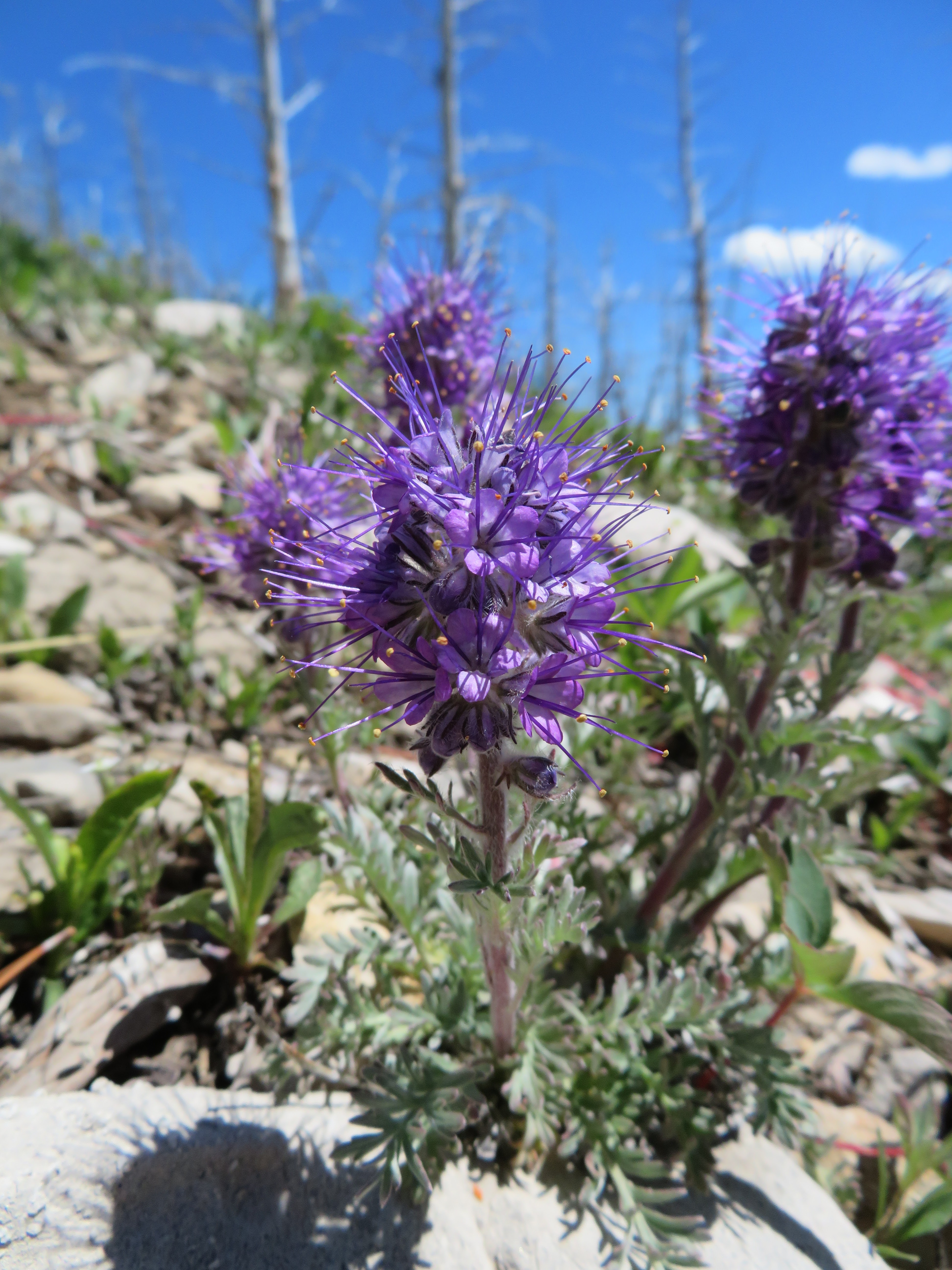
The various shades of orange Indian Paintbrush

Twin Falls

Some of the trash we found on the trail

Katie at the west end of Two Med Lake

 Against my better judgment I returned to East Glacier Park for an overnight stay at the Mountain Pine Motel for the first time since its owner and good friend Terry Sherburne died of cancer three years ago.

Over the past 40 years the motel has been a go-to for my family as a jumping off point to explore Glacier National Park and enjoy the quirky East Glacier Park environment, with its small non-chain restaurants, bakeries and artsy shops.  We sorely missed this part of the park, which was closed last year by the Blackfeet Reservation Covid shut-down of the east side of Glacier.

I've been hesitant to return because of Covid, but felt it was safe to take the risk with my vaccinations.  Also reports of throngs of people returning to the park, the new reservations requirements on the Going to the Sun Road, and the road construction tie-ups on Highway 2, Many Glacier Road, and the North Fork Road.  Ugh.

The Mountain Pine is being run by Terry's nephew, Ryan, who has done major upgrades and who is very personable and service oriented.  Our stay was very pleasant.  We were touched to hear that on Saturday some of Terry's ashes had been scattered on Scenic Point.  We would have liked to have been present to honor our friend.  Now we know he'll always be there.

Unfortunately, some of the town's restaurants still haven't reopened, so eating out must be built around the Glacier Park Lodge (and its outsized prices), the Whistle Stop, which has reduced hours, Brownie's (bakery), Serranos (new owners) for dinner, and a new restaurant next to Serranos.  The village's mainstay, funky restaurant, the Two Med Grille, has not reopened since being shut down by Covid.  It is sorely missed.

Otherwise, we must have gone to the park on a lucky day.  Despite what we've been hearing about overcrowding, we found the park trails and facilities at Two Medicine not too badly crowded.

We hiked around Two Med Lake and visited Twin and Aster falls (about 10 miles), and encountered far less traffic than we expected.  The lack of foreign visitors is noticeable.  The Lodge employees also said they missed the foreign workers, mainly from Eastern Europe, who gave the Lodge an international feel.

On the down side, we found more trash on the trail than we had ever seen before.  I cut down a large dream catcher and amulet of gold glitters someone had hung on a tree at a creek crossing.  Katie brought out a sack full of trash from the trail and an outhouse near the Pray Lake boat dock.  We delivered this to the ranger at Two Med.

Even more outrageously, near the boat dock at the east end of the lake we bumped into a large family hiking with a friendly and rambunctious black lab dog.  We advised them that the dog was illegal on the trail and to their credit they turned around and headed back to the trailhead.  However, they never did put the dog back on leash even after being told to do so by the employees at the boat concession.  We followed the folks back to their car, which bore Florida license plates.

While the number of foreign visitors had declined there is a definite uptick in the number of visitors from the south, states like South Carolina, Texas and Florida.  The lack of familiarity with trail courtesies and civilities are very evident.

The main takeaways from our Two Med Lake hike were the lovely flowers in bloom, particularly the orange Indian Paintbrush.  The Beargrass has started.  The snow is clear on the Dawson-Pitimakin Loop around Rising Wolf Mountain, my favorite hike in the park.  Our East Glacier friend Laurie Lintner did the 18 mile trek solo on Saturday.  She joined us for supper at the Lodge.

I hope East Glacier returns to some kind of normalcy.

It is our favorite part of the park.


Friday, June 18, 2021

Rierdon-South Fork Teton Loop: covering some new ground

Going off-trail to gain the ridge line paid off with exceptional views

The view of Ear Mountain from the ridge

I don't think it was Native Americans who left this on the ridge

Looking south.


A favorite spot on the trip at the Deep Creek forks

Gordon, glad to be done with the snow chute

With a looming fire season heavy on my mind, Gordon Whirry and I set out on an early-season backpack trip on the Front/Bob Marshall area west of Choteau.

We were also taking advantage of a dramatic temperature drop, with temperatures falling from the mid-90s to the 60s and 70s.

This was a 21-miles loop that gained and lost nearly 6,000 feet over two days.  We climbed the unnamed high-point of a ridge (8,237 feet) between Rierdon/Slim gulches and Ear Mountain, hiked along a 2-mile stretch of Deep Creek, climbed out and descended along the South Fork Teton-Blacktail National Scenic Recreation Trail to the South Fork Road.

I thought I had seen nearly every part of the Rocky Mountain Front, but somehow I had missed that 2-mile trail that snakes high above the Deep Creek Canyon, comparable to the vast canyons in Yellowstone Park, and full of waterfalls.

We began this trip by returning to familiar ground --- Rierdon Gulch off the South Fork Road.  At a low saddle just north of the Rierdon-Slim divide we gained the ridge, walking up and down small peaks along the way with dramatic alpine views in all directions ---- Ear Mountain to the east, Rocky and Old Baldy peaks to the west, the Scapegoat country to the south and the Lockhart-Wright-Patrick Gass country to the north.  It was so clear that we could see the Sweetgrass Hills, the Highwoods, Little and Big Belts, the buttes to the east on the Great Plains. 

Given the unseasonably dry and hot conditions on the Plains I was surprised at how much snow there was, particularly on north-facing slopes, and in draws.  There seemed to be water coming from every direction, feeding spectacular displays of wildflowers.

We set up camp at the Green Gulch trailhead, but wished we had waited for Sheep Creek, only a half-mile beyond and even more scenic and closer to water.

We saw grizzly sign, but no grizzlies and were surprised at how little animal sign we saw most of the trip.

Our greatest challenges ---- aside from being 73-year-olds --- were climbing over many downed trees and snow.  We found the Deep Creek-South Fork Divide clogged with snow, running steeply down the drainage for more than 500 feet. We finally gave up trying to post-hole in the snow that covered the trail by dropping to the creek bottom where there was room to descend unimpeded, but eventually having to cross the snow when the trail moved to the east side of the creek.

We had this remarkable area all to ourselves and it was clear to us that we were the first to go down the South Fork portion of the trail.

I had hiked in the Deep Creek country about 33 years ago, and don"t know why I hadn't returned.  I thought I had hiked the South Fork Teton, but I didn't remember anything of it.

Not only is it empty but for hunting season and some summer dudes, but it may be some of the most scenic and wild part of the Front.

Luckily, much of this country was included in the 2013 Rocky Mountain Front Heritage Act that added it to the Bob Marshall Wilderness, but spots like Rierdon Gulch to the Slim Gulch divide and the South Fork Teton from the Deep Creek divide to the road, were not. 

This is tough country to access.

I hope I can get back there in this lifetime.


This is missing about a half mile and at least 300 feet of elevation.  I got my GPS started late


Monday, June 14, 2021

Catching up: the Wright of Spring, wildflowers at Rogers Pass, Mount Kennon, another Pioneer Loop

I encountered Brice Addison and Mary Gray on my way up Mount Wright

Looking south from the top of Mount Wright

Pentagon Peak in the middle of the Bob Marshall Wilderness

One of my favorite alpine flowers, the Jones Columbine

Pink Douglasia and blue Forget Me Nots dressed up the alpine landscape

Showy silky phacelia were in bloom

Hiking was on hiatus, as well as posting on this blog, as we traveled to Minneapolis to visit grandchildren we hadn't seen during the pandemic.

Before going, though, we checked out the alpine wildflower bloom on Rogers Pass, did a loop on the northeast edge of the Highwood Mountains, climbing Mount Kennon along the way, and I did another loop on the Pioneer Ridge.

Despite the high temperatures (it's going to be 100 degrees today!), Montana is a beautiful green, giving the state its temporary Irish-looking tint, if only for a short while.  As we drove across Montana to Minnesota we saw some evidence of drought, particularly in the Glendive region.  

Upon return I immediately decided to go up Mount Wright, just below 9,000 feet, the third highest peak in the Rocky Mountain Front.  It was as clear a day as I have ever had climbing this peak.  This is an annual spring trek to kick out the kinks.  I was delighted to bump into Dr. Brice Addison and Mary Gray, who had hit the summit and were coming back down as I was a couple hundred feet from the top.

I was in search of Jones Columbine and found this miniature alpine flower just below the ridgeline in the alpine tundra.  The other wildflowers were beautiful all the way up and down.

I'm always thrilled by this climb which allows the hiker to see clear across the Bob Marshall Wilderness and even into Glacier Park to the west, north and south.  To the east the Front rises, but beyond the Sweetgrass Hills, Highwoods and Little Belt mountains were clearly visible.

Steve Taylor takes a rest on top Mount Kennon in the Highwood Mountains