Sunday, January 02, 2005

New year: Deadman telly


Deadman tele slopes
I first did the Deadman Creek run in the Little Belt Mountains 23 years ago with H. Wayne Phillips who conceived the idea of the 8 mile run from Kings Hill Pass south along a ridge down into the creek bottom.
Originally, I liked the run for its backcountry touring variety and great vistas, readily available from its open ridges.
Now I’m in love with it because it delivers some great backcountry telemark skiing within an hour of the pass.
The slopes we used to glide past are now our playground destination.
The slopes attract generally consistent snow and offer 200-400 foot runs --- about the level I can handle telemarking. We’ve also found them consistently safe from avalanche. However, that’s something I could never assure. Dig a pit, study the snow, wear your beacons, be ready for a slide.
Anyway, Great Falls has been locked in a deep cold wave. It was about 10 below zero when we took off for the hill this Jan. 2. Often the temperature is about 20 degrees warmer at King’s Hill, so we decided to take a chance.
Luckily for us, the rule held true, and in addition to 15-20 degree temperatures, we had a bright bluebird day with about two feet of good powder sitting on top of a solid base.
We headed directly for the telly slopes and spent the afternoon practicing turns and slogging our way back through the deep snow to the top.
The new telemark ski technology with the wide shovel tips and more narrow waists allowed us to float on top, yet cruise through unbroken snow.
The skiing was heavenly. The weather was so clear we got vistas as far south and west on the horizon as the Elkhorn Mountains between Helena and Butte!
Not much could mar such a day, but I found myself irritated by the snomobile tracks that were with us on most of the run.
The snow machines had ignored very clear signs that mark the Deadman trail as off limits to snowmobiles.
With more than 10 times the number of trails in the Little Belts marked for snowmobiles over the number marked for cross country skiing, I fail to see why the snowmobiles violate these few backcountry areas.
The machine tracks wreck the ski tracks and often ice up, making them unsafe for skiers.
What can we do to keep the machines away and get their operators to respect a backcountry skier’s desire to get away from it all --- including noisy, stinky machines?


Friday, December 31, 2004

O'Brien Creek on New Year's Eve


Some water showing, but the O'Brien Creek snow bridges were in
A backcountry ski trip down O’Brien Creek was a great way to bring a year to a close.
O’Brien Creek is the watershed of the old mining camp of Neihart about 8 miles north of the Showdown Ski Area at King’s Hill Pass in the Little Belts Mountains.
It is the premiere backcountry trail in the Great Falls area that has it all --- good scenery, consistent powder snow, and solitude. The Great Falls Cross Country Club maintains it.
The trail is straightforward --- start at King’s Hill Pass on the trail west of the pass clearly marked with diamonds. There’s about 500 feet of elevation gain, and then it is all down hill to Neihart. It passes through a nicely recovered clearcut, across Divide Road, which is heavily hammered by snowmobile use, down into O’Brien Creek through a series of beaver willows frequented by moose, and past the O’Brien Creek water treatment plant and summer cabin areas before depositing you back on U.S. 89 at the Montana Department of Transportation maintenance sheds.
It was bitterly cold on New Year’s Eve when I took off. It was about minus 3 in Neihart with a slight breeze coming in from the north.
Since I was by myself I had to hitchhike back to the top of the pass.
I’ve never had a problem hitching a ride. I just put out my skis and raise my thumb and the Showdown crowd or one of the snowmobilers pick me up.
On Saturday I was picked up by an 18-year-old Air National Guard employee who had just returned from a one month hitch in Iraq. He found the whole experience a tad confusing because the country is so diverse. He said it is possible that he may have to return. I told him it was a shame someone so young would have had to experience something like that.
At the pass there must have been 30 vehicles unloading snowmobiles.
I recognize that snowmobiling is probably the most popular winter sport in our area and King’s Hill is the center of activity.
The pass is quickly approaching a time when there’s going to need to be some kind of more orderly disembarkation of the snow machines. The air up there (in the vicinity of the Forest Service rental cabin) is quite foul from machine emission. The noise is frightful and a person wanting to access the two cross country backcountry trails there needs to be very careful not to get run over by the snowmobiles jetting back and forth across the highway. It is a very disorderly and potentially dangerous scene. I wonder if the snowmobile parking area could be moved away from the pass itself, perhaps north of the pass in the power line area so there isn’t such an intersection of skiers, cabin users and drivers heading to Showdown to cross country ski.
I’m always glad to get away from the pass as I begin my ski.
The snow machine users offer an interesting contrast to the skiers.
It used to be that in the battle for recreational lands, snowmobilers would point to cross country skiers as “elitist” recreationists implying a higher income.
All one would have to do is observe which recreationist is spending the most money in enjoying their sport. One snow machine is worth 10 times any cross country skier’s equipment. That doesn’t include the expensive vehicles it takes to haul the machines.
I’d argue the economics of snowmobiling makes the snow machine recreationist economically elitist. I sure couldn’t afford that sport.
The snowmobile is getting more and more powerful and venturing further and further into the backcountry where conflict with the cross-country skier is increasing.
I’m seeing the snowmobiles in areas clearly marked as off limits and reserved for cross-country skiers even as far more areas are set aside for snowmobiles.
Which brings me back to O’Brien Creek.
Snowmobiles continue to trespass into area marked for skiers.
Too much of the trail is shared by skiers and snow machines.
You can count on snowmobile tracks on the lower three miles of the trail, which gouge the trail, ice it up and make it difficult to navigate.
With all the snowmobile trails designated in the Little Belts and less than 35 miles of cross country trails set aside, you’d think the best cross country trail could be marked for skiers only.
All that aside, I had a great ski, saw no other human, and only heard the whine of the snowmobiles (although I had to ski on tracks) in the three hours it took to do the trip.
I was thankful that other parties had been over the trail before me.
There is about 8 inches of new snow, which would have been tedious to break.
Happy New Year!

Wednesday, December 29, 2004

Let the backcountry ski season begin!


Katie Myers practicing tele turns
There’s no denying it. No matter how dry and warm the weather is down here in Great Falls, there’s enough snow in the high country for cross country and backcountry skiing.
I’ve been out twice now and the skiing is good above about 6,500 feet in the Little Belts Mountains south of town.
It was particularly beautiful on Tuesday, Dec. 28. The skies were bluebird and sunny. The hoarfrost on the snow twinkled so much it brought the Beatles’ “Lucy in the Sky with Diamonds,” to mind.
I had gotten out two days before Christmas to limber up and test the snow off King’s Hill Pass.
I had the usual problem of fighting the downhill skier traffic to the pass.
About three miles from the top I came on a car pulled off to the side of the road and the driver looking over the side into a steep ravine. I looked down and there was one of the trucks that had passed me dangerously on a curve. It was on its top. Luckily, none of the four guys in the car were hurt and they were able to climb out through one of the windows.
My friend H. Wayne Phillips was the first to lay down tracks on the Deadman Creek run from the pass on Monday, Dec. 27.
I followed his tracks Tuesday about halfway through, lingering in the telemark slopes to practice and find out what kind of early season shape I’m in. Not bad.
At that 7,000 foot level there is about 18 inches of snow; about six powder/hoar on top of an icy base of about a foot. I suspect there could be avalanche potential after the coming storms top it.
We stopped briefly at the Silvercrest track ski area and saw numerous cars and skiers there.
I say let this season begin, if belatedly!

Sunday, December 19, 2004

A 'sweet' December climb


West Butte
Gold and East buttes from top of West Butte
I’ve always had a quick excuse not to climb in the Sweetgrass Hills, just south of the Canadian border and north of Shelby.
Either I’m in a hurry on my way to Calgary or Lethbridge, or I’m off to Glacier Park or the Rocky Mountain Front where I’ve been satisfied to view this “island range” from afar.
The lack of snow and thus the opportunity to do some backcountry skiing has had me casting about for places to hike this December.
We’ve been hitting the unique butte country west of Great Falls in pursuit of recreation while we wait for enough snow to accumulate to make putting on the skis worthwhile.
On Saturday the right stuff converged for a West Butte climb. At 6,984, feet, West Butte, is the highest of the three large buttes that most folks identify as the Sweetgrass Hills.
It is an area that looks a lot like Baldy in the Highwoods. There is a 2,400 foot rise from the parking area to the top, so it is a respectable.
Several years ago I climbed in the East Butte area of the Sweetgrass Hills north of Chester, bagging that area’s highest peak, Mount Brown, elevation 6,977 feet, just seven feet shy of West Butte.
I had sort of set my sights Saturday on doing not only West Butte, but also Gold Butte, 6,456 feet, but because of the short winter day and long drive from Great Falls (120 miles) we’ll have to do that some other time.
This volcanic range, really a clustering of small peaks, rises like a mirage off the otherwise brown, desolate prairie that is pocked with oil and gas development, saline patches, and cattle ranches. We saw some evidence of wheat and even irrigated land in this otherwise barren landscape. From the map we could see that the area had been prospected and mined. From our knowledge of local history, we know that the Blackfeet Indians considered this area to be a sacred place, which had been used to collect the “sweet grass” necessary to ceremonies and for vision quests.
The mountains are an oasis. We found evidence of healthy elk and deer herds on this climb.
Although there are patches of BLM and State Lands, permission is required to hike the West Butte, and one of our party secured that.
The weather held up. It was in the 40s and 50s most of the day with the exception of right on top when the wind whipped up and chilled all of us to the bone.
We got to our hike by taking the Sunburst exit off I-15 and following a good road that turned gravel, pointing the car directly toward West Butte.
The climb was straightforward. You can see what you need to do from the southwest approach we used. We got into a small gully, topped a ridge with a laccolith extrusion, and alternated between grass, talus and white pine forest clusters.
The talus was laced with old game trails, which makes traversing the face of the mountain easier.
The top is rounded and marked with a low cluster of rocks and a good-sized metal register box that we all signed.
It was interesting to see how many Canadians had crossed the border to climb this landmark. I know that it is clearly visible from north of Milk River, Alberta and from the Alberta Writing on Stone Provincial Park.
We could see the other buttes from the top. The pointed Gold Butte looked the most interesting. I was surprised to see the many prairie potholes from above.
On the eastern and southern horizons there were the other “island” ranges like the Bearpaws, the Little Belts and Highwoods. The west, the Front as far south as Sawtooth and as far north as Waterton and the Canadian Rockies. Directly, the vast void of the plains.
When we finished we took a drive around the southern end of West Butte to examine the gorgeous high cliffs and rocky outcroppings.
While I was happy to climb this late in December, it worrisome to realize how dry it is.
We desperately need moisture and snow or we’re sure to have fire next summer.


Sunday, December 12, 2004

Square Butte in December


If you live in the Great Falls area you know that Square Butte between Cascade and Sun River is one of the area’s most visible physical features.
You might say it is one of our symbols, so much so that the great western artist Charlie Russell would use it in his early 20th century paintings.
I’ve been driving past this gorgeous butte for more than 30 years, admiring it and always saying to myself that someday I would climb it. I’ve craned my neck from my airplane seat to get good looks at this massive hunk of rock.
Square Butte, not to be confused with another gorgeous central Montana butte near Geraldine, is a laccolith, a volcanic extrusion. The magma has found a crack in the crust and squirted up through it, creating these flat-topped semi-mountains.
These buttes dot the horizon between Great Falls and the Rocky Mountain Front.
The problem is that the butte is not on public land and it takes some effort to track down a landowner and get permission to go on top. Nearby Crown Butte, closer to Simms, is run by the Nature Conservancy, and doesn’t require permission getting. If you’re intimidated by seeking out landowners and dealing with them, that’s a great place to get started seeing these buttes.
The weather here this December has been quite open and dry, not exactly good skiing weather. I’ve seen reports of six inches of snow in the Teton Pass country and Showdown has only 24 inches, which isn’t great for cross-country skiing in the backcountry. Hiking the butte is a great alternative.
So I finally tracked down a friendly landowner and got permission to climb Square Butte from its southeast flank.
The weather Sunday was cloudy and foggy to begin with, but by early afternoon it had cleared sufficiently that we could get breathtaking views of the Rocky Mountain Front to the west, and see the Big and Little Belt mountain ranges, the Highwoods, Sweetgrass Hills and Bearpaw Mountains, as well.
Driving up, the butte looks impenetrable, its volcanic walls rising 1,000 feet above the valley floor. There was a fresh skiff of snow, which coated these hills like frosting on a layer cake.
As you near the walls themselves you realize that they are not as solid as they look from afar, but have many breaks in them, presenting interesting climbing possibilities.
We decided to do a rock climbing route that required the use of our hands most of the way up, although there’s a much easier walk-up on a rough road not far from where we started. It is about 1,000 feet from the road through the rock wall. To the top-most point on the butte’s northwest side, is 4,793 feet, about a 1,300 foot gain.
Once on top there’s undulating grass as far as the eye can see. I had heard that the top of this butte hadn’t been grazed, but I was quickly disabused of that notion when I saw cow pies, fence, and a stock-watering pond.
We kept to the perimeter of the butte, gaining and losing a couple of hundred feet many times as we walked this “square” butte that is about a mile and a half wide and two miles long.
The most interesting features of walking it this way are the regular “cuts” in the rock buttresses. They revealed massive rock faces. We enjoyed poking around these cuts admiring the views and figuring out routes down them.
Throughout the day we encountered large herds of mule deer on the butte itself and below us as well.
Once the clouds had lifted and the fog cleared, we were treated to the snow-covered Rocky Mountain Front marching out in front of us, and the surrounding buttes.
One of our party remarked that a walk like we had done should be required of all school children in the area because it revealed such amazing scenery so quickly and easily. It is about a half-hour drive from town to its base.
How could I disagree?

Sunday, November 28, 2004

Adel Mountains getaway


Climbing Mount Chisholm in Adels above the Hardy Bridge over the Missouri River 
Last day of the hunting season and the snow’s not quite right for cross-country skiing, so what’s a backcountry hound to do?
You don’t want to waste much time driving to high country that will probably yield lousy snow, and you don’t want to compete with hunters on this frantic day for the precious high country trails.
My climbing partner Mark Hertenstein suggested we give the nearby (35 miles via I-15 and the Frontage Road) Adel Mountains a try. Many consider the Adels to be part of the Big Belt range, but they aren’t.  They do flow into the Big Belts, but geologically they are quite different.  The Adels are a volcanic range, which sends out laccolith fingers in all directions south of the town of Cascade.
The majority is in private ownership, but there are fingers of public, mostly BLM lands that can be reached by the resourceful hiker.
One such place is Mount Chisholm, elevation 4,639 feet that rises above the Hardy Creek state fishing access site near the Hardy Bridge, in the Mountain Palace area.
From bottom to top is about 1,200 feet, nearly the same size as Mount Helena. The difference is that Chisholm rises straight up, and the summit ridge is a jumbled knife-edge.
The volcanic rock ranges in color from a gray to an almost purple, with reds and oranges mixed in. It is not as crumbly as some of the rock in the Rocky Mountain Front, but you need to be careful that you don’t tear it away as you grab your hand-holds.
We figured we wouldn’t get any competition from hunters here, and we didn’t, not encountering another person all day.
We chose a high Class 3 route (use of hands required!), while a couple of pitches at the top were exposed Class 4, meaning that any misstep would send us 500 feet down the sheer face of this pretty outcropping.
A fresh skiff of snow made the entire climb treacherous, particularly as the sun warmed it up and it began to melt and became super slippery.
The difficulties were balanced by the thrill of the immediately spectacular views of the Missouri River canyon below, the scenic silver-metal Hardy Bridge, and the higher snow-covered Adels and Big Belts in the distance.
From start to finish, with time to drink in the views, the hike took 2-1/2 hours and we were back in Great Falls before 1 p.m., on this bright sunny day!

NOTE ON TRIP TO HELENA

Helena is always a wonderful place to visit for its history, scenery, and great little shops in the Last Chance Gulch downtown business district.
Although this was the first weekend of the Christmas shopping season, the downtown was virtually empty.  Several store clerks remarked that everyone was at “Wally’s World (Wal-Mart).
We stopped several art galleries, took a drive to the east side of town for a view of the Capitol and surrounding neighborhoods and then back to the Myrna Loy Theater, where we caught a showing of “Ray,” a well-done biography of singer Ray Charles.
Toi’s Thai restaurant was too crowded, so we ate at On Broadway before returning to Great Falls.
The short distance (less than two hours away) makes this a quick day trip.


Sunday, November 07, 2004

Driven indoors


Our North Shore River's Edge Trail Walk was full of fall beauty
It’s hunting season, which means it is my “shoulder” season and I’m headed inside to enjoy myself and escape the crowded forests and guns.
But that is sweetened by the increase in cultural things to do around Great Falls.
Cases in point are the many choices I’ve had this weekend. Aside from some interesting new movies opening, there were plays and musical events to entertain us.
We chose the Montana Rep’s production, “The Beat Generation,” at the public library on Friday, and the Great Falls Symphony’s mostly Russian program Saturday, which featured the spectacular playing of a Bulgarian pianist.
The Rep is a University of Montana professional touring company, which also presents to schoolchildren.
“The Beat Generation,” is a look at the beatnik writers, poets and jazz musicians of the late 1950s and early 1960s who took on the cultural rigidity of the 1950s and issues like civil rights and the proliferation of nuclear armaments. They experimented with drugs. It laid the groundwork for the anti-war and hippie movements that followed.
As presented by this company, this generation of “beatniks” (derived from beat + Sputnik) left a lasting literary and musical contribution.
I was one of those college students who carried around hip pocket copy of poet Alan Ginsberg’s “Howl,” with me, so I was delighted to hear it read to bongo drums accompaniment.
The three young actors (none of whom were alive yet during this period) dressed in period garb, the shaggy beard, the beret, and as was the style of this generation played instruments to the beat of their poems.
This was the era of Jack Kerouac, Miles Davis, Charlie Parker, Thelonious Monk, and Ferlinghetti. Appropriately the bebop jazz of the era punctuated the performance.
To warm the crowd up to the times there was a slide show of the cultural icons of the time from the “Howdy Doody Show” to images Elvis and of shiny new appliances and rapidly constructed, gleaming new suburban neighborhoods.
The hour-long performance was both entertaining and nostalgic, yet somehow poignant to the current times --- many of the same issues raised by the beats are around yet today, i.e., nuclear proliferation.
Are the beats of this generation the rappers?

When I saw that there were five pieces of music (including two piano concertos) on the Symphony’s program Saturday, I groaned that the orchestra might be trying to cram too much into one program. I’d rather be a little hungry (for more) after a concert than overstuffed.
However, I was looking for even more dessert when the evening ended.
Not only was the music engaging --- based largely composers from around Russia --- but the guest soloist, Bulgarian Pavlina Dokovska, was simply spectacular.
This diminutive pianist filled the concert hall with the driving modern rhythms of Russian Prokofiev’s 1st Piano Concerto, and the dark melodies of Hungarian Liszt’s more romantic 1st Piano Concerto.
The orchestra was particularly effective in backing up Dokovska in the Prokofiev piece.
The program brought the audience unfamiliar music by other Russian composers Gliere and Glinka. While not Russian, the final piece was by Finnish composer Jean Sibelius written about the Karelia region of Russia.


Saturday, October 30, 2004

Yellowstone during the 'shoulder' season


Our Fall "shoulder season" visit to Yellowstone yielded many treats
Timing a trip to Yellowstone National Park is important if you want to get the most out of it.
Go during the height of the summer tourist season and I guarantee mobs of people, stressful traffic and high prices.
I love to visit during the “shoulder” seasons between the summer rush and the winter snowmobile season and then again in early spring.
You’ll have the park to yourself.
I like the last week of October and made such a trip again this year.
The attractions include bugling elk that wander near the road and into the town of Mammoth, the “winter” lodging prices, and the elbow room. Generally, the hillsides are dusted with snow, which enhances the visuals.
I traveled to the park with a brother from Chicago and seeing it through his fresh eyes made it more pleasurable for me.
We found a very good and quiet motel for $45 a night in Gardiner at the park’s north entrance in Montana. Gardiner is a tourist town, but has an authentic western feel to it. There are no McDonald’s, no Holiday Inns, no Giant Mazes or Snake Pits to foul the ambience.
There are some good cowboy bars and places with Montana character with names like the “Two Bit” restaurant, where you can get a reasonably priced meal.
One night we found a bar that makes homemade pizza and were entertained by the owner and her son with stories about local characters.
If you want a gourmet meal there’s Chico Hot Springs resort about 15 miles downriver. Our first night we had a creative dinner there, served elegantly, but unpretentiously in rustic lodge-style surroundings. By Montana standards the meals are pricey --- in the $20-$25 range per plate. But this is a treat well worth paying for.
My main goal for this visit was to show my brother the elk that gather on the grounds at Mammoth, the park’s historic and scenic headquarters. The elk were there in numbers wandering in front of the park offices and residences. The big bulls had gathered their herds of cows and jealously bugled out challenges to other bulls nearby. There is something primeval about the high-pitched bugle.
Because there was already sloppy snow and ice on the ground our hiking was limited to getting in and out of the car. We stopped at the Grand Canyon of the Yellowstone River, Mammoth Hot Springs, Yellowstone Lake, Old Faithful, the Norris Geyser Basin, and a trip down the Firehole River.
In addition to elk we saw lots of bison, tundra swans, a coyote and the biggest treat of the trip, a grizzly sow with her two cubs who put on quite a show just off the road near Yellowstone Lake. They ignored about a dozen people who watched just yards away from their cars as they rooted around sagebrush stirring rodents who popped out and were quickly eaten. These were smallish silver-tipped creatures, but awesome enough that all spectators can them a respectful and quiet distance.
As we drove it started to rain that turned to light snow.
The plan was to cap our tour with a soak in the Boiling River that flows into the Gardner River just beyond the Montana-Wyoming border and just downhill from the Mammoth campground.
There is a parking lot there and it is a half-mile walk to the put-in.
There was a party of two leaving, and another party of four in the water when we arrived.

There is about 150 feet of prime water to soak in, where the water from the boiling, thermal stream gushes into the ice-cold river. It is partially overhung by caves and there are some holes deep enough to go neck-deep in the warmer water. You can feel an occasional cold current of the Gardner River hit you, pushing you back toward the warm, sometimes hot waters of the Boiling River.
The party of four left and for more than an hour my brother and I had the hot spots to ourselves. We could sit in the rushing waters and look above us and see the snowline coming down the cliffs across the river as the rain and snow continued. We would occasionally take advantage of the overhangs and shelter ourselves from the rain because eddies of hot water flows into these caves.
Our soak had warmed us up sufficiently that we didn’t get cold walking the half-mile back to the car.
When we woke up the next morning there were a couple of inches of fresh snow on the ground that turned the high mountains around us into a winter paradise.


Thursday, October 14, 2004

Crown Mountain fall finale


I was looking for a way to bring my fall season’s climbing to a finale and considered a number of options for what promised to be a crystal clear autumn day.
I knew from experience that the high country snow and winds are just days away.
Top on my list was the Blindhorse Canyon with Guthrie Peak above it as the goal. It would have been to celebrate the BLM decision to pull back on the drilling permits there.
But, this is prime grizzly habitat and I’ve seen too many signs of grizzlies this fall, what with the berry crop failure, so I crossed it off my list.
I’d been thinking about Crown Mountain, elevation 8,401 fee up the Benchmark Road outside of Augusta, just inside the Scapegoat Wilderness Area. It had been 19 years since I last scaled this peak. With the short fall days I was looking for an area I could get to quickly, and offer the best scenery in a compact space while getting over 3,000 feet in elevation.
It is 52 miles to Augusta from Great Falls and the Crown Mountain trailhead is another 20 miles up the Benchmark Road.
I was there in an hour and a half.
There has been much improvement at the trailhead since last I climbed here. There’s a nice parking area, better signs, and a clear notion of what’s private and what’s public.
The three and a half miles to where Petty Creek Trail comes in is mostly in the timber, with an occasional clearing where you can look at Crown Mountain, aptly named because its massive cliffs are crown-shaped. It is a pretty steady pull and about 2,000 feet in elevation gain to that junction.
In one of the clearings you can see a large waterfall on Whitewater Creek, shooting off a cliff at the base of the mountain.
Before you climb into the saddle, which takes you around to the backside of the mountain, look up and study the mountain. You’ll see a possible route up through the scree on the mountain’s northeast face. That would be for another day.
While traveling up the trail I was also studying the bare, parallel ridgeline that runs to the west of the creek. I decided that if I could find a breach in the Crown Mountain cap on the west face, I would try to traverse to that ridgeline and follow it down.
Once you reach the Petty junction you enter the Scapegoat Wilderness Area and it is above timberline with stark blond walls of sedimentary rock rising hundreds of feet above you.
Once above a pile of loose rock the south ridgeline of Crown Mountain opens up like a fan.
I stayed to the right, got in the scree and began a 1,000 foot slog up, trying to get to the edge of the cliffs to make the walking easier and which would allow me to use my hands if I needed to.
At about 7,700 feet you can see over the other side and the views of Steamboat and Haystack Butte mountains are spectacular. Haystack sits like a sentry on the Great Plains.
The higher up you go the better the views become with the Sawtooth and Teton peaks of the Front coming into view and when you reach the top you’re able to look all the way across the Bob Marshall and Scapegoat Wilderness Areas. Scapegoat Mountain, with its high-cliff barrier reef is right in your face.
I was stunned by all of the red-colored mountains in the center of the Bob Marshall and vowed that I would plan trips to climb many of them.
As I had expected, there was a way down through Crown Mountains cliffs to the west and by staying just below those cliffs I discovered a good animal trail that led me to the ridgeline on the west side of Whitewater Creek.
The ridgeline climbs up and down several small peaks, none requiring more than 700 feet in elevation gain, and staying pretty consistently at about 8,000 feet for more than a mile.
Wood Lake on the Benchmark Road below me came into view, as well as Alpine Lake, hidden behind limestone folds.
When I hit the trees the traverse became a little more difficult because of rock outcroppings, cliffs and very steep terrain.
However, there were enough openings that I could see my way as the ridge took its twists and turns.
On several of the turns you could get views of Crown Mountain’s north face and I could make out the faint animal trail I had used.
Once again I saw the waterfall, this time from a different angle, and then it was down to the creek through the timber and up to the trail about a quarter-mile from the parking area.
The weather was so good, the views so spectacular, and the off-trail traverse so interesting that I’ll put this climb on my list for a repeat trip.


Tuesday, October 12, 2004

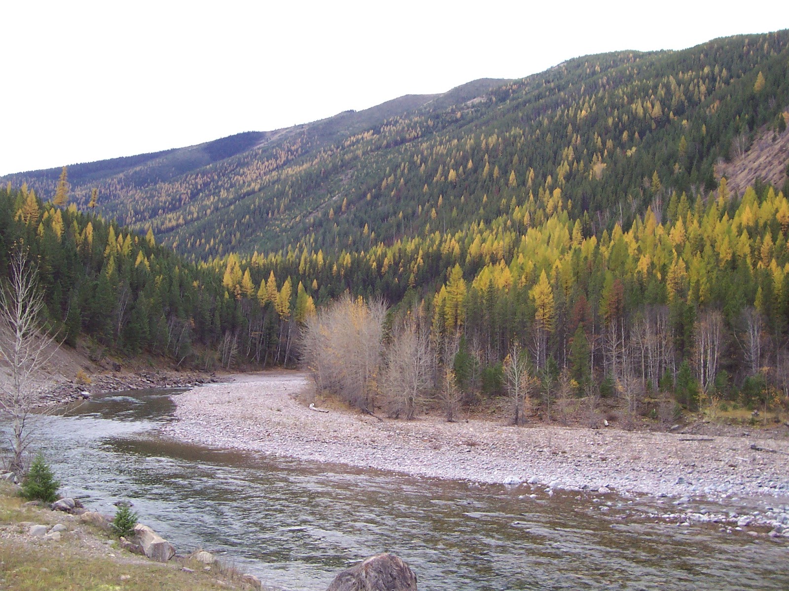
Glacier Park larch tour: do it now!

Middle Fork Flathead larch in the fall speak for themselves
Now is the time to take that last trip of the season to Glacier National Park.
The western larch, a deciduous pine-looking tree, is in its blazing yellow glory, readying to shed its needles for the winter.
Several miles west of Marias Pass the trees begin to dot the hillsides on both sides of U.S. 2, and around the Goat Lick near Essex, dominate the landscape to nearly West Glacier.
You’ll have about 10 days yet to catch this spectacle in western Montana. It is by no means limited to the Glacier Park Middle Fork country. Go to Missoula and west, where you can catch this sight.
I’ve taken this Middle Fork trip annually in the fall for more than 30 years and am always satisfied with what I see.
It is also a great time to be in the park, when there are few visitors.
I generally drive along Highway 2 from East to West Glacier and then back to St. Mary by way of the Going to the Sun Highway.
I took a short drive around East Glacier Park, one of my favorite places in the Glacier Park area and felt saddened by seeing my favorite restaurants and the Glacier Park Lodge and Amtrak station boarded up for the season. This is a reminder of short and sweet this season in the park is!
Likewise, once in the park, I looked around the Apgar, Logan Pass, and Lake McDonald Lodge areas and found similar reminders that winter is nearly here.
The high peaks of the park and Great Bear, particularly on the west side, have a dusting of snow, and appeared to be receiving a bit more the Monday afternoon that I drove through.
I stopped for a short hike at Packer’s Roost on the west side, a trail that leads to Fifty Mountain and ultimately Goat Haunt and into Canada. Then I took a longer walk up the Sunrift Gorge to view the bright red colored rocks that carry water to it from Going to the Sun Mountain and Goat Mountain that flank it.
There was a brief stop at the Haystack Falls area where workers are still busy on rebuilding the road.
There can’t be much time left before the snow is deep enough to close it until next June.


Sunday, October 10, 2004

Charlie Russell's South Fork Judith country


Pole Creek, High Peak country of South Fork Judith in Little Belts
Cowboy artist Charlie Russell was drawn to the ranch country of the South Fork of the Judith River in the Little Belt Mountains when he immigrated to Montana in the late 1800s
But this is more than just ranch country. The scenery of this area epitomizes central Montana --- the low slung mountains, the ubiquitous limestone canyons and caves, the meandering streams jammed up with willows brought on by beaver dams.
Like Russell, I’m also drawn to this scenery, which has Square Butte as a sentry for its backdrop.
A group of us traveled into the South Fork Saturday to prowl the ridgelines and enjoy the scenery.
You enter by way of Utica, a quaint ranching outpost known as a jumping off point for nearby Yogo Sapphire mines, but recently even more so for the “What the Hay” contest, where locals dress up and sculpt bales of hay.
It is also the beginning of a scenic road that bisects the Little Belts, and contains a major trailhead for the Middle Fork of the Judith Wilderness Study Area. The South Fork road is lined with campsites that fill up during the summer because they offer good access to fishing, sightseeing, and some great hiking.
We set out to get on top of the east ridge above Dry Pole Creek where we intended to climb high peak and everything else along the way in getting to the ridge’s west side before returning to the car.
Along the way we were treated to a great perch from which to view the limestone canyons we could see trailing up the many canyons in sight. In the distance we could clearly see Square and Round buttes, the Highwood Mountains, the Bearpaw Mountains, the isolated ranges surrounding Lewistown like the Judiths, Mocassins, and Snowies. To the west and south there were the Big Belts with Edith and Baldy, the Castles, Bridgers and the north end of the Crazies. And this was on an overcast and windy day where I’m sure the views were obscured.
From the Dry Pole Road to the top of the ridge you pass through several limestone cliff bands that are relatively easy to traverse. The ridgeline slopes gently up for the next 1,000 feet to its almost featureless and undistinguished peak, High Mountain, at 8,242 feet, that is marked by a cairn on grass back in the trees.
There’s a rough road that comes up from the west, but we descended off trail down the north, rocky slope, much steeper than our approach.
We moved into the small Douglas Fir trees that opened occasionally into meadows of tall grass, but found ourselves mostly on an undulating ridgeline of limestone and occasional volcanic outcroppings.
At one point we dropped through an opening in one of the cliff bands through limestone spires.
Below us we could see more spectacular canyons, large stretches of open grass, and numerous clear cuts that appeared to be regenerating for the next harvest.
We could see that multiple use is very much in evidence in this end of the Little Belts. The ranching roads have opened up this country to loggers as well as recreationists, but somehow it appears to be working.
Despite the development the land retains its spectacular canyon and forest feel, and that’s what makes it worth coming back to.
If you decide to try Dry Pole look to the east ridge immediately after turning onto the road after coming off the South Fork road. At the top, about a half mile onto the Dry Pole you’ll see a very spectacular limestone arch on the skyline.


Thursday, October 07, 2004

Scarface: a Blackfeet legend


Scarface climb offered views into Badger Two Med, Bob Marshall and North Fork Birch Creek
I’ve always thought that mountain climbing gives a person one of the best all-around aerobic workouts.
I’m here to tell you that mountain biking has it beat by a mile in that category.
The fall days are getting shorter and I had my heart set on climbing Scarface and adjacent Morningstar peaks in the Badger Two Medicine Area near Swift Reservoir, but hiking it in the daylight just didn’t pencil.
So, I decided I would try mountain biking the first, relatively flat (elevation gain 400 feet) four miles, hoping to save valuable time and daylight. At that point, Small Creek, I would stash my bike and gain the last 2,600 feet to the top of Scarface, elevation 8,282 feet.
What I didn’t count on was the extreme workout I would get on the bike before the climb.
Yes, I gained only 400 feet, but in the process went on a harrowing roller coaster ride on the North Fork of Birch Creek Trail, trying to outsmart ruts, steep-drop-offs, treacherous rocks and roots in the trail, and stream crossings. In many spots the horses had chewed up the trail with their hooves, adding to the obstacle course.
I found myself walking the bike across streams and steep pitches.
I was also carrying my heavy daypack, crammed with survival equipment for mountain climbing trips. It threw me off balance and added to my winding as I cranked on the pedals uphill.
I covered the distance to where I began my climb in about an hour and 20 minutes --- not much faster than had I walked it. There was the added disadvantage in that I had to keep my eyes on the trail straight ahead of me, meaning I couldn’t take in this beautiful backcountry scenery.
I’ll be re-evaluating this mode of outdoor travel for future climbs. I’m not optimistic I’ll be doing that again.
Scarface and Morningstar are named for characters in Blackfeet mythology, that tribe’s version of the Christ-legend. Scarface’s other names are Poia, which is also the adjacent mountain peak which I climbed last fall, and Morningstar.
In the legend Poia comes down to earth to live among the Blackfeet, where he was derisively called Scarface, and then made his way back to the heavens, where he became the Morningstar. It was Poia who brought the Sun Dance to the Blackfeet.
I’ve been particularly hot to climb all three because Great Falls will host as part of its Lewis and Clark bicentennial signature event a 1903 opera based on this legend called Poia.
I chose a difficult route up small creek crossing the creek to the west side and gaining the massive limestone ridge that separates Small and Steep creeks, as quickly as I could. The ridge is typical of Bob Marshall Wilderness Area ridges, full of cruddy, loose rock and is very narrow.
I dealt with a high wind all day long, which kept threatening my balance and eating up time.
Along the way there are several challenging pitches that make you figure out your next move and approach. To escape the wind, I would occasionally drop behind the ridge and walk as far as the steep slope would permit.
There are a couple of nice peaks on this ridge that top out over 8,000 feet. There were terrific views of the seldom seen Emerald Lake beneath Family peak. I could see out to the plains, the Front, across the Bob, and into Glacier Park from this ridge. Poia is quite impressive from here, too.
Scarface is aptly named. It has a deeply striated face several hundred feet above the saddle adjacent to Poia.
When I got to the top I mistook the Scarface top for Morningstar, and didn’t realize I was not on Morningstar until I gazed across a small valley and that monstrously large peak.
I checked out the possible approach across a connecting ridge and with the wind being what it was (it had cost me much time) and the impending earlier nightfall, I opted to turn back after Scarface.
Instead of following the limestone ridge top back down, I worked my walk through some shallow cliffs to the great basin above Small Creek formed by limestone ridges running off Poia and Scarface.
I found some krumholtz tall enough to shelter me during a break and enjoyed impressive views of Mount Richmond across the North Fork Birch Creek valley.
I followed an elk trail out of the basin into the trees which eventually opened up into steep summer elk meadows, and then found a well-worn elk path that lead me down through a series of meadows and into tree-lined benches ending at the North Fork trail above Small Creek.
Thoroughly exhausted by this time, I got on my mountain bike for a rough four-mile ride back out.
Unfortunately, I didn’t get Morningstar, but learned enough about a direct route using those great elk trails, that on a long summer day I’m sure I’ll get both peaks ---- next time without the mountain bike.

Tuesday, October 05, 2004

Granite-Taylor Little Belt traverse


Some shots from the Granite-Taylor peaks climb
I like to joke that you don’t climb to get into the Little Belt Mountains east and south of Great Falls --- you drop into the them.
When you drive to the town of Monarch in this island mountain range you descend into the mountains from the high plains above them when you hit the forest boundary.
But anyone who has hiked there will tell you that you had better be in great shape if you want to reach any of the ridgelines or peaks.
The ridge lines are just as lofty as the Rocky Mountain Front, rising more that 2,000-3,000 feet above the floors of the valleys, with many 8,000+ foot mountains and Big Baldy going over 9,000 feet, putting in the same class the Front’s Rocky Mountain Peak, the highest point in the Bob Marshall Wilderness.
I’ve been quite taken with high peaks on the Little Belts’ northern edge and in the past two weeks have climbed Wolf Butte, Barker, Peterson, Granite and Taylor peaks --- with all but Barker accessible from the Lonetree road a mile east of Geyser, a 50 mile drive from Great Falls.
This entry will focus on Granite and Taylor peaks, since I’ve already had entries on the other three peaks.
These peaks are connected by a ridgeline and are east, across the Lonetree Road from Peterson Mountain, and south of Wolf Butte.
I began the climb of Granite from a ridge above Bowers Gulch. The ridge goes right to the top of this rounded, volcanic peak. While you hike through thick, short timber, there are good breaks. The ridge line to the south breaks out into limestone that offer good vantage points to view Taylor peak across the gulch to the south.
While Taylor peak is about 150 feet taller, it is mostly timbered to the top. Granite peak’s west and south faces opens into a beautiful blond granite scree field extending 700 to 1,000 feet to the top.
About the greatest difficulty with this climb is the timber that can knick you up if your arms and legs aren’t covered.
On top you get good views of Wolf Butte’s granite spires to the north and Peterson mountain’s long limestone marked ridgeline to the west. There are some old timbers lying on the ground at the approximate high point of 7,634 feet.
Granite is a rounded off peak, which makes it a little trickly to find the ridge connecting it to Taylor peak. Look for the treeless outcrops in limestone to the south and east and drop about 600 feet to reach it.
Then it is a pleasant, open walk across the ridge to the last 1,000 feet up Taylor peak.
The 7,785-foot top is marked by a scenic cairn of flat granite stones.
I followed a ridgeline and animal trains extending west and north, hanging just below the limestone on the north until I reached an old jeep trail in Bowers Gulch. There are high limestone walls above the gulch, and no water.
Then back to the car after another fine fall day!


Tuesday, September 28, 2004

Mount Sentinel in the Bob Marshall

Ralph Thornton works way up Mount Sentinel in Bob Marshall Wilderness

On top Sentinel
I’m very taken with the Bob Marshall Wilderness Area just west of Swift Reservoir outside Dupuyer and returned for my third trip this season, this time to climb Mount Sentinel, elevation 7,680.
There couldn’t have been a more spectacular fall day to do this trip. The cottonwoods and aspens were in glorious golden, brown and orange. Lots of the groundcover and shrubs covering the mountainsides were brilliant red. There was no wind and the sky was a bright blue.
I like this area because it delivers a quick wilderness experience, it is an extension of the Rocky Mountain Front, and the named mountains are easily accessible.
I had been looking at Sentinel for a number of years and have contemplated a traverse from adjacent Mount Richmond along a knifey ridgeline.
Monday’s trip was intended to spy that ridgeline and see if it is remotely doable.
My conclusion is that it is doable, but one would need ideal conditions and one of the longest days of summer to get the job done.
I had climbed Mount Richmond a year ago and had that perspective to inform me for this trip.
Earlier this summer several partners on the Mount Field trip had started up Mount Sentinel on the Tubby Creek ridge, and one of them, Byron Wallis, made it, racing most of the way so we didn’t have to wait on him.
My partner on this trip was Ralph Thornton of Choteau, the capable Glacier Mountaineering Society climber who has begun moving some of his climbing south from the park in the spring and fall.
We began our climb on the first ridge, west, just beyond the junction of the Middle and South Forks of Birch Creek, immediately encountering limestone scree for nearly 800 feet before accessing the ridgeline above towering limestone faces.
The climb reminded me a lot of Mount Crandell in Waterton Park. Crandell is the large, limestone mountain above the town site of which the Bear’s Hump is a part.
Just like Crandell, Sentinel has dominant limestone ridges, but also offers adjacent easier, treed slopes as an alternative.
Negotiating the limestone layers of Sentinel required some use of hands on easy third class pitches. Occasionally, the ridgeline got a little narrow and hairy to walk, in which case it was easy to descend below it for a less exciting experience.
There are three peaks at the top, the first 104 feet lower than the summit. If you take this route you have to drop down from the end of this peak about 30 feet through an exposed Class 4 pitch that would have been more comfortable with rope.
The views from the top of Sentinel are exceptional. It is a well-named peak because it sits in the middle of the valley with high peaks all around. We could see Silvertip and Pentagon deep within the Bob. There were peaks of the Front including Ear, Rocky, Teton and Baldy. The Badger Two Medicine and Glacier Park were to the north and the Great Plains and Swift Reservoir to the east. The forks of Birch Creek were silver threads winding their way through the valley.
We dropped off the lowest peak and traversed along a timbered ridge to the east with its three cliff bands.
About the only downside of the climb, if you can call it that, was the long walk out around Swift Reservoir.
It makes for a lengthy, if eventful day.


Thursday, September 23, 2004

Little Belts: diverse adventures

Wolf Butte in Little Belts

The Arch
Over the past 30 years I’ve driven by Peterson Mountain and Wolf Butte in the Little Belts to the south of Montana 200 repeatedly and thought, “Someday I’m going to climb those things.”
This last week I made two trips to the mountains, located outside Geyser up the Lonetree Road.
I kept my promise to myself and climbed those things.
For good measure the Peterson climb included one of the most fantastic mountain sights I’ve come across, a giant limestone arch.
On the Wolf Butte climb, I also did the adjacent Granite Mountain false summit.
These mountains provided a smorgasbord of different kinds of rock.
Wolf Butte, although only 6,750 feet, is remarkable for its rose-colored granite and some easy third class scrambling.
Peterson Mountain has a ridgeline on it like you would find in the Bob Marshall Wilderness, exposed, steep, long and connecting.
The country is very wild with lots of elk sign. We saw lots of fresh black bear sign, too.
From the top of either peak you see a myriad of mountain ranges. I counted 12 from Peterson: Highwoods, Bearpaws, Little Rockies, Judiths, Sweetgrass Hills, Rocky Mountain Front, Adels, Big Belts, Little Belts, Snowies, North and South Mocassins.
The Lonetree Road is excellent gravel about a mile east of Geyser, and is well signed to the Lewis and Clark National Forest, about 9 miles from the highway. There is a bit of private land here, so I would recommend the BLM Belt Map that shows ownership.
I climbed false Granite first to about 7,300 feet and then dropped north to the saddle between it and Wolf Butte and then picked my way straight up its south face.
It was wonderful to be in some rock that wouldn’t come off in your hands or slip away under your feet. There were boulders as big as houses and jutting spires of granite to negotiate. No walk-up here. It is about 900 feet from the saddle between it and Granite to the top. About 30 feet from the highest point your route finding is challenged. I found it safest going to the right and scrambled easily to the summit, where I enjoyed the views and thought about coming back to top rope and to try some of the spires.
From here I vowed that I would do Peterson the next day.
I had deceived myself that Peterson would be a simple walk up.
We spent all day exploring various canyons and ridgelines on our way to the top.
We followed the base of high limestone cliffs up to the long summit ridge. Because there were so many breaks in the ridge, we could have stayed on top of it for the climb, but we would have missed the beauty of the towering walls from below.
We finally reached the long ridge that I had admired from the highway all these years. There’s nothing as sweet as a good ridge walk. We considered other distant Little Belt climbs that were within our vision --- Butcherknife, Mount Taylor, Barker, Mixes Baldy.
Many more trips here in my future!
From the top we spied the Arch below us in the distance and noticed that one of the northeast ridges runs directly into it. While it had looked heavily timbered from a distance, it turned out to be surprisingly easy going and relatively open.
We dropped to the base of the arch and I scrambled right through its opening and then figured a way to walk across its top.
On the way back to the car we came across several piles of fresh bear scat full of berries, and admired the autumn colors on the ground, in the trees and growing out of the limestone walls.
I came away from these hikes convinced that northcentral Montana is blessed to have such an incredibly diverse mountain range as the Little Belts.
I’ll be back to both these hikes.


Sunday, September 19, 2004

Middle Fork Judith spectacle

Norm Newhall in one of the many Middle Fork caves

Walking up the river bottom
The weather forecast was threatening rain and even snow, so I figured a hike along a stream bottom rather than a ridge top or mountain was in order.
So, Norm “Dodger” Newhall’s Middle Fork of the Judith River traverse by way of Woodchopper Ridge hike in the Little Belt Mountains was especially appealing.
Newhall, whose family owns property in the area, has been leading this popular and scenic 10-mile hike for the Montana Wilderness Association for many years.
As we drove in we were treated to the hay bale sculptures from the What the Hay contest held the previous week. We ended the day with the world’s biggest order of French Fries at the Oxen Yoke bar in Utica, which epitomizes central Montana ambience.
The Middle Fork Judith is a Wilderness Study Area that was proposed by the late Sen. Lee Metcalf in the 1970s.
What holds it up from designation by Congress are private in-holdings and a four-wheeler road up its gut that crosses the stream dozens of times, muddying it with each vehicle plunge.
In fact, while on our hike we saw two groups of ATVs cross the river and heard another group in the distance.
Otherwise, the scenery in this spot is similar to the Gates of the Mountains Wilderness Area south of Great Falls, except with lots more water on its interior.
The low-slung mountains are heavily timbered with occasional breaks of grassy elk meadows. Like the Gates, the rock in the Middle Fork is porous limestone with lots of interesting caves.
Newhall began the hike by way of a rough road from the Middle Fork trailhead that lead to a Yogo Creek crossing leading to the Woodchopper Ridge, about 1,000 feet in elevation gain.
When the timber gave way to grass we could see flat-ridged top of the southeast end of the Little Belts with its spiky canyons and the Snowy Mountains, another Wilderness Study Area even further east.
We met the Arches Coulee Trail which drops to the Middle Fork and descended into the limestone outcroppings, which culminates in a small arch just before reaching the Middle Fork. We stopped and had our photos taken there.
At this juncture we played on the limestone, climbing to a deep cave about 500 feet above the river and found a shy porcupine hunkered down on a ledge above us.
We worked our way down the river, with four cold shin-deep crossings, stopping to poke around in some of the larger caves along its length.
Newhall gave us a choice for the last mile of the hike, either following the road back to the trailhead, or doing a bushwhack down the river, which narrows considerably.
We chose the bushwhack and were treated to sheer walls coming down the river, and more deep caves.
The reds, oranges and yellows of the groundcover and shrubs along the river bottom enhanced the scenery.
Up from the river we cut through a cabin property and took a last look at one of the “Indian” caves, and then back to the car.
We had even dodged the weather forecasts, completing our hike before the cold and wet of the approaching autumnal season change had hit us.
The Little Belts had yielded yet another of its spectacular charms.


Sunday, September 12, 2004

Rocky Mountain traverse, high-pointing in the Bob

Rocky's "spikes"

Ascending the ridge line

Formations on the traverse down
At 9,390 feet, Rocky Mountain Peak is the highest point in the Bob Marshall Wilderness.
Ironically, it is one of the most accessible of the peaks in the Bob.
The approach to this monster is less than three miles, and the standard route is a Class 2 walk up.
The mountain is reached via Choteau and the South Fork of Teton River Road. The trailhead is the same as the Our Lake Trail.
On Saturday we decided we would try the more difficult route up the north ridge that runs up from Headquarters Pass. We had our sights on a long traverse that included climbing Rocky’s adjacent “twin” peak and then running that ridge east to just above the parking lot.
As has been the case most of this unusually wet summer, the weather started to turn and the winds began to gust, signaling an approaching front.
We could see the front moving in as we crested Headquarters Pass and got that thrilling view across the Bob Marshall to the Chinese Wall.
I hadn’t been on this route for more than 10 years and recalled that it involved working your way around sharply uplifted and jumbled outcroppings for more than 1,400 feet from the pass.
There are findable routes on both sides of the ridgeline, and the more daring can cling to near the top of the ridge if desired. With four in our party, all three approaches were tried.
With the gusty winds, I preferred to stay on the lee side, or east side of the mountain. From my earlier climb I recalled that you could avoid the mountains sharp up thrusts by taking fairly defined goat trails on that side. I’d advise to take the trails that are nearest the ridgeline to the trails below that cliff out.
It was much too windy to stay on top for long, so after a quick bite we worked our way down the long ridge to the east to a saddle below Rocky’s smaller twin. The views from the top of Rocky are exceptional. The high peaks of the Front spread out below you to the east (with the distant Sweetgrass Hills, Highwood Mountains, Little and Big Belts in view). To the north, Glacier can be seen. To the south, the Scapegoat country. To the West, all the way across the Bob to the Swan Range. It was fun to pick out some of the major sights of the Bob, including Pentagon and Prairie Reef peaks, the massive fire spotted Sun River Drainage, and of course, the Wall.
We lost about 700 feet to the saddle, and had to regain about 550 feet to the top of that other peak.
Continuing down that long, exposed ridge involved some immediate route finding through some substantial limestone cliffs, but we discovered that by bearing to the south a tad we could achieve the easier scree and then the long, gentle ridge line below us.
The weather moved in on us and we lost our views as the clouds enveloped the peaks.
We did see a large mountain goat on the cliffs below us as we approached the many caves and limestone formations on the ridge.
This area would be a cave-lover’s paradise. Everywhere we looked along this ridge we could see interesting caves and areas where water had eaten away at the limestone, leaving arches.
It began to rain and we hustled off the ridge and back onto the trail, just above the Our Lake cutoff trail.
We could look back on the towering mountain, some 3,400 feet above the valley floor with some satisfaction that we had walked its backbone despite the wind and rain.
On the way out along the Teton Road we were treated to a black bear that lumbered out of the brush toward the road. We backed up to take a better look, and we had a chance to exchange glances with the large animal that had fur with a slight honey colored tint.
A day well spent!


Monday, September 06, 2004

Labor Day weekend

Smith Creek Falls
If Labor Day is the unofficial end of summer, summer ended perfectly this year.
The Labor Day weekend was spent in a frenzy of mountain activity.
We climbed Highwood Baldy and North peaks on Saturday; visited Memorial Falls and the Sluice Boxes State Park in the Little Belts on Sunday; and hiked to Smith Creek Falls in the Rocky Mountain Front outside Augusta on Monday.
The groundcover is rapidly changing colors; the elk are bugling; and the sharper air and shorter days signal the arrival of fall.
Here’s a summary of each hike:

Highwood Baldy and North peaks
The Highwood Mountains are quickly reached out of Great Falls.
The standard route up Highwood Baldy, at 7660 feet, the highest peak in this volcanic island range, is up Deer Creek from the north flank.
We decided to go at it from the Geyser side, gaining North Peak first, walking a long ridgeline to Baldy.
This was my third time up Baldy this season.
It was windy and a tad cloudy on the way up. However, the longer the day progressed, the more clear and beautiful it became.
Aside from some cattle along the way, we saw no animal life on the way up. On the way down we heard an elk bugling and followed an elk trail to within sight of him.
We came down the heavily timbered east side of the mountain and traveled through some very high grass in the clearings.
How refreshing to encounter greenery (thanks to the wet August) at this time in the season.

Memorial Falls and Sluice Boxes State Park
I hadn’t been to the Memorial Falls in several years and hadn’t seen the completed reconstruction of the trail. It has been made handicap accessible and it is a hike that nearly anyone can do --- shorter than half a mile.
There are upper and lower falls, and a good trail has been roughed in making the upper falls more easily reached than in the past.
Bring your camera on this hike!
We then headed for the Sluice Boxes to take some friends who had never visited it before.
We approached from the upper parking area, dropping into Belt Creek through the high canyon with its Zion-like waterfall.
We were very surprised to have seen so few people on the trail, although there were some kids at the cliff jumping beach, and a couple of families.
The asters were the flowers most in evidence, and the groundcover was turning more yellow than red.


Smith Creek on the Front
I hadn’t been in this area since 1988 and had never hiked the trail that is really a main artery for trails leading into the Scapegoat Wilderness.
Our goal was Smith Creek Falls, a 2.1 mile hike that loses about 500 feet before gaining slightly. We proceeded past the falls to the junction of Jakie Creek, another mile or so more.
When you go into this area you have to be tolerant of cattle ---- you pass through a working cattle ranch. And you have to have the right mindset about land affected by fire. This trail passes through one of the main areas high hard by the Canyon Creek fire 16 years ago. In fact, I calculated that we were on trail exactly 16 years to the date that the fire roared down this creek and threatened the town of Augusta!
There’s much evidence of regeneration, but there are hillsides full of whitened dead snags as well. It reminds me of what is happening in Yellowstone National Park, which is recovering from the fires the same year. However, it seems as though this area is coming back more slowly.
The cattle trails and cattle manure are everywhere. The cattle trying to reach the fresh springs above the falls have really hammered the area above the Smith Creek Falls.
You really don’t get away from much cattle sign until you hit Jakie Creek, another mile beyond the falls.
The falls themselves are an oasis. They are quite large and very interesting because adjacent to them is a large cave. Water from a spring above the cave pours down in droplets reminiscent of Glacier Park’s Weeping Walls, except there are no walls.
You can climb down to the base of the falls about 50 yards to the north of a gate across the trail. It is steep, but not too difficult.
The falls were a respite from the cattle sign and dead trees.
The falls are worth the hike!