Thursday, April 26, 2018

Sketchy Chisholm Peak in Adels

This will have to serve as my 70th Birthday portrait.  It will be official Saturday.

This shot illustrates the mountain's difficult terrain 

Gordon descending the mountain's south flank

A map of the Mount Chisholm area
I love the Adel Mountains, an appendage of the Big Belt Mountains south of Cascade.
This range is an old volcano that sent fingers out onto the plains, creating our beloved Square, Crown and Birdtail buttes on the southern Great Falls horizon.  They have a maroon hue and are dotted with massive Ponderosa pine trees.
They are cut through by the Missouri River and some of the best trout fishing in the state as attested to by the growing number of outfitters and their clients who wet a line year 'round.
The problem for hikers and climbers is one of access.
There are numerous BLM and state sections in this area, but they are separated by private lands historically used for grazing, but increasingly for rural subdivision.
Finding the access is tough, but possible.  Of course, there's asking the landowners, but they are hard to find.
I've done that, but usually I study BLM maps and find public lands sections that are adjacent to one another and accessible from the Missouri River Recreational Road or Interstate 15.
Probably the most accessible hike and climb I've found is located in the little settlement of Hardy just west of the Hardy Bridge Fishing Access site.  There is a BLM section there below one of the more prominent mountains in the area ---- Chisholm Peak (elevation: 4,639 feet).
First Arrowleafs of the season

Finally, a Pasque flower, a real sign of Spring
In the absence of an organized Wayne's Wednesday Walk I climbed the peak with Gordon Whirry, a third time for me.
From a saddle on the west side of the peak we went to the north side of the mountain (through the trees) until we reached a gap in the ridgeline and then climbed on the peak's south side, hugging the wall and looking for logical spots to gain elevation.  If you look closely you can see a climber's route and several ducks that we found helpful in navigation.  It is very slow going and you have to use your hands in many spots.  I would say this is full scale scrambling in spots that are high Class 3.
The rock throughout is broken igneous that moves around and it leaves patches of ball-bearing like rock that is easy to slip on.
On top the views are amazing;  the Missouri River meandering in bends below the Mountain Palace and in the distance to the west the Continental Divide, dominated by the largest peak in the Scapegoat Wilderness and Bob Marshall Complex, Red Mountain (elevation:  9,411 feet).  It is completely covered by snow as are the other peaks along the Divide. There is still plenty of snow in the Adels as well. We were surprised to see many beds that bighorn sheep had set up on the south side of the range.
We came down the south and then east side of the mountain through a lovely canyon and tall ponderosa trees to the railroad tracks just north of a train tunnel in the mountains.
Walking along the railroad tracks along the river back to the car there were drift boats full of fly fishermen wetting their lines.
It was encouraging to see some wildflowers in bloom.  Spring has been inordinately late this year.
We saw our first Pasque flowers of the season, buttercups, fritliary, and even a blooming clutch of Arrowleaf Balsamroots!  A week earlier we had gone looking for wildflowers in the Sun River Canyon and found a measly dandelion for our effort.  The next day we went to the Trout Creek Canyon near York in the Big Belts and the Kelseya rose hadn't bloomed either.
Mount Chisholm's East Face

Our walk out was along the railroad tracks and Missouri River with Mountain Palace above us


Thursday, April 19, 2018

Hiking season begins belatedly

Steamboat Mountain from Sun River Game Range/Sun Canyon Road

Katie and me below Castle Reef Mountain

View from Wagner Basin

Our Wednesday hiking group on lunch break


Sun River in the Canyon
We're a tad late to begin the hiking season this year with all the snow.
Not that I'm complaining.
The backcountry ski season was long and wonderful and I'd love to see more of the same in the future.
It's just that we've become used to hiking in late March and early April, and we have been tentative about getting out there this year because there have been wave after wave of storms.
We really began our season with a hike up Mount Sentinel in Missoula on Saturday, about a 2,000 foot gain to the top.  The mountain trail, which starts on campus, has a bit of snow on the ridgeline, and I caught flurries when I topped out.
There are several ways to reach the top.  My favorite has been to take the trail immediately to the left up the north edge of the mountain.  This is very steep.
On Saturday I decided to explore and went to the "M" and above it took the trail to the right (south) that crosses an old road and switchbacks up a ridge and past an abandoned 1890 copper mine.  When the ridge top is reached I had a choice of connecting with the north trail or going back south that parallels the ridge and wraps around the east side of the summit cap and then to the top.  I went south.
I found this a less strenuous approach than the north ridge line.
I hit only one short patch of snow and ice.  We saw three alpine flowers.
On Wednesday, Wayne Phillips led our old-guys hiking group into the Wagner Basin below Castle Reef Mountain in the Sun River Canyon below Gibson Dam and did a roundtrip hike of 5.5 miles, gaining and losing 1,200 feet.
We saw a single dandelion, but numerous bighorn sheep and deer.
I also picked up a couple of ticks.
The weather was superb, with bright sun,  blue skies, moderate wind,  and the landscape was dappled with abundant snow.
This easily accessible area from Augusta offers some of the best Rocky Mountain Front scenery.  It is dominated by Castle Reef and Sawtooth Mountains that flank both sides of the road like a giant gate.
Mount Sentinel in Missoula

From the top of Sentinel in a snow squall


Tuesday, April 10, 2018

A rite of Spring: Two Medicine Lake ski

On the Two Med Road with Scenic Point Mountain in background


Katie near her favorite bench in front of Two Med Lake 
The buried Two Med Camp Store


We've finally had a break in the weather, with the Great Falls Tribune announcing as news that temperatures might rise to 60 degrees for the first time since November.
Knowing this is coming, Katie and I took an early morning trip Monday to Glacier National Park to do the ski to Middle Two Medicine Lake out of East Glacier Park, a 10-miler roundtrip with about 1,200 feet of elevation gain and loss.
This is a ski on a snow-covered road with the snow going fast.
It had already been plowed, with about four inches of new snow on top of that which melted off throughout the day.
The road is open to the park boundary and it is another 4 miles from there to the lake.  Adding a Trick Falls side trip and skiing out onto the lake brought us to nearly 10 mies.
As the snow began to melt, we climbed up onto road berms to ski, at points at least 6-8 feet above the road.
On the way to the park we traveled U.S. 89 and were able to catch the annual snow geese/tundra swan migration against the alpineglow of the morning sunrise;  truly one of the most amazing sights in Montana.
We had a Spring mix of weather, which ranged from rain to graupel, and lots of wind, particularly once we reached the lake.
There's a ton of snow in this country.  It looks like the dead of winter.
At the lake and Two Med Campground large drifts bury structures.
I was able to climb on top of the Two Med restroom building in front of the camp store and thought about doing the same on the store, but the roof's steep pitch deterred me.
I skied out onto the lake, which is still solidly frozen as far as I could see, to the boat launch piers.
The Two Med River as it comes out at the Trick Falls is running, although the large side stream is frozen over.
The snow is Spring snow, but plentiful.
I can imagine that within a week at these temperatures that the road will be clear of snow between the boundary and Trick Falls and open enough for bicycles.
There are years I have been able to drive to the falls by now and walk to the lake.
Too much snow this year!
We viewed the snow geese migration with the Rocky Mountain Front as our backdrop

Geese lifting off enmasse

A shot of the geese up close in a grain field


Thursday, April 05, 2018

Almost too much snow!

Ice pillars form columns from the roof of the Kings Hill Forest Service Cabin

Deep powder, empty slopes

Surreal at top of the abandoned lift

So much snow that trail signs are at our feet rather than eye level
Our Wednesday hiking/skiing group thought a short, easy trip down O'Brien Creek was in order this week.
Only we didn't count on so much snow and we ditched the idea once we got to the trailhead.  The new snow was kneecap deep and on the wet side.
We decided, instead to ski to the top of Showdown Ski Area, which closed for the season last Saturday, and try some tele turns.
Lucky for us, a groomer on its way to the top on Tuesday had flattened enough snow that the going was easier than the knee-deep stuff.
But, it was snowing and had snowed over night so even that track had about six inches of new powder on it.
It was great to be out enjoying the quiet of a ghost town ski area.
We started down the Big Seven black diamond run and quickly realized that the snow there was too deep to make meaningful turns.  On me, the snow was now at thigh level!
So, we quickly returned to the top of Porphyry Peak with the goal of the Trail 747 Loop around the backside of the mountain in mind.
We had to keep a sharp eye for the trail sign because so much snow had fallen that we feared it had been covered.  When we got to it, it was at boot level, meaning at least four feet of snow formed the base.
We quickly lost of the trail because of the snow and were pulled to the south by wonderful open patches of snow.  Of course we made waypoints on our GPS devices to help us remember how to get back to this wondrous place.
I had made this directional mistake once before and knew what was in store for us.  We enjoyed a descent of about 800 feet, making soft-as-butter turns in the powder and began searching for a road along the base of the mountain that we knew was there.
Once we reached it, we had about a mile to connect to the base of Trail 747 and the way out.  The Forest Service Road 6413, which we called the "Jumping Creek Road," because traveling south on it would take you to that trailhead.  Again, we made a mental note of that potential route.
The 747 connects to the O'Brien Creek Trail and we returned to the ski area via that trail.  The snow depth on that trail confirmed that we had made a wise decision not to go all the way through.
In addition, the snow had become sticky, despite the 25 degree weather, and was beginning to clump up under our kickers.
I guess I have never thought in terms of too much snow in the past.
That'll teach me.

A week earlier

We wanted to do the Bender-Henn run up the Dry Fork of Belt Creek, but lack of snow stymied us.
Instead, we opted for the only snow available --- on King's Hill.
In driving rain we climbed the hill via the Deadman route and then skied down through the trees back to the pass.
It was plenty icy in the trees and we found ourselves side-stepping considerable distance.

Carefully using our edges across the Deadman route to King's Hill top.


Saturday, March 24, 2018

Yellowstone: Wet, but skiing pretty good

Katie on Upper Gallatin River in Yellowstone

Katie and I at the Lee Metcalf Wilderness boundary up Bacon Creek in Yellowstone Park

Safely over a snow bridge over Bacon Creek in Yellowstone
We spent a couple of days at Big Sky Resort, guests of our Helena friends, Dave and Sandi Ashley, who have purchased a condo there.
We're not downhill skiers, so we didn't ski there, but the Ashleys took us about 25 miles south of Big Sky for some backcountry skiing in Yellowstone Park's northwest edge, where it abuts the Madison Mountains and the Lee Metcalf Wilderness, just off Highway 191.
It was a rain and snow spring mix  (afterall, this was our first ski of the new Spring) where we stayed, but the Ashleys chose skis in the upper reaches of the Gallatin River and Back Rind Creek into the Lee Metcalf, which are still very wintery.
There was plenty of snow, particularly on the upper Gallatin and we were able to pull turns in some moisture-laden white stuff.
Both areas offered low-angle telemark opportunities, but the kick and glide on the valley floor was superb.  There were several skiers, mostly on tour using Big Sky guiding services, on the Gallatin trip.  No one on Bacon Rind.
We went about 6 miles roundtrip both Thursday and Friday.
Most of my friends from Great Falls go to the extreme northeast corner of the park at Cooke City for their winter skiing.
This trip reminded me of what great scenery and opportunities abound in Yellowstone, and how easy they are to reach.

Sunday, March 18, 2018

Glacier: An icy Marias Pass to East Glacier Park trip along Continental Divide Trail

The classic view of Little Dog and Summit mountains at Three Bears Lake near Marias Pass 

Into an scenic bottom

Our group framed by an aspen grove 

We passed many areas like this that tantalized with their telemark potential
This is a 15-mile point-to-point backcountry ski in Glacier National Park on the Continental Divide Trail from Marias Pass to the town of East Glacier Park.
It is one of my favorite backcountry skis for its breathtaking scenery and variety.
It is an all-day trip and route-finding is required because snow covers some trail markers.  I'd advise taking this trip after fresh powder.  It can be treacherous when  icy or after a rainfall.  There are about 2,000 feet of elevation gained and there are uncountable number of drainage crossings, requiring much up and down.  There are several robust climbs, such as to the top of Railroad Creek.  This means there are also substantial downhill runs, which can be tricky on icy trails.  The scenery is the incomparable Glacier scenery that starts at the foot of Summit and Little Dog mountains at Marias Pass.  There are open slopes that will tantalize the tele skier.
I've done this run every couple of years over the past 30 years, mainly with friends from East Glacier Park.
Unfortunately, Saturday we skied after a rainfall and the route was very icy and, I think, somewhat dangerous.

For a map and more detail, CLICK HERE

Wednesday, March 14, 2018

Late winter sun in Glacier, Front

Old Man of the Hills  in the Front looms over a Dupuyer area ranch

Middle Two Med Lake in Glacier Park was below me as I skied

At the end of her shift at the Two Med Grill Laurie Lintner went for a workout on Looking Glass Road


This is how East Glacier Park looks.  Sears Motel is marooned by snow.
I could see this coming in the weather forecast for several days.
Everything aligned and off I went for a drive on U.S. 89 up the Front for a scenery tour and then on to East Glacier Park and a 9 mile out-and back ski on the Looking Glass Highway (to the Pass).
Although there was some fog in the morning, the weather cleared Tuesday and it was bluebird all day, with no wind and temperatures that rose from the high teens to the mid-50s.
On the way up to Glacier I made numerous stops for photos of the Front ---- Choteau, Guthrie, Old Man of the Hills, Walling Reef, Feather Woman, Round Butte, Half Dome, with the scenic ranches out on the Plains giving those mountains some perspective.
I had wondered about the snow totals and shape of the roads given the record winter.
I found the roads in pretty good condition, except in East Glacier and north of that town to Looking Glass.
There were snowplows out in force creating vast mounds and walls of snow. 
There was some concern about flash flooding, but I didn't see any indication of that.
There was snow up to and over the rooftops in East Glacier and higher mounds of snow at Marias Pass in the Burlington Northern parking lot than I had ever seen.
Laurie Lintner at the Two Med Grill told me the best bet was to try Looking Glass, and I'm glad I did.
It is also known as Montana Highway 49 and goes from East Glacier through a mountain pass to the Kiowa Junction on U.S. 89.   It is a shortcut from East Glacier to St. Mary. The road is blocked off in the winter because of the heavy snows.
The pass is four miles from where the road to Two Med Campground comes in.
The highway department plows a parking spot at this "Y."
Lintner said the scenery is beautiful on this run, and she is right.
It looks down on Lower Two Med Lake below Scenic Point, with Rising Wolf Mountain the dominant mountain at the flank of Middle Two Med Lake.  The Badger-Two Med is within view, as Mount Sinopah at the head of Middle Two Med.
The snow was not great, a three-inch wind crust on top of about four feet of packed snow, but it softened up with the heat of the day.  The road rises gently, some 250 feet per mile, for a total of just over 1,000 feet.
At the top of the pass I noticed a rough road to the west and took it another half mile or so, just short of the Park boundary, where the views were magnificent and I had lunch.
The road is not steep enough to make tele turns worthwhile, but it was an enjoyable run nonetheless.
Then back to Great Falls along the Front, watching the sun sink and cast shadows and colors over the Front.
What a day!


Sunday, March 11, 2018

CDT: Stemple to Flesher and then some

Steve Taylor (left) and Wayne Phillips do check on avalanche transceivors 

Rob Phillips kicks and glides.  That's Mount Joy in the background.

Remarkably large snow amounts hung from most trees 
The star of our show, 76-year-old Wayne Phillips who says this is his last Stemple Flesher trip

Each backcountry ski season there are several trips that are on my "must do" list.
The Continental Divide Trail's 11.5 miles Stemple Pass to Flesher Pass trip near Lincoln is always one of these.
I missed during last year's horrendous season.
We made up for it Saturday with a run that included an inadvertent side trip because the trail makers were very difficult to find because the snow is so deep they are covered or at least partially so.  Usually the markers ---- the upside-down slash on both sides of a tree ---- are at eye level or above (5 feet or so).  This year they were at our feet.
This is a difficult section of trail to follow because it winds through thick forest and across the face of mountains that rise to more than 7,000 feet.

The trail markers were buried in snow.  They are usually at eye level
Luckily I had with me my GPS and on it was the marked route we had taken in 2016.  We were able to see if we were varying from the trail or the route we had taken that year --- mostly.
We were also blessed with an exceptionally beautiful bluebird day and a skiff of fresh snow.  Temperatures were in the teens at the start, warming up to freezing during the trip.
We started early knowing that when the sun hit even cold snow it could radiate heat far in excess of the outside temperature and clump up our skis with wet, heavy snow that are nearly impossible to move.
We had some of that which was remedied by some scraping and glide wax.
We also had some wind-crust that sent us hurtling down the trail out of control.
But overall, the trip was marked by pretty good, if variable snow and magnificent views and tired skiers at the end of the day.
We skied nearly 2 more miles than was necessary by prematurely climbing to a high point thinking it was another high point we needed to scale to avoid an avalanche exposed side hill on the CDT trail.  Also, because we wandered around looking for the trail markers and at one point got way off trail.
One of the highlights of the trip was the performance of 76-year-old H. Wayne Phillips, a long-time skiing and hiking partner, who said this would be his last Stemple Flesher run.
Over the 10 hours and 40 minutes of hardcore skiing Wayne performed like a 25 year-old.
Truly impressive.

Take a look at trip route on topo map with more by clicking HERE

Thursday, March 08, 2018

Sunshine, bluebird skies make for snow mush on Jumping Creek

Gerry Jennings enjoys some downhill

The snow on the cabin is an example of our snowfall this winter 


Lots of stopping to scrape snow and reapply waxes

An example of the mush we went through when doing our tele-turns
I've never been much of a fan of the new Jumping Creek run that runs across the top of the Porphyry/Mizpah Ridge in the Little Belts and descends to Highway 89 near the Jumping Creek Campground.
I've done this twice as a ski and once as a hike and have encountered problems each time.
Our Wednesday trip was no different.
What promised to be a sun-filled day got ugly about half-way through this 8.5 mile backcountry ski as sun penetrated the snow, softening it and making skiing without snow-clumping nearly impossible.
There's about 1,700 feet of elevation gain on this trip and 2,700 feet of loss, which should have provided us with interesting terrain variation and plenty of tele-turns.
Instead, we spent too much time scraping snow, and re-waxing, while carrying around tons of weight on the bottom of our skis.
It made turns difficult in the mash-potato snow.
At points there was wind-glaze that made the downhill suicidal and lots of trees for a dangerous obstacle course.
The course was just fine to the Mizpah cabin, but difficult from there on.
The sunlight and blue skies compensated somewhat.  Also, the company, our retireds from the Wayne's Wednesday Walks group, with members ranging from 78 to 60.  Our two oldest members, Chuck and Gerry Jennings, 78 and 77 are absolute marvels.
The snow looked great, but that was deceptive.  Yes, we've had great amounts, but the base was uneven.
My feeling is you can get the same highlights by taking the same route to either Nugget or Ranch Creek runs.
Save yourself the bother from there.

Sunday, March 04, 2018

A CDT treat: backcountry ski Rogers Pass to Cadotte Pass


We are so blessed to be just an hour's drive from the Continental Divide Trail at Rogers Pass.
I was doubly-blessed Saturday to be able to ski that trail from Rogers to Cadotte Pass in deep powder on a bluebird day, with relatively light wind.
I've tried this a number of times before, but have always been blocked by high winds that strip the snow from the ridgeline and hardens any remainder to concrete.  That has meant that we have skied the Rogers Peak side many times.
The circumstances of the ski trip were fortuitous;  a dump of snow overnight that wasn't to be blown about.
We used the CDT from the pass, but had to scale a wall of snow plowed back by the Montana Department of Transportation, which has been doing a great job clearing the roads and passes this extremely snowy and cold winter.
We skinned to the top, veering from the trail to the south, topping a high point on the ridgeline above Cadotte Creek.  This offered amazing views to the Rocky Mountain Front, Red Mountain, the highest point in the Bob Marshall/Scapegoat/Great Bear wilderness complex, and the Great Plains.
We skied the rest of the day without skins, occasionally dropping off the ridge for tele turns in terrific powder.
We went as far as the high point just above Cadotte Pass, traveling 6.5 miles roundtrip and gaining and losing 2,100 feet of elevation when the tele stops are thrown in.
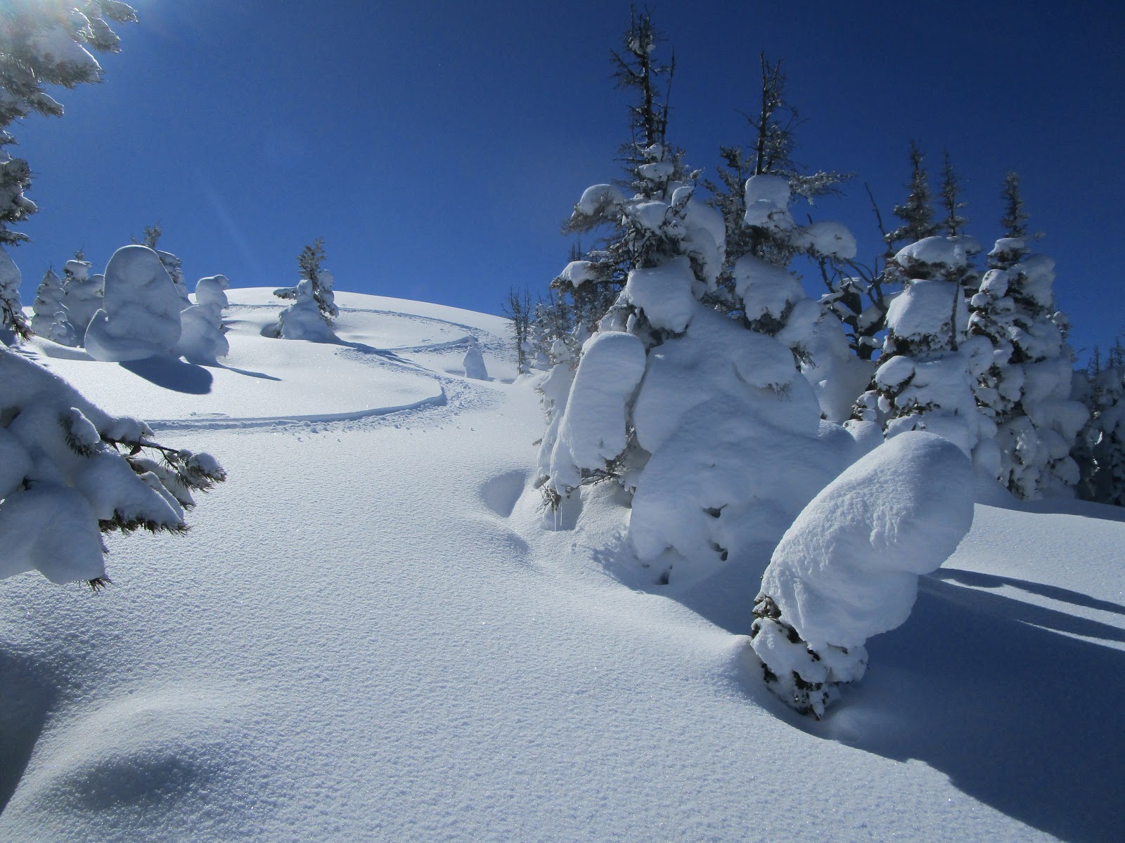
On the way back after several long tele runs, we veered to the south across a small streambed and found the best powder of the day on the shaded, steep and thinly timbered hillside.
My friend, Mark Hertenstein made turns to the bottom about 800 feet below, while my legs crapped out and but for a few stretches had to traverse rather than drop.  Guess I'm getting old and weak!
I'm not sure why the Rogers Pass area is not a mecca for backcountry skiers, like Marias Pass south of Glacier Park.
When it's not good at the pass we can usually find great skiing in Cadotte Creek on the westside a few miles south or up Meadow Creek where there's mine reclamation work going on and the road is plowed.