 |
| On the traverse to the top of Scapegoat peak that sits above high cliffs that look like the Chinese Wall |
The trip started and returned via the Crown Mountain Trail west of Augusta to Straight Creek and then to the Green Fork, a 12.5 miles walk to our campsite at a shallow, unnamed lake below the Green Fork cutoff in a lush valley where several large waterfalls gushed from towering walls.
The second day is a walk across the cutoff along the Halfmoon Basin below the towering cliffs of the Scapegoat Masif.
I've been to the Chinese Wall and I can say the views here and the overall wilderness experience was far superior to the Chinese Wall.
We walked to the south end of the wall, some 3 miles across and up via the Scapegoat Mountain trail, where, seemingly, all hopes of climbing Scapegoat appeared to be dashed because of the impenetrability of the high cliffs.
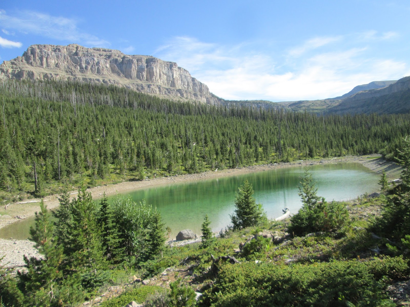 |
| Our campsite at an unnamed, shallow lake at the Green Fork Cutoff Trail |
Once on top, it was an easy walk north in desolate alpine tundra to the base of Scapegoat, and then 700 feet up scree and then I went to the back where I had remembered a scree ramp to the top from when I had climbed this peak some 25 years ago.
The views from the top are exceptional, into the entire Bob Marshall complex as well as the Missions, the Great Plains and the handsome peaks of the Rocky Mountain Front.
We proceeded down to the north, knowing from previous climbs that we had to hit a break in the cliff band back to the Green Fork. The only glitch is that I had remembered a climber's break just to the left of a waterfall, but the climber's trail we followed took us high along the cliff band to the east and then down a scree field to the trail. This high trail is precarious. Any misstep would result in disaster. If you try it, be careful!
 |
| Strolling along the Scapegoat Massif in the Halfmoon Basin |
However, I enjoyed the steep trail down Crown Creek immensely, despite it having burned three years ago. It was resplendent with asters and fireweed. There were plenty of signs of grizzlies; scat littered the trail.
I would not recommend this traverse to anyone who is not comfortable on precarious goat trails. I would recommend the climb of Scapegoat from north to south and back, and I would try to locate the climber's trail adjacent to the waterfall rather than through the cliffs to the east.
Unfortunately, my batteries went out on my GPS on the way through the cliffs, so the route and distance is off in the map and charts.
It should add about 1,000 feet and another 2 miles to the trip.
For more on hike, map and chart, click here
 |
| A floral display of asters and fireweed on Crown Creek |
 |
| A lonely snowfield below the peak |
 |
| A view from the top of Scapegoat Mountain |
 |
| Looking down the Green Fork Valley where we were camped |
1 comment:
Tom - Just wanted to say that I've gotten my $ worth out of your new book this summer. It's been GREAT! Here is a link to my photo albums, including trips to Ear Mountain, Crown Mountain, Wagner Basin, Castle Reef, and Steamboat East. Thanks!
https://plus.google.com/photos/115130083077206049223/albums
PS - Your Scapegoat Traverse looks amazing. I will have to add it to the list.
-Rod Benson
Helena, MT
Post a Comment