 |
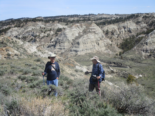
| Rugged, almost beyond belief, is this Bullwhacker area of Missouri River Breaks National Monument |
 |
| Like the spires of a cathedral |
 |
| Tim Faber led our hike and explains the landscape |
 |
| A wonderful, short hike in the Breaks |
I've long been aware of the six wilderness study candidates in the breaks, but haven't had the gumption to endure the long, tough drives to get there. I think the badlands here are better than what I saw in the Theodore Roosevelt National Park in Medora, ND. If less colorful, these are wilder and more expansive.
Luckily for me the Montana Wilderness Association and trip leader Tim Faber made it possible by leading a wilderness walk into this magnificent area Saturday.
This area is simply jaw-dropping for its rugged badlands and unusual vistas.
For those of us in Great Falls it takes a trip to Big Sandy (90 miles) another 71 miles, mostly on pretty good (if dry) gravel roads. I'm certain that I could not navigate to this trailhead by myself. The roads in the Breaks are poorly marked and there are plenty of turns that can lead you astray.
Let's just say you need to take the McClellan Ferry Road and hope you can find the BLM-numbered sign before you get to the ferry.
There's also a Bullwhacker Road, but it has been closed by a Texas-owned family. I hope this eventually gets worked out.
Faber, who lives in Missoula, but still has a place in Big Sandy, really knows this Breaks country and can stories about those rugged pioneers who settled this country or who were driven out by the tough conditions.
This area has a rich history that includes Lewis and Clark, the flight of the Nez Perce Chief Joseph, and the steamboat days.
Apparently steamboats would unload here and then goods loaded onto oxen-driven wagons that were driven on by whip-wielding "bullwhackers" who beat them onward.
We walked a short ridgeline through these breaks, achieving amazing viewpoints that included the Bullwhacker Creek below us. I don't think it would have been impossible to descend to the bottom, but it would have been rough. Having a rope would be helpful here.
There were bighorn sheep signs everywhere, and we saw one herd of about 20 mule deer. There were some wildflowers, mainly light lavender phlox.
This is dry, prickly and barren country, beautiful for its desolation.
I'm not sure I'll ever return, but I feel enriched for the visit.
Should there ever be better access this would be an amazing recreational opportunity.
 |
| A map of the National Monument. I've circled the area we were in red. |
No comments:
Post a Comment