 |
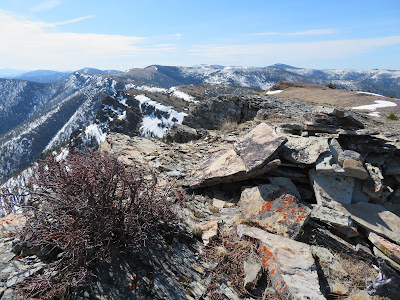
| Rodgers Peak looking south |
 |
| Red Mountain, high point in Bob Marshall complex |
 |
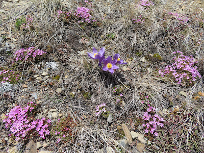
| A Pasqueflower in a Douglasia bloom |
 |
| The first of the glacier lilies |
 |
| Old friends Gene and Linda Sentz |
Glacier lilies are a sure harbinger of good hiking weather and they were out Thursday as I tested myself by hiking to the ridge lines on both sides of Rogers Pass on the Continental Divide Trail.
On Tuesday I did a similar hike, this time a favorite loop in the Little Belts from the Pioneer Ridge starting near the Belt Creek Ranger Station.
They are roughly similar in distance and elevation gain.
The Little Belts have more snow, particularly on north-facing slopes.
There are more flowers at Rogers Pass,
Both are hikes which I use to tone my conditioning.
At Rogers Pass park the car at the pass sign near the stair steps. Look across the road and a little to the left and you'll see a snowmelt stream. There's a prominent ridgeline to the left of the stream. Start up steeply. There are quite a few deadfalls for the first couple hundred yards, but they give way to grass and rock which you can follow all the way to the top of Rodgers Peak, some 1,500 feet and 1.15 miles above you. There are two patches of trees beyond the deadfall, but it is easy to work your way through them. I chose this route because it was clear of snow, while the Continental Divide Trail is still covered. The payoff are exceptional 360 degree views. Mount Powell, the highest point in the Flint Creek Range is visible to the southwest above Deer Lodge; west, Red Mountain, the highest peak in the Scapegoat and Bob Marshall complex raises its snow-covered flanks to 9,411 feet. There were displays of Douglasia alpine flowers, as well as Pasque flower. It took me just under an hour to the top without pushing it, but I was also practicing a new breathing technique that distracted me. I've been reading John Nestor's, "Breath," about avoiding mouth-breathing, and found sucking air and exhaling through the nostrils very difficult.
Once back at the pass, the stair-steps lead to the Continental Divide Trail. I had spied this trail to the ridgeline from Rodgers Peak and figured a route around the snow. The trail is covered with it. At a bend in the designated trail just above the large, colorful outcropping, I left the trail and entered the grass, which I stayed in to the ridge. While still on the trail I was treated to an encounter with Linda Sentz, who was photographing flowers. Her husband, Gene, was above her sitting on the higher outcropping above the grass, enjoying the views. It was a delight to visit with these Choteau hikers. There were also lots of wildflowers out on this side of the pass, including the beginnings of a glacier lily bloom, a real treat to the eyes.
There weren't nearly as many flowers out on my Little Belts hike, one of my favorites when I don't have much time. There is a lot of deadfall here, too, particularly on the first quarter-mile of the Pioneer Ridge Trail and on the abandoned Forest Service Trail atop the ridgeline. There was a ton of snow below that ridgeline, which I skirted by staying on top.Combined, I had covered 4.1 miles and gained more than 2,100 feet.
 |
| Pioneer Ridge Loop |
 |
| Rogers Pass ---- both sides |


No comments:
Post a Comment