 |
| My brother Dan working his way along the Dawson-Pitamakan alpine trail |
 |
| Alpine lake view from Dawson-Pitamakan |
 |
| Chief Mountain looms above Ninaki and Papoose adjacent peaks on the ridge line |
 |
| A calm and hazy Slide Lake |
 |
| Mount Cleveland, highest peak in Glacier, from Gable Pass trail to the Belly |
 |
| Belly River Ranger Station |
 |
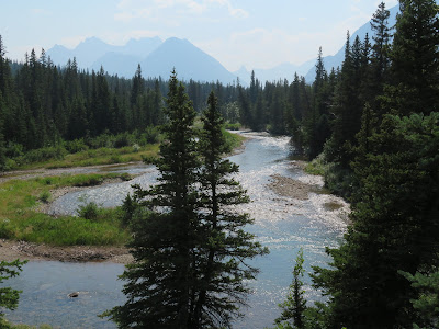
| The Belly River |
With my brother in town from Indianapolis it meant a trip to Glacier Park, despite the smoke and crowds.
It turned out to be a good choice in spite of my reservations.
Yes, Glacier is teeming with people; our Two Medicine campground filled by 8:30 a.m., and we were lucky to get a spot. Yes, there were hazy skies from the West's fires, but the Glacier skies were less smoke-filled than Great Falls'.
When we arrived in East Glacier Monday the air was so pure we immediately decided to do the Dawson-Pitamakan loop after setting up camp. We hit the trail at 9:20 a.m., a late start.
I'm not sure what I was thinking, but instead of going from the Two Med Campground to the north shore I headed past the camp store and followed the south trail. As we hit the Paradise Creek swinging bridge I realized my mistake --- that we had added more than 2 miles to the 18-mile hike that traverses Rising Wolf Mountain.
The day got hot and the sky hazy, but we were pleased that very few people had chosen this hike. The last time we took it there were hordes of folks, some of them running, that detracted from the experience. It was just perfect this time.
A very tired, and hot pair reached our campsite at 7:30 p.m., after hiking 21.5 miles.
On Tuesday my brother left after a walk along Ole Creek and some of Scalplock Mountain and I packed for a solo backpack trip out of the Chief Mountain boundary station.
My goal had been to check out whether a point-to-point 16-mile day trip to Gable Pass and down to the Belly and back via Lee Ridge was practical.
I concluded that it is not for this 73-year-old.
However, I did cover the ground for such a hike over two days and enjoyed a night in the Slide Lake backcountry campground as well.
I began my hike at the Lee Ridge trailhead a half mile south of the Chief Mountain trailhead.
The trail is in heavy timber for more than 4 miles, but when it breaks out into the open on the ridge line the views are comparable or better than Dawson-Pitamakan---- and I was the only one on trail hiking!
To the east and south is the Blackfeet's sacred Chief Mountain. Directly ahead was Gable Peak. To the north and west were Glacier's highest peak, Mount Cleveland, Miche Wabun and Bear mountains and the glorious Belly River valley.
Slide Lake trail descends south from a high point on Mile 6, on the Lee Ridge and over 2.5 miles loses 1,400 feet in elevation, traveling through rock slides and thick forest steeply to the lake, an impoundment of Otatso Creek created by rock slides off Yellow Mountain during some earthquake.
The creek flows from a couple of glaciers on the side of Seward Mountain.
The three space campground is set back in the trees, but the lake is very accessible by hikers' paths.
There is another way into this lake, straight up 7.4 miles of rough road from Highway 17 on the Blackfeet Reservation. I walked this back after climbing Chief Mountain more than 20 years ago. I don't recommend it; it's rutted, rocky and in the trees, offering no vistas.
While I thought I had the camp to myself, about 8 p.m., five young backpackers wandered in, recent Westbury, MA high school grads taking a cross country trip before heading off to college. They were a refreshing and lively group. It was great to see other humans!
In the morning I had to turn around and ascend the 1,400 feet to the Lee Ridge high point and headed down the ridgeline to my next reserved campsite in the Belly River, the Gable Campground. The views of the mountains on the north end of Glacier Park along the open ridge line were breathtaking. The trail, like the one to Slide Lake, was extremely steep. As I descended, Mount Merritt, one of Glacier's six 10,000 foot peaks, came into view with its enormous Old Sun Glacier. Unlike the Slide Lake Trail, this one had plenty of open views.
It was 2 p.m., when I reached my campsite and the air had begun to foul with smoke. I had already covered 6 miles with 1,400 feet of elevation gain and 2,700 feet of loss. I thought about my bed at home and the 6 miles to the trailhead and I went for it, although the remaining mileage meant climbing another 1,600 feet out in the heat.
These last six miles is where I ran into many people descending into the Belly.
I reached my car at 6 p.m., having been on trail nearly 9 hours and having climbed more than 3,000 feet and having lost 2,700 feet.
I was beat.
My takeaway on this backpack trip is that there is still plenty of country in Glacier Park that is not crowded, in fact, empty, if you choose to find it hiking!
No comments:
Post a Comment