Sunday, December 01, 2024

Better late than never: 1st ski of season


My first tele-turns of the season

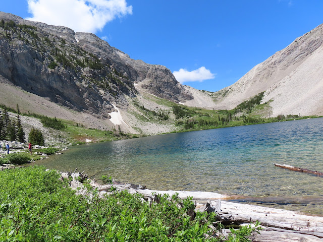
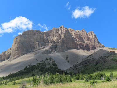
Porphyry Peak above an empty Showdown Ski Area, two weeks before the ski hill opens

The first cross country ski of the season on Dec. 1?

That's pretty darn late.

I guess I could have gotten it in earlier if we hadn't traveled to Salt Lake City for Thanksgiving.

There really isn't a lot of snow.  But, it was set up just right on Showdown's Golden Goose runs so that I could take my first turns of the season.  It was a balmy 31 degrees on the hill, while the temperature in Great Falls, locked in an inversion, got only into the low teens.

There was 3-6 inches of snow on a shallow base, but it was a nice powder and of the right consistency for an enjoyable ski.

This was the first time I was trying something new to correct for that awful hammertoe on my left foot, and bunions on both feet.

While I have fairly new Scarpa T-3 boots, the left boot has never fit comfortably.

I went online and bid on a pair of used T-3s for $99 a half size bigger and now tried out the used left boot and kept my new right boot, a half-smaller, and it worked perfectly!

I skied without rubbing my hammertoe on the left boot and both boots felt good on my bunions.

Looks like that should work in the near term.  The left foot is ominously disfigured enough that I know I've got foot surgery in my future.

Seize the day!

Sunday, November 17, 2024

Is it Havre or Bullhook? New hiking area up north


Katie in one of the lava-created draws

Mount Lieberg

The shadows highlight to dike coming off Mount Lieberg

 We are always looking around for new hiking possibilities, especially in the Front, and the Island Ranges.

Katie found a real dandy recently and we gave it a try: the newly opened Bullhook Trail a few miles outside Havre.  Directions:  Location: very south end of Bullhook Butte (aka Saddle Butte). Directions: take 14th Ave/Clear Creek Rd in Havre to Bullhook Rd. Proceed on Bullhook Rd about 1.5 miles until the pavement ends, continue and 0.2 miles later on the left (east) you'll see the parking lot.

It's not particularly long or hard, but it is really scenic.  I clocked 1.8 miles and about 660 elevation gain and loss on a main loop, but using your imagination with a good cutacross trail you could increase this.

This small butte (mountain?) is a lava outflow.  A well-developed and in part, steep trail leads through small canyons created by the outcrops.

Access has been donated by the Lieberg family and the high point bears the Mount Lieberg name.

From the top there are tremendous views of the Sweetgrass Hills, the Bearspaw Mountains and the Highwood Mountains, and into the Bullhook Bottom, and Milk River flats into Canada.

It's called "Bullhook" Butte because the top looks like a bison bull hooked it, creating a notch.

Bullhook was railroad magnate J.J. Hill's favored name for what is now Havre, the biggest city on the Hi-Line.  However, he lost out a settler whose family lived in LaHavre in France.

The 110-miles drive to Havre was enhanced by a stop at Jenny's Kitchen across from the BN railway station at 416 1st St., a funky restaurant you'd expect from a town like Bozeman or Missoula.  It is decorated with discarded industrial and agricultural objects and features an eclectic menu.

We're finding ourselves drawn more and more to Havre with its buffalo jump, Havre Beneath the Streets, Beaver Creek County Park hiking in the Bearspaws,  Fort Assiniboine, and MSU Northern.  Lots to do here.


Jenny's Kitchen with an old windmill hanging from the ceiling

Lots of ag and industrial objects to view at Jenny's back alley entrance


Saturday, November 02, 2024

After more than 40 years a Hauser Lake surprise


Katie in the Hauser Canyon

An angler near Beaver Creek with Gates Wilderness in sight


The trail scrambles across this talus field

Beaver Creek fishing area


It had been more than 40 years since I had been to Hauser Lake on the Missouri River northeast of Helena.  My only memories were good fishing and a lousy, winding road.

Both were confirmed at a trip there Friday as we watched anglers pulling in big rainbows and browns, and my experience with a road so winding that there is a mirror in one spot so you don't run into another vehicle.

What I hadn't done when I lived in Helena was hike the east shore, where there is a two mile trail to Beaver Creek, another legendary Helena-area fishing spot reached from the town of York.

The trail goes through an extremely scenic high canyon at several points crossing fields of talus made passable by flattened rock.  Placement of those rocks is impressive.

The Missouri was particularly beautiful, running a translucent, dark green.  There were many spots where the hiker or fisherman can descend to the river bank.

This is truly area is truly an extension of the the spectacular limestone canyon that borders the Gates of the Mountains Wilderness Area.

At the developed Beaver Creek site the Gates area at Big Log Gulch trailhead is a short distance to the north.

This area is yet another example of the amazing country that is adjacent to our wilderness system areas that haven't been designated.

Hauser Dam is reached off the Lincoln Road exit to Lake Helena.  At the Causeway Road turn left and take the road to the dam.

There is a much longer, dustier, bumpier road to Beaver Creek from the town of York.

This is so easy to reach with a high payoff that I'll be back again.  But I won't wait 40 years to do it.

Sunday, October 27, 2024

A Fall to remember: Coopers Lake, Windy Point in Highwoods, Scratchgravel Hills

The golden larch along Coopers Lake north of Ovando

I guess you can say Katie is a real tree hugger as she takes on this 130 foot larch

Larch showing off

Surprising late, aspen color in the Highwood Mountains

Some of the blowdown along Thain Creek in the Highwoods

 It's the final weekend of October, and while still colorful, I think my autumn colors treks are over.

I can feel winter looming.

In the past week I've taken two hikes in the Coopers Lake north of Ovando on the edge of the Scapegoat Wilderness, and a hike to Windy Point in the Highwood Mountains.

I expect the western larch to be in full color until the end of October, so I wasn't surprised to see the lovely display near Coopers Lake.

I was surprised to find the bright, yellow colors in the aspen and cottonwoods in the Highwood Mountains.  In normal years these would have been gone by now.

My wife has observed that it is rare to see the aspen and cottonwoods on the east side of the Continental Divide in bright color at the same time as the larch on the west side.  But there they were.

I had been invited to Coopers Lake by my friend Wayne Phillips, who was leading a hike for the Montana Native Plants Society, and who was interested in the giant larch trees in the area.  We parked at a gate on the east shore of the lake and walked a trail on that side that parallels the lake. It is a trail that can be taken to the North Fork Blackfoot Road Bear Creek trailhead, something I'd like to try someday.

We only went a mile and three quarters, and stopped to measure larch trees, which we estimated to be some 130 feet high and more than 5 feet in circumference. 

The larch were in such golden glory that I returned with Katie a week later to enjoy them again, only this time in better, sunnier weather that made the larch really stand out against the blue sky.

It must be at least 30 years since I had been in the area and didn't remember the lake or the trail, or how I managed to climb to Windy Pass and then Echo Peak.  But I do remember the late Sydne and Charley Abernathy on the trail.  They had a cabin on Coopers Lake.  The trail there was particularly poignant to me in that Sidney had died only two weeks previously.  These were two of the kindest, community-minded folks in Great Falls.

Phillips is convinced I accessed the pass and peak via Bear Creek trailhead.

Anyway, Thain Creek, which is the main drainage to Windy Point in the Highwoods, has been very affected by uprooted and downed trees from recent high wind storms.  The Forest Service has done a remarkable job clearing the trail. 

Oops!  Scratchgravels

I've returned here because I forgot to add a wonderful hike we did in the Scratchgravel Hills in Helena, accessed on the range's east face by way of the John G Mine Road.

Usually we come in from Green Meadow on the south.

We worked our way up a narrow mining road and eventually got to a small, grassy summit with fabulous views of the Helena Valley and the surrounding mountain ranges, the Continental Divide, Prickly Pear Pass, the Big Belts, and Elkhorns.

Up the Scratchgravels

An old mining road

The steep rise to the top


Friday, October 18, 2024

Robust Fall color tour: Teton canyon, Belt Creek, Bearspaw nature trail, Pioneer Ridge, Polebridge larch


Bowman Lake in Glacier


North Fork Flathead River

I've always maintained that our best colors in the Fall are on the ground, although I must admit that the larch in color are always a thrill.

 It seems as though the pace is almost frantic:  getting in as much of the Fall color as we can.

I don't remember a better Fall show, a combination of warm and dry with no frost.

In a two week period we hiked the Middle Fork Teton after touring the Teton Canyon west of Choteau;  took several trips up the Belt Creek Scenic Byway viewing the brilliant reds, oranges and yellows that climb the gulches and spangle the bottoms; hiked the Beaver Creek County Park Nature Trail in the Bearspaw Mountains; did side trips to Lewistown and Stanford to visit the American Prairie Museum and attend the Stanford Scarecrow Festival; did the Going to the Sun Highway and stopped overnight at the Polebridge Mercantile, with a visit to Bowman Lake and a hike into a lovely meadow;  we drove out along the North Fork Flathead River in awe of the spectacular larch in full color, proceeding down the Flathead and the Swan and through Seeley Lake and home via Rogers Pass.  Whew!  Oh, and I did a side hike, the Pioneer Ridge Loop near the Belt Creek Ranger Station.  The Belt Creek trip was coupled with a drive via White Sulphur Springs and the Skidway Campground in the Big Belts.

These trips took us into the Little Belts, Bearspaws, Big Belts, Rocky Mountain Front, Glacier Park mountain ranges.


Saturday, October 05, 2024

Firebrand in Fall: Let me walk in glory


The Lake Creek aspen show on the Looking Glass Road


Bold Ptarmigan didn't move when we hiked by

My favorite section of the Firebrand Pass trail

A sharp eye will spot the larch in golden color behind Summit Mountain

Peak 8888 dominates the horizon from Firebrand Pass

Mountain Ash tree is a blaze of color

Gordon Whirry enjoying the explosion of color on Firebrand trail

A wall of brilliant aspen

My headline is from an old Indian prayer to the Great Spirit, "Let me walk in glory," extolling the wonders of nature.

We walked in full Fall glory Oct. 3 on our annual autumn trip to Firebrand Pass in Glacier Park.

It's a relatively easy 10 mile, 2,000 feet trip to an out of the way spot on the southeastern edge of the park, entered across a railroad track and a barbed wire gate at a place called False Summit, about 7 miles from the park.

We time this hike for the last couple of days of September or the first couple of days of October when the fall colors on the east side of the park are at their peak.  That means the copious aspen groves and ground cover, especially the huckleberries are bursting with golden leaves and scarlet foliage. 

I love this hike any time of the year, but fall is when it is at its best.

It also has the advantage of being off the park's beaten path, but increasingly we're finding more and more people on this trail.  A portion of the trail is part of the Continental Divide Trail, but ultimately climbs to the divide above Ole Creek, which empties into the Middle Fork of the Flathead at Essex.

Red Crow Mountain is an easy climb from the pass via climbers' trails  Calf Robe is accessible via ridges from the trail at various aspects.

Along the way we got great views to the south of the spectacular aspen groves aglow in the Badger Two Medicine area in the Helena Lewis and Clark National Forest.

To change this up when we reached the flat below the pass we opted for the old, abandoned trail to the pass, which goes straight up the gut, rather than the new trail that hangs to the south high above steep scree fields.  We found the old route still passable, although some trees had grown over the path, easy to skirt.  We took the high trail back down.

On the return trip the sun had hit the aspen groves, lighting them up even more than in the morning.

At the pass itself we were treated to fully illuminated golden larch trees beneath Summit peak.  It will be a couple of weeks yet before we return to the Middle Fork country to enjoy the Fall larch show.

As an aside, I continue to marvel at the number of women and women's groups that do this Fall hike.  There was just Gordon and me and one other man, and 18 women in five different groups.  All were from the Whitefish/Kalispell area who misidentified themselves as being from, "here."  We set them straight that they were from the West side, and we, being from Great Falls, were "here" on the East side of the mountains.

Monday, September 30, 2024

Glorious Fall: Blackfoot, Glacier, Missions


 This is a glorious fall, and we've been blessed to enjoy it fully with trips to Glacier, the Missions, the Swan and the Blackfoot corridors.

Some of this has been just to get away on long drives to enjoy the color.

We've also stayed at the Laughing Horse Lodge in Swan Lake and attended the Glacier Two Med Alliance annual meeting in East Glacier Park.

Earlier, we had an ill-fated driving trip to Folsom Lake area of northern California, cut short by Katie catching Covid, which turned us around so we didn't infect Katie's parents.

Whew!

My favorite was the Sept. 28 drive from Swan Lake to East Glacier, experiencing the cottonwoods along the Middle Fork of the Flathead and the golden aspen in the Two Med and Lake Creek country of Glacier.I had usually reserved a trip along the Middle Fork for mid to late October when the larch are at their golden peak, so it was great to see the cottonwood and aspen color.

Our biggest hike was in the Missions to Cold Lake near Condon.

We've been struggling with what Katie can do as she battled Covid and severe anemia.  

While at the Glacier Two Med meeting we hiked in the Lubec Lakes area and then went with Laurie Lintner from Looking Glass Pass to a favorite ridge into Glacier.  It was blustery the day of our hike there.

The ground cover has been the main attraction for me ---- the reds, yellows, oranges and purples and deep green colors spangling the forest floor.

I've taken my backcountry skis in for a tune-up.  Some years I've been skiing by now.  Always pays to prepared.


Friday, September 06, 2024

Devil's Glen, Waterton Lakes, Glacier Park

We had a perfect day for the perfect Glacier Goose Island photo on St. Mary Lake
Katie strolling the Janet Lake shoreline

Katie with the Porcupine Quills behind her

 The smoke has abated somewhat. It's still there, just not as thick, so the outline of the mountains is visible.That makes getting out more palatable. 

We did a beautiful day hike to Devil's Glen in the Dearborn part of the Bob Marshall Wilderness and then spent three days in Waterton and Glacier National parks.

I had forgotten how beautiful the Devil's Glen area is because I've been returning to the Falls Creek part of this area more frequently.  Within less than three miles the translucent green Dearborn River flows through a sometimes high and jagged limestone canyon beneath Steamboat Mountain on the Rocky Mountain Front.  The canyon disappears, but the river cascades over patchworks of limestone.

Because I let our smog-filled summer keep me home much too often I developed a pretty severe case of cabin fever that Katie fixed by planning a trip to our favorite Waterton Lakes National Park north of Glacier in southern Alberta.

We spent three days hiking and enjoying the park for the three days immediately following the Canadian Labour Day holiday.  We arrived the day after and found the townsite and park deserted.  What a welcome contrast to Glacier Park, which we visited on our way home.

As usual, we saw black bears on the road to Waterton's Red Rocks Canyon

We walked the shore of Cameron Lake the first day, and the second day took the boat across Waterton Lake back to Glacier Park where we hiked 8-miles roundtrip to Janet Lake.  I hadn't spent much time there in more than 30 years and marveled at its beauty.  The dominant peaks above the lake are Thunderbird and the Porcupine Quills. Glacial waters fill it as well as Lake Frances above it.  We had stayed at Lake Frances three years ago on a Hole in the Wall destination trip that started at Bowman Lake.

As a side note for the record, I got my eighth COVID vaccination on Monday, and on our first day at Waterton experienced painful side effects that included body aches and extreme fatigue.  I didn't let it stop me and by Wednesday was back to my old, chipper self.

The final day we drove back, enjoying a leisurely visit to Glacier's St. Mary's valley.  We had set out to hike Sun Point, but to our surprise and dismay couldn't find parking!  This on a mid-week, post-Labor Day.  Glacier, unlike Waterton, was crawling with people all vying for the same sights along the Going to the Sun Road.

So, we retreated to the Red Eagle Lake Trail near the park entrance and had a nice hike to the shores of St. Mary Lake.  We encountered only a couple of other hikers.  The weather was the best of the trip with clear visibility and there we found our best photos.

I'm glad folks around the U.S. and the world are enjoying the park, but with large bus tours from international companies like Globus and Collette, the park has become a zoo.

My advice is to go off-trail in Glacier or confine your hikes to the U.S. 2 park portals and trailheads on the southern end of the park. 

I should mention that we also finished our Midnight Hill traverse near Rogers Pass, this time coming up the short hike from Montana 200 just west of the pass on an old logging road.  Possibly skiable.

At the Dearborn's Devil's Glen

The Devil's Glen spectacle