 |
| Looking down from Werner |
 |
| My solo extra lite camp |
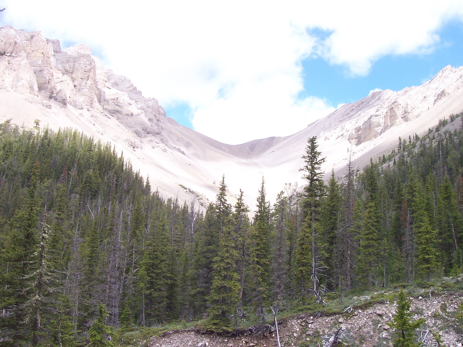 |
| The Front at its best |
I like to think of the West Fork of the Teton River area as my “expressway” into the Bob Marshall Wilderness.
This is where only a single mile of hiking can deliver you into wilderness solitude.
Such was the case earlier this week when I decided to complete a couple of trips I started in the past.
One was a hike up the entire East Fork of the Teton Trail No. 108 to the pass and climb Mount Werner (elevation: 8,090 feet). The other was to see where the North Fork of the Teton Trail No. 107 might take me. It led me over a pass and down into the South Fork of the Birch Creek country where I climbed Bum Shot Mountain (elevation: 7,544 feet), remote from any starting point.
I had been focusing on these hikes more intensely since last winter after I rented the Forest Service West Fork administrative cabin. We made it up the East Fork a ways on cross-country skis and turned back. I was concerned that since it led to a pass above Blackleaf Canyon it might be avalanche-prone. My hike on Wednesday dispelled that concern. It looks as though this would be a great winter route, although I’m not too sure about potential avalanche hazard on the Blackleaf side, where there are steeper walls tighter in on the trail.
The hike follows the East Fork to its source below Werner. The East Fork is hemmed in by forest most of the way. High limestone headwalls and spires crown these forests. Columbine is in season along the floors and slopes.
Werner is actually three separate 300-350 foot bumps on a ridgeline above the pass. It is a 2,400-foot climb from the trailhead to these bumps.
My original plan was to backpack a loop up the North Fork, around Old Man of the Hills Mountain, across the backside of Volcano Reef, and down the East Fork.
However, it had been raining steadily in Great Falls and I figured I could still salvage the trip by car camping at the West Fork campground.
When I finished the East Fork-Werner climb, however, I realized that it would be a mistake to camp with the cars and sprinted back to my car, repacked my backpack and went back to where the East Fork dumps into the North Fork and set up my backpack camp ---- an 18 minute, 1-mile walk from the car.
That set me up nicely for the second day of hiking, completing the North Fork trail.
Bum Shot Mountain
In years past I had hiked this trail only about three miles in, as far as Bruce Creek where it picks up Trail No. 152 to Corrugate Ridge on its way to the South Fork of Birch Creek.
As with the East Fork trail the day before, I wondered if there would be good cross country ski possibilities from the West Fork cabin to the trail’s end.
Another possibility I had in mind was to drop over to the Birch Creek side and climb Bum Shot Mountain.
The hike up the North Fork was more of the same --- mostly in deep forest with the creek in hearing distance and with little elevation gain for the first several miles. There were exceptional mountain views in meadows where tributary streams flowed into the creek. Nanny Creek was one such place, about 4 miles in. I think this would be primo backpack spot, with views of Mount Patrick Gass.
Not long after Nanny Creek the trail starts gaining elevation and then begins to switchback to the Birch Creek divide. On these switchbacks Bloody Hill, which sits just north of Patrick Gass comes into view. It is a classically beautiful peak with a high cirque east face. I figured out that it could be climbed from that Birch Creek divide along a timbered ridgeline. Later, I realized that I could have used a ridgeline from Bum Shot Mountain to climb it and return to the pass and North Fork trail. That’s for another trip.
I was no in the headwaters of Phone Creek, a main tributary of the South Fork of Birch Creek, and began losing elevation quickly on my way to the foot of Bum Shot. In about a mile and a half I reached a crossing of the creek and at that point decided to climb the mountain, reaching it by way shooting for a saddle adjacent to the mountain just above this crossing. I climbed nearly 1,300 feet to reach the top of this limestone peak, which is a very narrow ridge, some 2 miles long.
The ridge to the peak ascended and fell, but the views from the top were well worth the effort. Immediately to the east was Bennie Hill, which I climbed last August. Behind that on the horizon was gleaming white Walling Reef. I could see Patrick Gass and the ridge to Bloody Hill to the southwest. To the southeast a massive, unnamed ridge stretches the length of the trail from the East Fork to Bennie Hill and is higher than any of the unnamed peaks immediately around it. To the north were the high peaks of Birch Creek: Crooked, Drewyer (Droulliard), Field, Richmond, Sentinel, Morningstar, Poia, Scarface on into Glacier Park.
I bushwhacked down off the peak’s north end off an east-sloping ridge to Phone Creek, and hauled back to my camp, about 9 miles south.
Every time I enter the Bob Marshall Area, I realize how incredible and huge it is, and the great number of lifetimes it would take to see it all!
No comments:
Post a Comment