 |
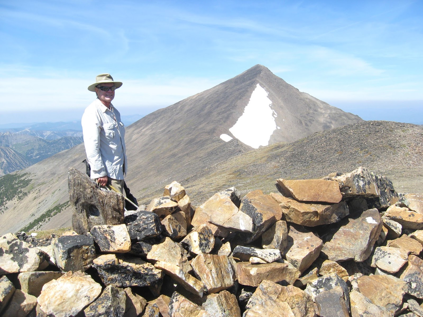
| H. Wayne Phillips on way to Pintlars High Point --- West Goat peak |
 |
| Alpine lakes beneath the peak still had ice |
Wayne Phillips has been trying to climb the highest peak in every Montana mountain range and asked if I would join him on West Goat (elevation: 10,793 feet) to grab the highest in the Pintler range in the Anaconda Pintler Wilderness Area.
The Pintlers straddle the Continental Divide south of Butte. East and West Goat peaks are on the east side.
I climbed in the Pintlers last year, getting the second highest peak, Warren (elevation: 10,460 feet). Warren is a much more handsome peak with more alpine challenges than West Goat.
West Goat is mainly just a walk-up Class 2 all the way.
The challenge with West Goat is the route finding.
That’s where Phillips excels.
He charted a course up a ridgeline from the south and east of the mountain as soon as we crossed the West Fork of Fishtrap Creek north of our Big Hole camp west of Wise River.
We gained nearly 4,700 feet to the top, climbing a small hump called Nipple Peak ( elevation: 9,655 feet. I don’t know why they bothered to name it) and East Goat Peak (10,399 feet).
To get to this high, alpine ridge we walked across much blowdown in a white bark pine forest.
The ridge itself was made up large volcanics covered with a silicate.
I love ridge walking, so it made up for the lack of mountaineering challenges.
This ridge walk reminded me some of the hike earlier in the summer up Caribou Peak in the Scapegoat Wilderness, also on the Continental Divide.
Once we began the descent off East Goat on our way to the saddle between it and West Goat the Lost Lakes to the north came into view. The scenery here was worth the whole hike. The lakes were a deep blue/green and the upper, larger lake still had ice in it reminiscent of Glacier’s Iceberg Lake.
We also saw seven mountain goats, but at quite a distance as they ran over a saddle on West Goat.
The views from the top were hampered by a thick shroud of dark smoke on the horizon, making identifications of distant mountain ranges impossible.
We could see most of the Pintlers, though, and marveled at the many lakes tucked into high glacial valleys.
Rather than retrace our steps we came down the ridgeline to the west, prolonging our alpine ridge walk, then found a pretty good game trail before descending to the valley floor where we picked up the formal trail.
This was Phillips’ statistical summary: “final route was 14.2 miles, gaining 4,762 ft elev. since it was about 6.2 miles to the summit, we evidently only added about 2 total miles to the trip by descending the west ridge (instead of retracing our up route). We had 4.75 TRAIL miles on the descent route and only about 0.75 TRAIL miles on the way up, so traded about 2 off-trail miles for 2 trail miles on West Ridge descent, which was one of the (my) reasons for going down the West Ridge. It just seems that trading 2 off-trail for 2 trail miles was not a net energy gain, considering the extra 2 trail miles added, especially considering the rough, rocky trail.”
I was pleased with the scenery and amazed that we encountered no one during this exceptionally pretty summer day.
Our night of camping on the Big Hole River was one of the nicest I’ve had. There was no moon and the stars and Milky Way twinkled above us. What a counterpoint to the backcountry camping last week in the rain at Glacier!
One other aside: The Front holds up well against the Pintlers for scenery.
No comments:
Post a Comment