 |
| Granite Butte lookout in a fog |
 |
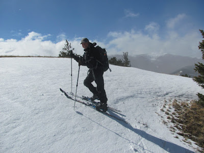
| I climb one of the snow berms along the way |
 |
| We gradually ran out of snow |
 |
| Snow gone. We hike out. |
It is ridgeline all the way, offering stunning views of the Nevada-Black Mountain section of the CDT and some telemark territory.
 |
| Wayne kept us on route by checking his compass frequently. |
It begins at Stemple, heads for the Granite Butte area, passes South Fork of Poorman and stays with the CDT until the Cellar Creek trail junction.
Cellar Creek follows a spur ridge east and south, but Wayne's route stays on the ridge when the trail descends into the bottom.
My favorite section is the Cayuse area, very open and offering great views in all directions. You get the feeling of being on top the world.
While most of the snow had melted off, there was a strip that hung close to the trees and we followed that down to within a mile of our end-point, strapped the skis to our packs and walked out.
Wayne did a remarkable job of planning this route, going to Google Earth and even identifying compass bearing points, open park-lands and what kind of trees lined the route, so that we would stay on course.
We drew all kinds of weather ---- from bright, warm sunlight, to snow showers.
The snow was crusty, but had a new layer of about an inch or two of snow that had fallen overnight.
I found the icy crust tough to negotiate at times, but by late afternoon the sun had loosened it up and were were able to cut nice turns.
Many spots along the way reminded me of another of Wayne's backcountry routes, Nugget Creek in the Little Belts, as it also follows an open ridgeline most the way.
Tracking our route along the Continental Divide Trail and Cayuse/Cellar Creek spur.

No comments:
Post a Comment