 |
| Six of the seven furry buddies met us on top |
 |
| On the unnamed summit |
 |
| Approaching the top |
We were weathered off by an approaching storm.
However, we did reach the summit of an adjacent, sharp unnamed peak on the Running Rabit Ridge (elevation: 7,434 feet), which even had a Geodesic marker, that usually graces a summit.
This was a bushwhack all the way from the Izaak Walton Ranger Station on a southwestern ridge that gained over 4,000 feet to the top over about 4 miles. This is the ridge above Ole Creek.
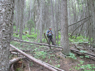
We descended on a southerly ridge adjacent to our ascent route. The map that accompanies this does not include our down route. Our biggest obstacles were many downed trees and thick vegetation.
 |
| The forest floor was thick with deadfall |
We were treated to a tremendous wildflower display in the occasional open meadows, particularly beargrass, arrowleaf, lupine, and orange paintbrush.
The biggest treat of the day was reaching the top and being greeted by seven curious mountain goats (2 nannies, 4 yearlings and a newborn) that pranced on the snow and did acrobatics on the rocks below. The yearlings were almost too curious about us and received sharp reprimands from mom. The scenery on this climb was stunning ---- the snowcapped Great Bear to the south and the southern end of Glacier Park to the North, dominated by big guy mountains like St. Nicholas, Stimson and Jackson.
Below us was the Wild and Scenic Middle Fork of the Flathead, twisting and turning out of the wilderness in its emerald beauty along Highway 2.
For a topo map and more photos, CLICK HERE
 |
| Mark Hertenstein in a field of beargrass |
 |
| Looking down on the Middle Fork Flathead |
No comments:
Post a Comment