Tuesday, June 27, 2017

A week's worth: Fairview again, CDT at Rogers (twice), Wolf Butte

At Lewis and Clark Pass 
Silky Phacelia were abundant


Beargrass was thick near Rogers Pass
Primrose were everywhere
A standard CDT view near Rogers Pass

Nearing the top of Green Mountain, the high point on the hike at 7,450 feet


As Spring turned to Summer 2017 I got extremely active with the great weather, climbing Fairview for the second time in a week, doing two variations on the Continental Divide Trail between Rogers and Lewis and Clark passes and doing my annual climb of Wolf Butte in the Little Belts with my son, Demian.
I took and re-took these hikes simply to enjoy the aesthetics, and the athletics.
Of particular interest were the wildflowers on the stretch of the CDT between Rogers and Lewis and Clark passes.  Rogers is easily accessible from Highway 200, just under an hour's drive from Great Falls.  Lewis and Clark Pass is reached from the Alice Creek trailhead in the Helena National Forest some 14 miles from Rogers Pass on the Alice Creek Road.
Usually at this time of year we enjoy the alpine flowers atop the CDT above Rogers.  But, this year everything seems accelerated. Yes, we saw some alpine flowers, but they were fading and being replaced by other varieties.  Where we normally see Forget-Me-Nots and Douglasia now, they've faded and have been replaced by Miner's Candle and Primrose and tons of Loco Weed.
On Sunday we hiked from Alice Creek trailhead to Lewis and Clark Pass and then to Rogers, covering 10 miles and climbing 3,000 feet in brilliant sunlight.
After reaching Cadotte Pass we began to see other hikers who had come up from Rogers, checking out the wildflowers.  We later found out that most were from the Missoula area.  Their interest was piqued by a story in the Missoulian newspaper extolling the blooms along the Divide.
I have been going to this area for 45 years, and have never seen so many cars at Rogers Pass.  I teased the Missoulian's Rob Chaney that his article made Rogers look like a Bozeman-area trailhead.
There were lots of grizzly diggings or 'rototillings' on the hillsides between Green Mountain and Cadotte Pass.
The views along this stretch of the CDT include the Red Mountain skyline, the tops of Steamboat Lookout, Caribou Peak, Ear Mountain and Table Mountain, the Great Plains, and as far south and west as the Flint Creek mountains near Deer Lodge and Philipsburg.  On a clear day the Island Ranges of Montana, including the Sweetgrass Hills, Highwoods, Bearpaws, Big and Little Belts and even Snowies are visible.
What an amazing thing it is to have this national scenic trail in our back yard!

Monday, June 19, 2017

Buffalo Lakes in Two Med, Otokomi after the fire

Katie in the Beargrass on Otokomi Trail in Glacier


Above one of the Buffalo Lakes in the Badger Two Medicine Area south of Glacier


We took a quick trip to Glacier for Father's Day weekend and explored the aftermath of the 2015 Reynolds Fire on the Otokomi Lake Trail, and were surprised by an easy trip in the Badger Two Medicine, which came our way by accident.

Fire has opened the views 
Hard to argue that fire hasn't changed the landscape


Katie on one of the snowfields leading to Otokomi Lake
Otokomi Lake Trail

We've done this St. Mary Lake area trip that starts at Rising Sun Campground many times, but not since the 2015 Reynolds fire the burned most that summer and scorched an area between the campground and the Jackson Overlook.
We wanted a look at how things are coming back and the extent of the fire.
I can report that the vegetation is coming back gangbusters and the fire burned in a nice mosaic pattern that left plenty of patches of live trees while clearing new vistas.  It was great we could see the Rose Creek bottom and its many waterfalls and cascades more clearly because of the fire.
Yes, there were areas we crossed that looked like a bomb had hit it, much like what we have seen the past 30 years of fire in the Bob Marshall Wilderness complex.  But even these had greenery coming back.
There is no doubt this is a big beargrass year, and the trail was covered in it, as well as bright patches of orange Indian Paintbrush, and yellow Arnica wildflowers, and neck-high thimbleberry bushes crowned with large white blossoms.
The Park Service has done a great job clearing the trail of downed trees and fire debris.
The normal trail is 5 miles and gains about 2,400 feet to Otokomi Lake, a jewel in a cirque with walls of bright red arguilite rock.  It lies below Goat Mountain to the south.
We got within .2 of a mile of the lake and after having negotiated three of five snowfields and being dampened by rain shower with even darker clouds heading in our direction, we decided to turn around.
The fire has improved this hike.

Walking the Bison Ridge opposite Lubec Ridge above Buffalo Lakes 
One of the Buffalo Lakes in extreme northeast corner of Badger Two Medicine Area


Buffalo Lakes in Two Med

This is a hike I had never heard of until Sunday morning at breakfast at the Two Med Grille in East Glacier Park at loose ends about what to do.
Serendipitously, in walks Kendall Flint, the local obstetrician and Badger Two Med Alliance activist,  who was there to meet those who had signed up for his hike into this area.
Flint was leading a Montana Wilderness Association hike into the area, which is really his backyard, an area bounded by Lubec Ridge in the Two Med area of the Badger Two Medicine Area of the Helena Lewis and Clark National Forest.
Flint said there had been cancellations and invited us along.
For the past 45 years I've driven north of this area on U.S. 2 heading to Marias Pass, and thought the area looked uninteresting.
I couldn't have made a less informed judgment that the hike disproved.
The area is in the extreme northeast tip of the Badger Two Med about a mile or so west of the Firebrand restaurant.
There is a small pullout on the south side of U.S. 2, which we got four cars into.  It would be very easy to miss.
It is gated, with a tight pass-through for hikers. To keep out 4-wheelers and motorcycles, there are a couple of effective concrete posts.  The Forest Service, which ruled this area off-limits to these motorized vehicles, obviously means business.
My new National Geographic map of the Bob Marshall Complex shows no trail here.
But, my old Forest Service Bob Marshall Map shows this trail as Trail 100.
It follows a portion of an old, but recently expanded natural gas pipeline right of way and within a mile and a half opens into a beautiful green bottom that had been dammed into a lake by (now gone) beavers, whose lodge is still visible.  It sits below a small ridgeline that separates it from a couple of other dammed ponds.
Throughout, this hike opens up and reveals great views into Glacier Park's south and east ends, looking straight at Sacred Dancing Woman, Red Crow, Calf Robe, Bearhead and Summit mountains.
We hit it when the wildflowers were in full bloom as they lit up these open eastside slopes.
After a short lunch we climbed the ridge to the east and walked it back down to the pipeline right of way and then through forest back to Flint's house.
We had covered 3 miles and almost 1,000 feet of elevation.
Along the way there were lots of signs of moose, elk, grizzly.  This area is really alive with wildlife.
It is an isolated area even though it is only a couple of miles from U.S. 2.
This is some of the land that the Badger Two Medicine Alliance is trying to save from oil and gas development and it lies close to the Hall Creek proposed wellsite that is sacred to the Blackfeet Nation.
Had we stayed on the ridge above the ponds and walked south rather than north we would have been able to access Baldy, Kyo Crag and Half Dome mountains deep in the heart of the Badger Two Med.


Friday, June 16, 2017

Fairview Mountain explorations

In the waterfall canyon I saw this large spring gushing from the canyon wall into Willow Creek 
The impressive first Willow Creek waterfall


Looking up toward the first saddle

A "selfie" on top with Scapegoat Wilderness behind me

Plenty of snow on east facing slope of Fairview

I negotiated this snowfield in the talus to the right

Like a Garden of Eden, these waterfalls cascade over several cliff bands in the narrow gulch

A band of sandstone at the end of the narrow gulch
Mountains can be climbed by varieties of routes.
Over the years I've settled on an easy route up Fairview Mountain (elevation: 8,215 feet) after approaching it from several different aspects that made the ascent more difficult.
On Thursday I had plenty of time and did some exploring that confirmed that my easy route is still the easiest route.
Yet, by exploring I found some very interesting scenery and a gorgeous waterfall.
Fairview Mountain in the Rocky Mountain Front west of Augusta is reached at the old Camp Scoutana junction and a ranch trailhead some two miles up a rough gravel road.
The trail immediately crosses Willow Creek, which is bank full with spring runoff.  I couldn't cross at the trail and it looked like I was going to be skunked right out of the chute.
The usual rocks and tree limbs were deep under rushing water.
To the right it was blocked by barbed wire fence across the creek.
So, I bushwhacked to the right, following what appeared to be a game or angler's trail.
About 200 feet the rough track went to the creek and there were two boards across it.
Problem solved!
The trail then climbs through grass and numerous wildflowers to a high trail into a deep limestone canyon high above the creek.
What follows is a series of three waterfalls and the canyon ends with yet another waterfall in sight.
At the end of the canyon is a narrow gulch immediately to the right at the foot of the mountain.
The favored route is to skip this gulch, round the bend on the trail to the next gulch on the other side of the ridge and proceed up, climbing progressively through two large saddles that can be reached on any of the abundant game trails.
What I did Monday was to get to the first saddle, and head to the right where there is a long limestone ridge. Above it are open, grassy areas in the trees that lead to the summit ridge.  I did this instead of going to the second saddle and then angling over.
This turned out to be a great, but little steeper route than the easy route.
On the way down I repeated my route to the limestone ridge, but instead of heading back down through the first saddle, I decided to explore the narrow gulch to the left, just below the mountain's extensive scree and talus west slope.
By moving back and forth across a small stream and climbing above into the talus I worked my way progressively down this gulch to the trail, just above the deep canyon with the falls.
Along the way my biggest hazard was a large snowfield that I avoided by climbing above it and side-hilling.
I also found an dazzling new waterfall that cascades down through a series of cliffs into the stream.
Unfortunately the day was a dreary gray, windy and cold and the light was flat.
Although Fairview Mountain isn't particularly challenging, the climb, with its waterfalls canyon and the views into the Scapegoat and Bob Marshall wilderness areas, Rocky Mountain Front, and even Great Plains with its Island Ranges, is quite rewarding.
By taking these new, direct routes, I figured I saved about a mile of hiking, 7.3 miles rather than 8.6 miles, gaining and losing some 3,000 feet.  I also saw several pretty good routes up to the ridge through the limestone scree and talus
The blue line is the traditional, or easy, route.  The red line is where I left the first saddle and went to a limestone ridge and then to the summit ridge.  The fuschia colored line is where I descended into the tight gulch.


Saturday, June 10, 2017

A failed try to climb Mortimer Peak in Front

This is the mountain we tried to climb on its west ridge (left) getting blocked 600 feet from top

The trail opens into lovely green meadows full of wildflowers

Look hard and you'll see Mark Hertenstein in the scree

On the ridge we could see Gibson Lake

A ridge line view toward the peak

Sometimes it takes failure to produce success.
I hope Saturday's defeat in getting to the top of Mortimer Peak (8,275 feet) in the Rocky Mountain Front, might be one of those times.
We got within 600 feet of the top, blocked by caution as high winds buffeted a jagged ridge line that made me think twice.  I did and then I didn't go.
The peak sits at the end of the wild and gorgeous Mortimer-Blacktail National Recreation Trail just north of the Gibson Reservoir above the Triple J Guest Ranch on the edge of the Bob Marshall Wilderness.
It appears as though our west ridge route was unnecessarily difficult.  From across the valley we could see a ridge line to the east that looked to be a much easier and safer scramble.
We've skied this Mortimer trail and I've used it to climb and hike in the Bob Marshall.
It travels above the Triple J through a forested area carpeted with lush foliage that opens to mountain meadows that show off Castle Reef and Sawtooth mountains to the east and south, sort of the guardians of the translucent emerald Sun River that passes between them out onto the plains.
This time of year the green is especially green and the wildflowers are everywhere.  We found both lady slipper and fairy slipper orchids, and fields of Arrowleaf and chick weed.
Along the way we followed fresh footprints of both wolf and bear.
Large wolf track
The peak is not officially named on any map I've seen, but we call it Mortimer because it sits at the head of Mortimer Gulch.
We approached it from Big George Gulch side, gaining 1,000 feet to a saddle on its long west ridge and then descended entirely along this ridge, which in spots is a knife ridge.  In spots it looks possible to pass to the valley to the east to gain that easier east ridge, but we were tired enough from getting hammered by the high winds.
We hiked just under 11 miles roundtrip and gained and lost 3,600 feet, so it was a robust day for a couple of elderly men.
We'll return later this summer to climb that east ridge.


Thursday, June 08, 2017

Three more: Twin Buttes in Dearborn, Mount Wright, Snowies ice caves


The fresh grizzly track we found when climbing Mount Wright
The weather has been absolutely superb and I've used it advantageously to pick a new route into Twin Buttes on the Dearborn, do my annual Mount Wright climb, and hike a new route into the Ice Caves in the Big Snowies.

I worked my way through these cliffs to find a route that would access Falls Creek

Finding a way into Falls Creek

The route-finding on Twin Buttes was purely accidental.
I had set out to look at alpine flowers on Rogers Pass last Saturday and did that, but got drowsy and needed a place to park the rig and take a nap.
I figured the nearby Dearborn River would be a good spot for that and headed for a drive across the southern Front toward Bean Lake from Highway 200, enjoying the mountains and the fields of Arrowleaf Balsamroot and lupine on the way.
The nearer I got to the Dearborn, which is running bank full, the madder I got about the lack of access into its big Falls Creek tributary.  About nine years ago landowners blocked the one mile access into Falls Creek from the Dearborn Road.
When I got to the Dearborn parking area I thought why not see if there's a route to the Twin Buttes to the south of the lot across BLM land, and if there is one use it as a route into Falls Creek.
It is steep, but short, just under a mile to the ledges beneath the Twin Buttes.  I gained 1,700 feet straight up.  I didn't climb Twin Buttes on this trip, but realized I had found the way into Falls Creek by this route.
There are a number of great game trails heading up, and as I moved east I found what looked like big elk trails, which were really steep, but relatively easy to follow.
I'll return to report what I find when I have the time to work my way down to Falls Creek.

We worked our way around snow fields

Gordon Whirry on top with the Bob Marshall Wilderness below him

At the first saddle below Mount Wright near where we found the grizzly track

There were fields of Pasque flowers just below the first saddle

Annual Mount Wright climb

Then, on Monday I did my annual Spring climb of Mount Wright, one of the Front's largest peaks at just under 8,900 feet.
Along the way we saw an array of wildflowers that changed as we entered increasingly more alpine zones, with Jones columbine along the ridgeline, and Forget-Me-Nots, Douglasia, and even Beargrass.
There's still pretty good snowfields near the top and on east-facing slopes, but they are easy to step around or avoid by staying on the ridgeline rather than on the trail, which switchbacks.
Near the first grassy saddle we saw fresh grizzly tracks, but thankfully, no grizzly.
I figure that I've probably climbed this mountain at least 30 times.
The payoff is always cresting the ridgeline and seeing the Bob Marshall Complex unfold in front of you.
From the top, three wilderness areas ---- the Bob, Scapegoat and Great Bear --- and Glacier Park are clearly visible.
There is still considerable snow on the peaks back in the complex and park, but the valleys appear relatively clear and hikeable.

The large room in the first ice cave 
Mark Good contemplates the consequences of trying to go into the Devil's Chute cave's precipitous opening


This ice cave connects to the Devil's Chute cave
This is where we went off track.  The trail is to the left of the sign.

A great ridge walk between Niel and Blake creeks.

Approaching Snowies' Ice Caves from the South

Over the years I had approached the ice caves in the Big Snowies Mountains Wilderness Study Area from Crystal Lake on the north side (Lewistown) of the range. On a route reconn on Wednesday with the Montana Wilderness Association we went up from the south side via Judith Gap.
The road is excellent and the trail somewhat shorter.  It is still a 7-mile roundtrip and rises about 2,300 feet to the caves.
The area is under consideration for wilderness designation and has been recommended as such by the latest Forest Service Plan.
There is a bit of a trail-finding problem when the Niel Creek trail rises from the valley floor to the ridge.  This comes a little more than a mile into the hike at a trail sign that has been shot up by  some morons.  The trail usage seems to indicate the trail goes straight ahead.  However, if you look behind the damaged sign the real trail emerges.  This route map shows that we followed the false trail and had to bushwhack to the ridgeline.  Coming down we found the real trail, which is in great shape and easy to follow.
Unlike many areas in northcentral Montana, this area hasn't been hit by fire and we walked in an old growth forest of Ponderosa and Douglas Fir pines.  We found the openings to the caves filled with snow, and could only enter the first one.

For a route map, CLICK HERE


Fragrant alpine flower displays greeted me on the ridge west of Rogers Pass

Thursday, June 01, 2017

The last burst of May: Waterton, Glacier, Highwood Baldy, West Butte Sweetgrass Hills

A band of 14 bighorns gathered near a house, under a tree, in the Waterton townsite

One of a half dozen black bears we encountered in Waterton Park

Waterton's colorful Red Rocks Canyon

High water in Waterton Lake swamps shoreline cottonwoods

More bears on Cameron Lake Road 
A large cinnamon black bear presented himself along the Waterton Road

The May weather was ideal for hiking and we ushered the month out with trips to Waterton and Glacier over Memorial Day weekend, and then climbs of Highwood Baldy on May 30 and West Butte in the Sweetgrass Hills on the final day of the month.
Often Memorial Day weekend is marked by skiing in a spring snowstorm.
This year it was weather in the low 80s with clear skies.
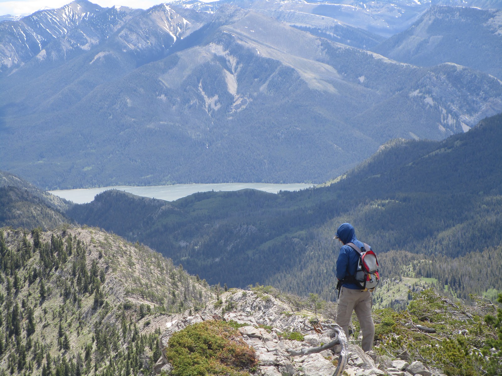
The wildlife was really out in Waterton.  I've never seen so many black bears in all areas of the park.  We spent one of our afternoons hiking to Crandall Lake, where we found clear, hike-able trails.  We also hiked to Blakiston Falls in the Red Rocks Canyon.  Parks Canada has built some really great metal stands overlooking the falls.
Otherwise, we toured the park, ate great meals in the townsite and at the lodge and stayed at a fantastic bed and breakfast in Mountain Home, a small Mormon tourist community 10 miles east of the park.
Of course, we used our Parks Canada pass that gives us free access to all national parks in Canada during this the celebration of the country's 150th anniversary.
Our visit to Glacier was an east-side drive through with a stop at the Jackson Overlook and a hike to the Deadwood Falls.

A Highwood Baldy mountain-top view

It took some snow-slogging to get to the top

Ultra green Highwood Baldy with plenty of wildflowers

Annual Highwood Baldy Spring climb

An annual goal is to climb Highwood Baldy (elevation: 7,625 feet), a Great Falls area landmark, before the cattle are turned onto the national forest in mid-June.
The problem is always the snow at the top, which remains until early June.
This year was no exception.
I slogged the last 400 feet to the top in deep snow, sometimes punching through up to my waist.
My route was the ridgetop walk just west of Deer Creek to the saddle below the large, grassy field below the talus-strewn summit cap. The route is from the spot where Highwood Creek comes across the road for the second time.  Instead of crossing it I follow a fence line to the ridgetop and stay on the ridgetop to the Deer Creek ridge.
The area was resplendent with wildflowers, but none of the alpine variety.
This is a deceptively rigorous climb of more than 3,500 feet and nearly 8 miles roundtrip from its start where the North Fork Highwood and main Highwood Creeks adjoin.
My heavy boots got even heavier after a soaking from the snow.  They seemed as though they weighed 10 pounds apiece.
I couldn't have found a more beautiful day for this climb.  The sky was a cloudless deep blue and the grass as green as Ireland.
I found myself stopping and soaking in the area's beauty many times along the way.

Our Wednesday hiking group follow the fence line up

Wayne Phillips conducts the "smudge" at the top 
Purifying smoke from the burning sweetgrass during the smudge


Steve Taylor on top in a tipi ring with East and Gold buttes on the horizon

Lots of talus on the way up and down

A bucolic scene, Annie Taylor and Wayne Phillips rest in the green grass, with Steve Taylor making his way down

West Butte in Sweetgrass Hills

It had been more than 20 years since I had climbed West Butte in the Sweetgrass Hills (elevation: 6,983 feet) on a cold April day with the late John Carr of Shelby.
A week ago I had climbed Gold (or Middle) Butte in the hills for the third time, and examined the best spot to approach West Butte at that time.
I love the Sweetgrass Hills, which rise like a vision on the dry prairie north of Shelby.
I view them on my many trips to Calgary or from points in Glacier Park or the Rocky Mountain Front.  On a really clear day, they are visible from the Little Belt Mountains.
This isolated island range is sacred to the Blackfeet and there are prayer flags that indicate the mountains are used in vision quests.
We found both prayer flags and tipi rings on the top of West Butte on Wednesday.
Our route began where Nine Mile and Coal Mine roads intersect about 17 miles west of Sunburst.
There's a fenced ranch there and a small creek running through it.  We parked on the road.
A public, state section of land is to the right (or east side) of Limekiln Creek.  Stay along the fence line until it runs out and then slog through the steep grass to the talus.  There are lots of good elk trails in the talus to the top.  It's a climb of 2,600 feet and about 4.6 miles round trip.
The top has a neatly built, tall cairn and is broad, offering a 360 view.  In addition to the tipi rings there were lots of elk sign.
Wayne Phillips, our leader on the Wednesday Wayne's Wild Walks, conducted a sweetgrass Indian "smudge" on the mountain top, burning the sweetgrass, the fumes we doused and purified ourselves in, and invoking the spirit of all living things.
To the east, East and Gold Buttes shimmer on the prairie;  to the north is Canada and the Writing on Stone Provincial Park on the Milk River; to the west Glacier Park and the Rocky Mountain Front; and south ranches, wheat farms, prairie potholes filled with water and a view that reminds me of a vast sea.  On a clear day one could see the Bearspaw Mountains to the east and south, but we had a haze that obstructed the view.
It was a hot day and so we got a 6 a.m. start from Great Falls.  We were on top before 11 a.m.