Thursday, September 27, 2018

Colorado Mountain Lookout, Yellowstone and Teton parks

Colorado Mountain (right) on a ridgeline
Our route
The stone walk way at the top 

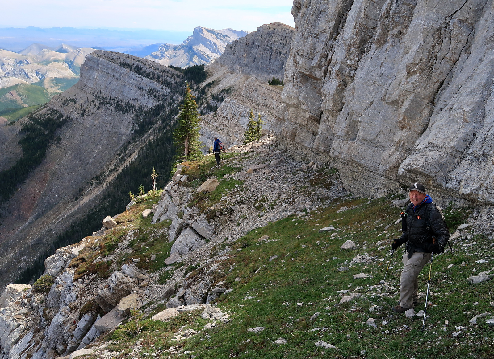
The top cairn with Black Mountain below 


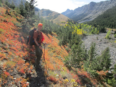
Katie with ground cover and copious deadfall along the trail
 We finally got up Colorado Mountain Lookout (elevation: 7,217 feet) in the Lazyman Roadless Area in the Helena Lewis and Clark National Forest west of Helena on our weekly Wayne's Wednesday Walks this week.
This followed a four day trip to Salt Lake City with sidetrips to Teton and Yellowstone national parks on the way home.  The red aspen and dramatic landscapes are a must see in the Fall.
My wife and I got part way up on a Montana Wilderness Association snowshoe walk two years ago.
This time, despite tons of windfalls on the upper part of the trail, we got to the top, a 8.5 miles, 2,400 feet elevation gain and loss on a gorgeous Fall day.
The trail is largely unmarked, which I found remarkable given that there was once a major lookout cabin there, now long gone.  Unless you knew there was a trail there you couldn't find it. The trail is not marked on the Forest Service map.
A break at top
It begins behind the Moose Creek Ranger Station, four miles up a good, paved road on a well-marked Rimini exit on U.S. 12 about 7 miles west of Helena, just below McDonald Pass.  Historically, this area was a mining district and is now part of the Helena Ten Mile Creek drinking water system.
It immediately gains a ridge west, above Moose Creek, climbing 2 miles to another flat spot to the south, where the Colorado Mountain summit ridge begins.  It travels up another 2.25 miles and 1,000 feet from here through deadfalls splayed like pickup sticks across the trail, which had to be dodged.
The grassy, exposed and windy top offers a great 360 view of the Helena area;  the Big Belts, Gates of the Mountains, Elkhorns, Continental Divide country into the Scapegoat and Bob Marshall and even the Bridger Mountains.  We could see Chessman Reservoir below.  Almost on top of us were Red Mountain another almost 1,000 feet above us at 8,160 feet, and the Rimini ghost town, and Black Mountain at 7,148 below us as a twin peak.
We were sad to see the lookout was gone, with only remnants of the structure's footings remaining at the high point.
There is a rock pathway to a rock outcrop in the trees to the southeast that offered shelter from the wind.
My takeaways from the hike:  it's terrific to have a national forest roadless area so close to a major city;  it's too bad that there's so much diseased and down timber there, the trail could be better marked.

Friday, September 21, 2018

Rock art near Lewistown, more Front Fall colors

Damage from South Fork Teton flood below the destroyed Rierdon Gulch trailhead is evident 
The ground cover is Fall eye candy


The wall above Rierdon Gulch resembles the Chinese Wall

A look down the valley from the divide

You best follow these cairns to find the trail head across the South Fork Teton

An example of the erosion
We got in a couple of quick trips this week trying to stay ahead of the approaching bad (Fall) weather.
We hiked the Rierdon Gulch Trail to its divide above Slim Gulch in the Front, and visited the Bear Gulch Pictograph/Petroglyph Indian site southeast of Lewistown.
The groundcover in the Front continues at its height.  Oranges, reds, yellows and lime greens spangle the forest floor, the aspens run yellow, orange and red.  The cottonwoods are golden.
Rierdon Gulch, like the South Fork Teton it drains into, was hammered by the Spring floods.
It destroyed the trailhead and the Forest Service has done a great job rebuilding it.  Follow the cairns from the South Fork parking area to find the trailhead.
Rierdon, again like the South Fork, has been considerably widened, trees uprooted and knocked down, and the banks torn apart.
In the higher country the high snowpack and heavy rainfall, including that which we have been receiving in recent weeks, has left erosion marks and soil slumping.
Rierdon is otherwise this incredibly scenic, narrow valley lined by a long, massive, limestone ridge resembling the Chinese Wall in the Bob Marshall Wilderness.
We hiked nearly 5.5 miles to a high divide above Slim Gulch that descends into the Deep Creek country that is in the Bob now.  We gained and lost 2,700 feet in the nearly 11 miles we walked.
Why Rierdon Gulch was left out bewilders me.
It is some of the wildest, most scenic landscape in the Front, of international quality, with its high limestone cliffs and sweeping views in all directions from any high point.


Examples of the pictographs

Ancient hand print

Our tour guide Ray Vodicka explains the drawings

Our group viewing the cliffs and wall markings

Bear Gulch Pictographs/Petroglyphs

I can't really count our trip to this ancient, sacred and scenic place as a "hike."
Our Wayne's Wednesday Walk hiking group traveled to this spot off the Forest Grove Road, some 30 miles southeast of Lewistown to take a tour.
It is something I had planned to do for a number of years, but hadn't taken the time.
It turned out to be an amazing trip for its scope and scenery.
There are some 2,000 Indian pictographs and petroglyphs, along with considerable tourist graffiti going back as far as 1824, when a "tourist" etched his name in this soft limestone.
It is said to be the largest such site on the Great Plains and used by Natives for at least 400 years, but probably longer.
Bear Gulch is a tightly enclosed valley surrounded by large limestone rimrocks.
Using ocher and chert Native peoples seeking spiritual healing or revelation painted and etched other-worldly symbols, animals and people into these rocks.
This area is in private ownership and any tour must be arranged ahead of time by contacting (406) 428 2185.
Our tour guide was Ray Vodicka, whose mother, Sally, owns the place.  Tours cost $17.50 per person.
Vodicka, in his early 40s, is passionate about the place and adds a lot to the enjoyment of the tour.


Saturday, September 15, 2018

Fall colors in full glory; a flurry of activities


The red aspens really lit up the Front

Mount Wright highlighted by aspens

Our group on the flanks of Wolf Butte

On the trail to Ptarmigan Tunnel in Glacier Park

The always beautiful Ptarmigan area
In the past week I've climbed Mount Wright in the Front for the second time this summer and Wolf Butte in the Little Belts, taken a side trip to the Cypress Hills in Saskatchewan and Alberta, and hiked to Ptarmigan Tunnel in Glacier National Park.
What they all had in common was spectacular early Fall colors.
The most surprising were the reds in the Front aspens and ground cover.  In all my years of hiking there I've never seen such red.  The only other place I have seen red rather than golds and yellows in the aspens has been in Utah, where red predominates.
The Fall colors have been magnificent, if a bit early this year.
We saw them in abundance at Many Glacier on the Ptarmigan Trail.
They weren't as showy in the Cypress Hills, though.
The Cypress Hills trip included a tour of Fort Walsh, once the headquarters of the Royal Canadian Mounted, a visit to Medicine Hat where we toured the famed Medalta pottery factory in the pottery district, a strange badland south of Medicine Hat full of "concretions" and an interesting windmill museum between Medicine Hat and Lethbridge in Etzikom, Alberta
My new favorite photo of Katie on a concretion in the Red Rocks Canyon a half hour south of Medicine Hat 
A sampling of the windmills at Etzikom, Alberta windmill museum

Sunday, September 02, 2018

Steamboat Lookout through the cliffs; 30 years after Canyon Creek


Mark approaches the base of cliffs

If you look really hard you'll see me ascending this (frightening) couloir (Gordon Whirry photo)

In the shelf (Gordon Whirry photo)

Mark and I in a spectacular spot (Gordon Whirry photo)

Walking the broken and tilted shelf
The roads outside Augusta washed out by Spring floods are finally fixed and open and gave us the opportunity to reach Steamboat Lookout Mountain Saturday.
Elk Creek Road is pretty rough, filled with potholes.  One bridge is still out, requiring a creek crossing.  But, the creek is now low enough that it's no problem.
We had intended to climb the peak via the good Elk Creek Trail, but instead concentrated on finding a new route to the top via the cliffs.
At the first big drainage and creek crossing after Elk Pass we left the trail and headed up through the burn and what appeared to be an opening in the vast cliff walls -- that appear impenetrable ---  guarding the peak.
I was uncertain whether the crack we saw was passable.
Mark Hertenstein seems always to believe there's a way.
There was a 300 foot patch of scree below the base of the cliffs that nearly did me in.  I'm having intermittent balance problems that forced me to all fours for much of this patch.
Hertenstein had gone far ahead and discovered that there was a (barely) walkable shelf below the cliffs that offered spectacular views and the possibility for climbing our way out to the top.
We had a nice lunch and watched the clouds pushed around the distant peaks of the Front and Bob and Scapegoat wilderness areas by high winds.
Mark found a great, climb able crack that took us to the next shelf above us that led to another crack and up on top.
All of us had been to the top of the peak numerous times and given the wind, we opted not to climb the remaining 300 feet to the top.
The views and shelf-walking were truly thrilling.  Why this Steamboat Ridge is not as popular for its grandeur as the Chinese Wall amazes me.
We enjoyed a leisurely six miles back to the car as the weather improved and the sun came out warming us and causing the early Fall ground colors to pop.  There were large patches of scarlet and purple huckleberry patches.  The slopes below the peak just  off- trail had been freshly rototilled by grizzlies looking for roots and insects.
We climbed more than 3,800 feet and walked 11.1 miles.

30th anniversary of Canyon Creek Fire


This is the 30th anniversary of the Canyon Creek Fire of 1988 that scorched 250,000 acres of the Scapegoat country, including this Elk and Smith creeks drainage.
The fire took a big run down Elk Creek the evening of Sept. 6, 1988.  I don't think I'll ever forget when it made its run.  The night skies of Great Falls west glowed red.
Nearly every year since I've hiked this Elk Creek country to assess the post-fire conditions.
Like the Yellowstone Fire of the same year, the regrowth is jaw-dropping.  The trees in most areas are 20 feet high and very thick, almost too thick.  There is diversity, too, with lots of Doug Fir among the Lodgepole. There are some southwest slopes that look pretty barren, but the north and east slopes are lush.