 |
| Damage from South Fork Teton flood below the destroyed Rierdon Gulch trailhead is evident |
 |
| The ground cover is Fall eye candy |
 |
| The wall above Rierdon Gulch resembles the Chinese Wall |
 |
| A look down the valley from the divide |
 |
| You best follow these cairns to find the trail head across the South Fork Teton |
 |
| An example of the erosion |
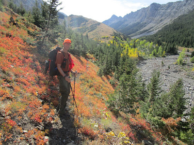
We hiked the Rierdon Gulch Trail to its divide above Slim Gulch in the Front, and visited the Bear Gulch Pictograph/Petroglyph Indian site southeast of Lewistown.
The groundcover in the Front continues at its height. Oranges, reds, yellows and lime greens spangle the forest floor, the aspens run yellow, orange and red. The cottonwoods are golden.
Rierdon Gulch, like the South Fork Teton it drains into, was hammered by the Spring floods.
It destroyed the trailhead and the Forest Service has done a great job rebuilding it. Follow the cairns from the South Fork parking area to find the trailhead.
Rierdon, again like the South Fork, has been considerably widened, trees uprooted and knocked down, and the banks torn apart.
In the higher country the high snowpack and heavy rainfall, including that which we have been receiving in recent weeks, has left erosion marks and soil slumping.
Rierdon is otherwise this incredibly scenic, narrow valley lined by a long, massive, limestone ridge resembling the Chinese Wall in the Bob Marshall Wilderness.
We hiked nearly 5.5 miles to a high divide above Slim Gulch that descends into the Deep Creek country that is in the Bob now. We gained and lost 2,700 feet in the nearly 11 miles we walked.
Why Rierdon Gulch was left out bewilders me.
It is some of the wildest, most scenic landscape in the Front, of international quality, with its high limestone cliffs and sweeping views in all directions from any high point.

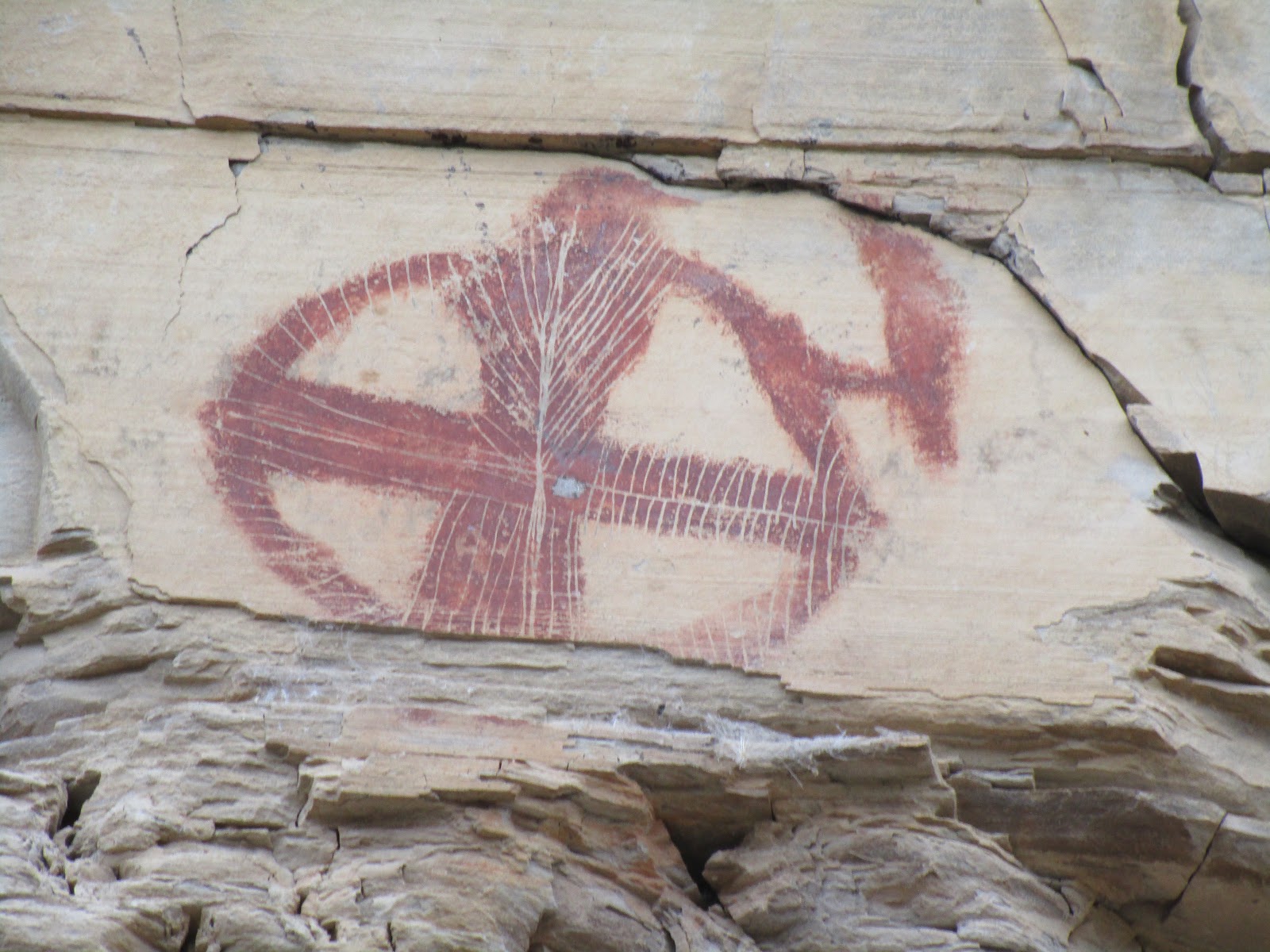 |
| Examples of the pictographs |
 |
| Ancient hand print |
 |
| Our tour guide Ray Vodicka explains the drawings |
 |
| Our group viewing the cliffs and wall markings |
Bear Gulch Pictographs/Petroglyphs
I can't really count our trip to this ancient, sacred and scenic place as a "hike."
Our Wayne's Wednesday Walk hiking group traveled to this spot off the Forest Grove Road, some 30 miles southeast of Lewistown to take a tour.
It is something I had planned to do for a number of years, but hadn't taken the time.
It turned out to be an amazing trip for its scope and scenery.
There are some 2,000 Indian pictographs and petroglyphs, along with considerable tourist graffiti going back as far as 1824, when a "tourist" etched his name in this soft limestone.
It is said to be the largest such site on the Great Plains and used by Natives for at least 400 years, but probably longer.
Bear Gulch is a tightly enclosed valley surrounded by large limestone rimrocks.
Using ocher and chert Native peoples seeking spiritual healing or revelation painted and etched other-worldly symbols, animals and people into these rocks.
This area is in private ownership and any tour must be arranged ahead of time by contacting (406) 428 2185.Our tour guide was Ray Vodicka, whose mother, Sally, owns the place. Tours cost $17.50 per person.
Vodicka, in his early 40s, is passionate about the place and adds a lot to the enjoyment of the tour.
No comments:
Post a Comment