 |
| Lake Rhoda from top of Big Baldy |
 |
| Elevation marker and climber register at the top |
Every time I would drive by the sign I'd think, why would I want to climb the mountain that way when the easiest way to climb it is to drive to its base and scramble about 1,000 feet to the top?
My thinking changed on that and I became obsessed with the idea of climbing it that way from its beginning point near the Belt Creek Ranger Station.
 |
| A Bitterroot, Montana's state flower, I found late in the day. |
I was very pleased with what I found: a pleasant ridge walk mostly in the trees with an occasional opening in lush green elk meadows revealing the Long-Neihart Baldy ridgeline to the south, Belt Park country to the west and Barker and beyond to the north. There are numerous diggings from old mines.
Yes, the area gets its share of motorcycle and four-wheel ORV use, but for the most part, the Forest Service has done a pretty good job regulating the off-road use and rehabbing past damage while restricting the uppermost section of this climb to hikers.
Because of the old mining and motorcycle roads the trail can be tricky at time and I suggest a map and advance familiarity before trying this on a day trip like I did.
I had a picture perfect day for the hike and the area still benefits from all the spring rains that has left the area an emerald green.
It appeared as though an ORV had tried to bull its way up the Trail 733 section, but got stopped by the large amounts of snow at 8,000 feet and above and had turned around.
At the 733-734 junction there were 10 feet snow drifts that I managed by walking across the top.
 |
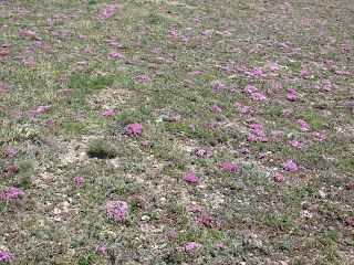
| Pink Douglasia alpine wildflowers carpeted Big Baldy's flanks. |
The views from Old Baldy on a clear day are always satisfying. I could see as far south as the Gallatin, Bridger and Crazy mountain ranges and as far north as the Bear's Paw mountains, Square Butte (at Geraldine), and even the Little Rockies. To the west I could see as far as the Rocky Mountain Front, and Edith and Baldy peaks in the Big Belts.
Below me, alpine Lake Rhoda was still half-covered in snow and ice and the ridgelines were streaked with the white stuff.
The Baldy summit cap was carpeted with the pink Douglasia miniature flowers.
I was the second person this season to sign the register. The first climber did it two weeks before me on June 26.
It took me 5 hours and 35 minutes to get to the top and 4 hours and 50 minutes down. I'm sure I could have done it a lot faster if I hadn't had to deal with as much snow and route-finding.
It was a great solo day!
No comments:
Post a Comment