 |
| Katie at Our Lake in the Front Friday |
Now the trail we walked a few days ago is closed because of the fire danger.
Great Falls has been filled with some, evoking memories of such horrible fire seasons as 1988 and 2007. This one seems to be starting earlier, though.
 |
| Barker is not that impressive this close. From the highway it is massive. |
Barker is one of the biggest mountains on the southeast horizon as one drives into the Little Belts via Belt Creek canyon. It is reached via Monarch and seven miles up the Dry Fork Road.
There are numerous ways to climb this big guy, all involving more than 3,000 feet in elevation and in some cases large fields of talus plates that wobble and threaten to throw you.
 |
| These cairns are not the top. |
I was lucky enough to find a pretty straight shot to the top, although I had to weave my way through lots of tall juniper bushes that scratched my legs, downed timber, and doghair lodgepole that threatened to stop me. Route finding is difficult because, unlike the Front, the Little Belts are so tree covered that route-finding vistas are in short supply. Generally, when you could look to the south, if Servoss Mountain was right behind you, you were on the ridge. I also made sure that I was on a ridge by not going too far down in a sidehill fashion in either lateral direction.
At one point the ridge was only about 10 feet across.
 |
| Talus slopes every where on Barker. |
The views from the top were pretty good considering the fire-smoke. Of course, Old Baldy, at over 9,000 feet, was the most dominant. Smoke kept me from seeing the Snowies or Bear Paws, but Square and Round buttes were in view as was the Highwoods mountain range.
Below me I could see reclamation trucks feverishly working near the old mining towns of Hughesville and Barker doing cleanup for the messes left almost 100 years ago by mining boomers.
This turned out to be superior route to the one I took in 2005, when I got hung up in the talus.
Temperatures in town were near 100 and as high as 91 in the Little Belts, a very hot day.
 |
| This route avoided the large talus slopes until I hit the top |
Our Lake
 |
| The falls off Our Lake |
On Friday I was looking for something a little more tame and Katie and I went to Our Lake in the Rocky Mountain Front.
If the Heritage Bill passes Congress this area will be added to the Bob Marshall Wilderness Area.
It is probably the most popular hike in the Front because it is only 7 miles long, although the 2,000 feet in elevation gained can seem arduous. We were at the lake in an hour and 20 minutes.
 |
| The lovely Lady Slipper was everywhere |
 |
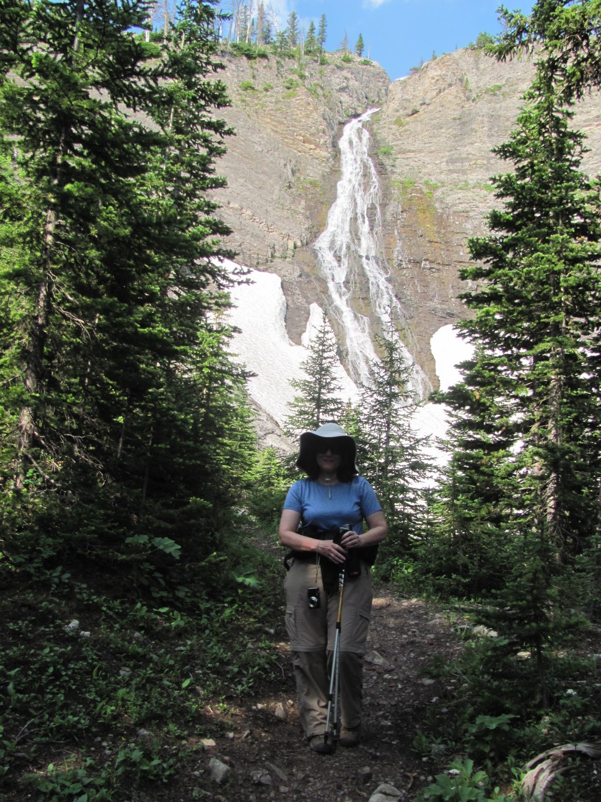
| A waterfall bonus near the lake and in sight of snow fields |
By comparison with the dry Little Belts, this part of the Front was lush, green and full of wildflowers --- from the beargrass to lady slippers and all kinds of vetch. What makes this hike so special are the old growth spruce trees that offers spectacular shade.
Then the forest opens to an alpine zone and then two great waterfalls, the final one spilling off the lake.
Although this was a work day for most people there were four other hikers on the trail with us, although the area was far from crowded and pristine.
Normally I use this hike as a part of a traverse to Headquarters Pass. Instead, I decided to go up and back and investigated an alternative route to the pass, which I determined could be reached from the trail at a gully just before the lake.
The regular route is the south, usually snow-covered gully from the lake itself.
The weather was quite changeable, sprinkling on us and then clearing.
It was much cooler than the weather down below in town.
We counted 13 mountain goats in the cliffs, high above the lake and three big horn rams at the Our Lake/HQ Pass divide.
No comments:
Post a Comment