 |
| The view from the top of Eagle Plume Mountain in Glacier |
On Saturday I led a group of eight Glacier Mountaineering Society climbers on this wonderful ridge walk with all eight reaching Mad Wolf (elevation: 8,341 feet), seven of the eight up Eagle Plume (elevation: 8,721 feet), and three hearty souls (not including me) climbing Bad Marriage, (elevation: 8,350 feet).
 |
| The Mad Wolf-Eagle Plume ridge walk |
The last time I did this I followed the traverse detailed in Gordon Edwards' "Climbing in Glacier Park," book and explored by Bill Hedglin.
We opted for a much less complicated up and back and I'm glad we did.
The Hedglin traverse includes a descent into a basin beneath Bad Marriage and a wicked bushwhack. I remember getting back to camp around 11 p.m.
As we did it last weekend we still didn't finish the trip until 9:15 p.m., even though we had begun around 8 a.m.
 |
| Feral horses at the base of Mad Wolf cliffs |
The last time I did this I recall bushwhacking straight up from the Ranger Station through lots of downed timber and thick vegetation to reach the Cut Bank Ridge and ultimately the northeast flank of Mad Wolf. It was very direct.
This time we checked out the so-called "Boundary" trail that begins just beyond the first long meadow from the Triple Divide Pass Trailhead. We reached this fork in the trail about 10 minutes from that trailhead.
 |
| The boundary "trail" bushwhack |
This trail is supposedly maintained, but we found heavy vegetation and some deadfall, although there is evidence of that maintenance in the form of cut logs.
We got drenched from early morning dew and the remnants of the previous day's rainfall.
It eventually emerges into glorious grass at the base the Mad Wolf cliffs where there are a number of trails used by feral horses. We scattered a group of five of these beautiful beasts at the cliff base.
We saw a good break in the cliffs and went up through them. These have plenty of vegetative hand-holds, but need to be treated with respect, although they are not difficult.
That was followed by a 1,500 feet slog through steep scree and broken rock to the top.
Off in the distance was the sharp-pointed top of Eagle Plume. When I identified that destination there was surprise that it seemed so far off. I think it was the scree-slog speaking.
 |
| The GMS climbers were sure glad to break out into the open after the heavy vegetation on the trail |
Eagle Plume was another 800 feet up through easy cliffs and ledges.
 |
| Clearing the cliff band and getting ready for the slog |
We were all amazed at how beautiful the views are from that Eagle Plume perch.
Greg and Cecilia Notess and Rod Graham left us to descend to the saddle between Eagle Plume and Bad Marriage and climb their third mountain of the day, along an easy ridge line.
We could no longer see them by the time they reached the top because of the clouds.
Those of us on Eagle Plume decided to wait until we were sure they were safely headed back our way.
It was about a half-hour and we could see them coming and we started down through the Eagle Plume cliffs.
 |
| The glorious ridge walk to Eagle Plume from Mad Wolf |
 |
| The cloud ceiling drops in on us |
Luckily Greg Notess had recorded our route on a GPS. Thank goodness, because I didn't know where the heck I was at or which direction to go because the clouds were so disorienting.
 |
| Gordon Swenson has an "Kodak" moment |
The sun was setting, playing on the amazing wildflower show ---- Cecilia Notess counted 62 varieties on this trip --- and the icy cold creek crossing and our day was complete.
 |
The Red Line is "Glacierscrambler" post on Summitpost.com. The Blue line is where our GMS group climbed Saturday. The Green, is how my route varied 15 years ago.A quick trip up to Siyeh Pass
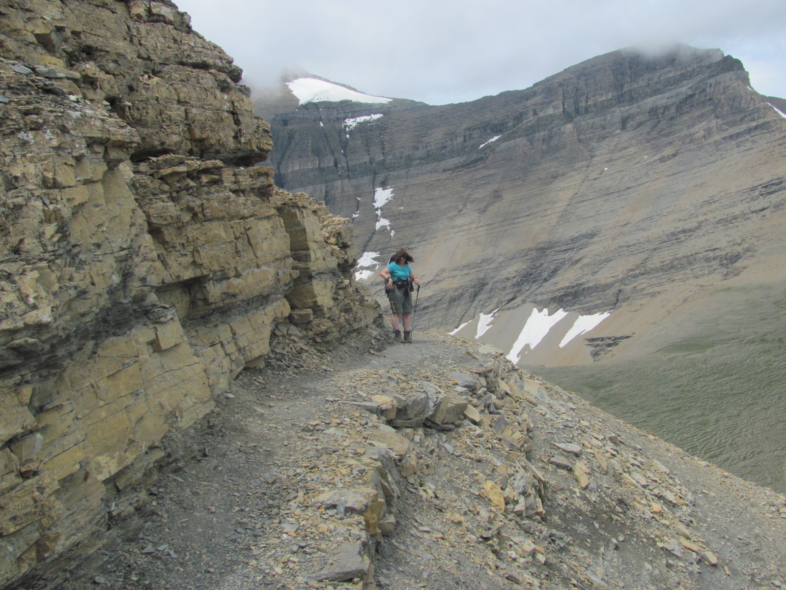
To shake out the kinks on Sunday, Katie and I took a quick trip up to the Siyeh Pass from the bend on the Going to the Sun Highway.
It is a little over 9 miles round trip and one of the park's classic hikes.
We had intended to walk through to the Sunrift Gorge, but changed our minds at the pass when we saw how much snow remained on the upper portions of the south or gorge side of the pass.
On the way down we got hit by a torrential rain that accompanied us most of the way. It was so intense that it filled my pack with water, and wet me right down to my underwear.
The rain also caused mud and rock slides on the Avalanche Lake to Logan Pass section of the road, slightly injuring two motorists and trapping 11 vehicles. The road remained closed over night.
|
No comments:
Post a Comment