 |
| Gordon Whirry beneath Patrol Mountain Lookout cabin |
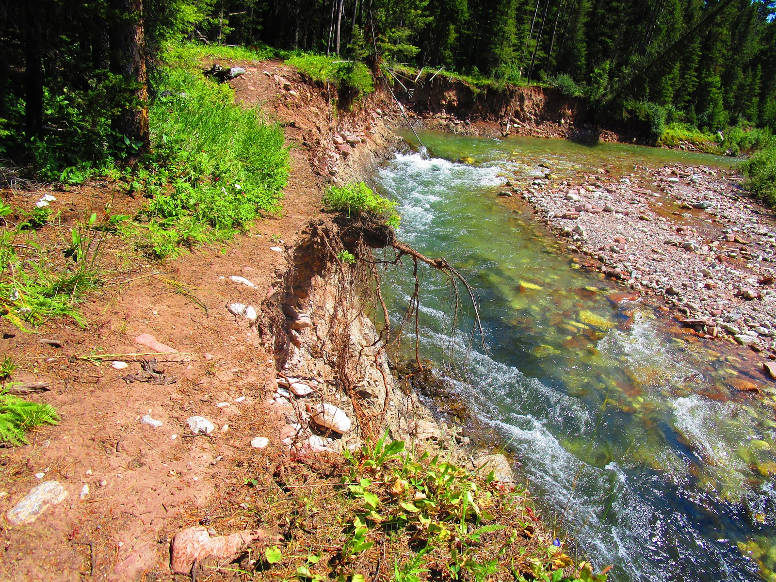 |
| Trail damage on Straight Creek on way to Patrol Mountain |
 |
| The classic photo from the saddle between HQ Pass and Our Lake |
 |
| My "selfie" on top of Peak 8780 above Our Lake |
 |
| Plenty of snow and avalanche debris still in basin below HQ Pass |
 |
| Arsenic Peak at head of Big George Gulch |
 |
| Sticky Geranium wildflowers patch near foot of Big George Gulch |
 |
| Plenty of water in Gibson Reservoir as evidenced by these submerged cottonwoods |
 |
| The recent flood created this gorge at Norweigian Gulch in Sun Canyon |
I checked out a couple of roads this week that took big flood hits three weeks ago when the mountains were socked with rain.
Benchmark Road is fully opened out of Augusta and in great shape. This delivered me to my annual Patrol Mountain hike on Sunday.
Our Lake-HQ Pass Traverse
The South Fork of the Teton River has been sufficiently repaired to allow me access to the Headquarters Pass trail where I did the Our Lake-HQ Pass Trail traverse Monday, climbing in route mountains 8,780 (feet) and 8,485 from the saddle in the middle of the traverse.
There are tons of water in Our Lake and a large snowbank beneath its falls. The alpine basin beneath HQ Pass is loaded with snow and avalanche debris.
I found the mountain-tops on both hikes clear of snow, but the skies were less clear as the haze of wildfires from California and Nevada have been drifting into Montana, polluting the skies.
Patrol Mountain
We had hoped to find Samsara Chapman Duffey at her post in the lookout tower on top of Patrol, a post she's had about 15 years. Usually she begins her fire watch on July 1, but the wet weather and lack of fire danger has postponed her arrival. I spoke to her later and she said that she has been helping get other lookout posts ready, like Beartop and Prairie Reef (where her father is returning).Porphyry Peak in Little Belts
After those hikes I took a "break" Tuesday and climbed to Porphyry Peak Lookout in the Little Belts from Kings Hill Pass, but like Samsara the ranger was on break and I missed her. I proceeded to White Sulphur Springs, where I took a break, soaking my tired bones in the hot springs.On Thursday, an extremely clear and somewhat hot day, I thought a climb of Steamboat was in order and via Augusta checked out the road conditions: Elk, still closed; Smith, open, but who knows what kind of condition that road is in; Dearborn, still closed. So Steamboat was out.
I decided that perhaps a loop hike near Mortimer Gulch might be the thing to do.
However, it was getting late and time wouldn't be on my side.
Mortimer-Big George Loop
I would have liked to do the traverse around Mortimer Peak, but when I added up the distance it came to nearly 18 miles.So, instead I decided to explore the Mortimer-Big George loop, which I estimated in the 13 mile range.
This involves doing the Mortimer Trail to the Big George cutoff and then finding the Big George Trail.
Trail signs at various junctions on hike are missing, which makes navigation tricky. Thank goodness for my GPS.
I went to just below the pass opposite Arsenic Peak before deciding I hadn'd found it.
I doubled back and headed downstream through the trees and eventually picked up the trail.
The trail at Big George is pretty rough. The animals had found it before me, churning it up. That hardened into lumpy obstacles that were tough on the feet. There were lots of deadfall across the trail. It seems as though this trail is really a packer trail for hunting season.
I cut the trail above Big George Gulch and connected to the trail that follows the Gibson Reservoir shoreline.
The prettiest parts of Big George are at its head beneath Arsenic and at its foot above the reservoir. Both were resplendant with wildflowers and vast, open views.
This is real wilderness country and for the life of me I don't understand why it is not within the Bob Marshall Wilderness Area boundaries.
The hike ended at 15 miles with just under 3,000 feet gained and lost.
No comments:
Post a Comment