Friday, July 29, 2022

Celebrating the 50th anniversary of the Scapegoat Wilderness Area


Heart Lake with Red Mountain in background

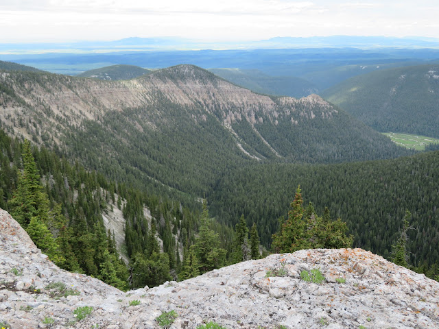
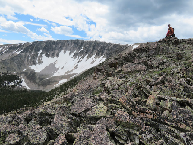
Enjoying the red at top of Red Mountains (and the views, too)

The obligatory 'entering the wilderness' sign

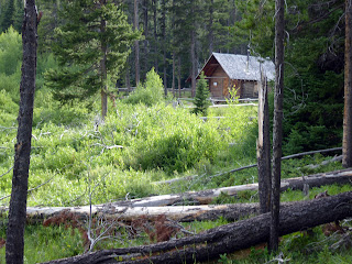
The Ranger Station at Webb Lake

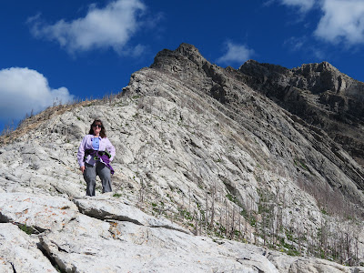
Katie celebrating at top of Red Mountain

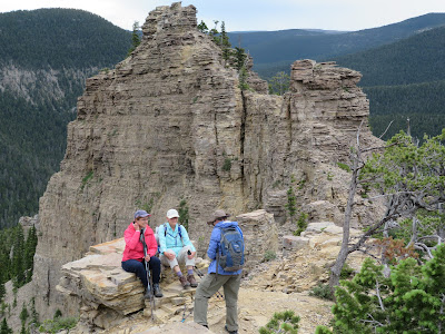
Katie pauses on the trail

It was 50 years ago that Congress added the Scapegoat to the National Wilderness System, significant because it resulted from a citizen-led group that had opposed Forest Service plans to log, road and otherwise develop the area near Lincoln.

  Here is a link about that fight for preservation of this 225,000 acres area south of the Bob Marshall Wilderness along the Continental Divide:  https://books.google.de/books?id=FJ5voW8EAcoC&lpg=PA27&dq=quote%2C%20cecil%20garland&pg=PA27#v=onepage&q=quote,%20cecil%20garland&f=false 

 To celebrate this anniversary Katie and I did a three-day backpack trip from Indian Meadows to a camp between Heart and Webb lakes and climbed Red Mountain, at 9,411 feet the highest point in the Scapegoat, and the Bob Marshall Complex of wilderness areas.

It was particularly significant to me because my bosses at the Great Falls Tribune had sent me into this particular part of the Scapegoat 48 years ago to familiarize our readers with this new wilderness area.

Since that original trip I've returned to the Scapegoat numerous times and climbed Red Mountain many times but from different approaches than the one we used in 1974.

Time can play tricks on your mind after so many years.  I don't remember much about that original climb.  The route to Red Mountain is on FS Trail 223, which I gather was constructed for and used by packers supplying a lookout post on the mountain, long since removed.  The Forest Service has done a nice job keeping the trail clear, but in spots it is a trace, particularly below the summit cap.

When we got to that cap, almost on cue about nine mountain goats appeared.  On other occasions I've seen as many as 19 goats in this spot.

The wildflowers on the way up were glorious, particularly the purple silky phacelia that carpeted the path.

While a bit hazy from fires to the south, the views from the top were exceptional and it was fun to pick out the mountains of the Rocky Mountain Front from behind --- like Sawtooth and Steamboat.  Scapegoat peak was particularly prominent, and of course there were the Swans, Silvertip and Great Northern to the west and north.

We stayed at a hunters camp and in the middle of the first night were awakened by critters that chewed holes in our tent's netting, which I had to patch when we got home.

That first day we took a side trip to Webb Lake after supper.  There's a Forest Service cabin there.  Red Mountain was visible from the lake's shore trail.  It would have been a nice place to camp.

We walked out the third day via Heart Lake, an absolute gem with turquoise, deep water.  There was only one camp there, and a fisherman said he had caught a grayling on a spinner there.

In retrospect, I wish we had camped there a night.  There's always next time.

At about 5 a.m. on the day of our departure, Katie heard a bell clanking on the trail above our camp and we noted that at least one horse had come by.  Just as we were ready to depart three hours later a young man on a horse was going quickly up the trail in pursuit of horses that had escaped a camp 8 miles above us, or 14 miles from the trailhead.

As we got near the trailhead that man had two horses stringing behind him and told us that he had to return to the Meadow Creek camp, break it down and come back out that day.  That would be 42 miles of riding in one day!

The only other people we saw during that three days were several day trippers on horseback, and hikers coming out of the Landers Fork area.  The horses have beat up the trails pretty badly.

This part of the Scapegoat was pretty empty, thank goodness.

Because I didn't remember a lot about my trip years ago, this area was a fresh experience.

There will be a 50th anniversary celebration in Lincoln Sept. 16-17.


Sunday, July 24, 2022

Bitterroot, bitterroot, bitterroot


 It seems as though the week has been consumed with bitterroot sightings.

Oh, how I love this Montana state flower!

On Wednesday we found a bitterroot blooming on a disturbed piece of ground on the Pioneer Ridge loop in the Little Belts.

On Thursday, I finally took that 50-mile drive from Utica to Spring Creek in the Little Belts along the South Fork of the Judith and found an enormous patch on the Russian Flat.

On Friday I had an unusual trip to Rogers Pass and the Continental Divide Trail and found the flower along the ridgeline heading toward the Anaconda Hills.

Our Sunday hike was at Two Medicine Upper Lake to view mainly beargrass.  The park was not overly crowded and we got rained on.

Folks have been reporting an outstanding bitterroot bloom in other spots, including Yaeger Flats on the South Fork of the Teton near Ear Mountain.

My hiking buddy, Gordon Whirry, said he didn't think there was much bitterroot in the Little Belts until we happened upon a patch just off trail on Pioneer Ridge.  I had seen a single bitterroot on the ridge last year and thought he might be right.  Guess not.

The weather has been stinking hot, so I decided to spend my day Thursday driving that South Fork Judith road.  Katie was with friends looking for bitterroot on the CDT's Anaconda Hills.  I was thinking about her when just south of the Russian Flat I was surprised by a Pepto Bismal pink color in the ground cover, stopped the car, and found one of the largest patches of bitterroot I have ever seen.  I took a side trip over terrible road from Sapphire Village to the Morris-Yogo Peak trailheads and found that Yogo Creek had been overrun by spring runoff and was too difficult for me to cross, so I gave up on it.

When Katie got back from her hike she described her bitterroot sightings and mentioned that she had accidentally left her hiking poles at one of the spots on the CDT.

So, on Friday I hoofed it up there to retrieve the poles and found numerous spots where the flower was growing, although I was so early in the day they hadn't fully opened to the sun yet.


South Fork Judith drive

 The highlights of this drive are many:  the funky town of Utica with its fake old Western storefronts and Oxen Yoke Inn with its giant burgers and fries; the settlement of Sapphire Village, with its Blue Nugget Bar commemorating the famed Yogo Sapphire mined nearby and the gateway trailheads to the Middle Fork of the Judith Wilderness Study Area --- Morris-Yogo Peak, Rickerts Gulch: the limestone walls along the road leading to Hay Canyon: the towering Russell Point rock; the glorious valley housing the Trask Ranch, now home to high end summer mansions of the rich; Russian Flat, a vast multi-miles long, flat grassland that houses a airplane landing strip and Forest Service campground; the Spring Creek Canyon of towering limestone walls.


Sunday, July 17, 2022

Patrol and Sentinel mountains in summer heat

 This has been one long heat stretch.

I don't feel like doing much because I don't want to get roasted.

The Patrol Mountain lookout sits high up in the Bob Marshall Wilderness

Samsara Chapman, who has been the lookout ranger for 26 summers

I'm atop the lookout mountain

But, I did get out twice this week, one to do my annual climb of Patrol Mountain in the Bob Marshall Wilderness, and the other, a climb to the top of Mount Sentinel in Missoula from the University of Montana campus.

The visit to Patrol, (elevation: 8,015) is a round trip of 10 miles and a gain of 2,500 feet from Straight Creek you have to cross back and forth to reach the top.

I go up there yearly to see lookout ranger Samsara Chapman, who is doing her 26th year.  I've been climbing the mountain for nearly every year for the past 42 summers.  I first encountered her when I did a story on her at Patrol and a sister at Prairie Reef.  Samsara looks great and still seems to be enjoying her posting.  The creek sure felt good when I came down.  I didn't find the flowers particularly exceptional this year.  I did encounter a fresh pile of grizzly crap, and I realized I had left my bear spray in the car.  Thankfully, no sightings.

Two days later I went to Missoula and did Sentinel for the second time this year.  I did the walk up of nearly 2,000 feet in just under 58 minutes, which pleased me.  While I top I was entertained by paragliders who were pushing off this peak to enjoy great views of Missoula.


Monday, July 11, 2022

WSAs: Middle Fork Judith, Big Snowies


In the shale headed up to the ridgeline in the Snowies

Katie coming out of the ice cave

We walked that ridgeline to the Grandview scenic point at its end


At Grandview

Katie at Grandview with Crystal Lake below

Lots of these Lady Slipper orchids on this hike

 This past weekend we returned to two Montana Wilderness Study Areas:  the Middle Fork of the Judith River and the Big Snowies, both Island Ranges located east of Great Falls.

These areas have been studied, but not designated by Congress as formal wilderness areas for more than 40 years.

They remain under attack mainly by Montana's Republican congressmen, in this instance particularly Sen. Steve Daines.

I can understand reservations to the Middle Fork designation (in-holdings and a road up the creek), but objections to the Big Snowies is incomprehensible.

Katie and I traveled to the Middle Fork's northwest edge Saturday up the Forest Service Road we refer to as "Cemetery Road" (FS3328) because there's a fenced grave just across U.S.89 from the Silvercrest winter recreation area.  It's a bumpy 5 miles to the turnoff to FS251, and then another mile south to the (hard to find) Deer Point/Coyote Peak trailhead.

Shooting Stars galore at Big Deer Point trailhead

I took this hike three years ago and it is about 2 miles to the top of Deer Point (8,050 feet) where there are terrific views into the Middle Fork backcountry, Yogo and Big Baldy mountains.  The trail can be hard to follow in places because the Forest Service has tried to block off-road vehicles and motorcycles here.  You'll have to work your way around barriers of dead timber and look for faint trail tracks. Eventually you should find the way to the top.  The open field at the trailhead was ablaze with wildflowers, particularly purple Shooting Stars.

On Sunday we ventured to the Snowies in the center of Montana, where from the high point you can see into Canada to the north and all the way to the Wyoming border to the south.  This is one of the three or four best hikes in Central Montana that starts at the Crystal Lake Campground west of Lewistown.  This 10-mile loop goes up about 2,200 feet to the ridge line through thick forest and then open shale before coming out on top in an alpine tundra.  This year it is especially green from all the rain and the late snow.

We did the full 10 mile loop that took us down a glorious ridge and past the Grandview scenic overlook and then down to the lake.  There was a short detour to the Devil's Chute ice cave just off the trail, but it was too full of steep-pitched snow to venture in.  Then, at the half-way point a trail comes in from Neil Creek to the south that leads to the main ice cave, which also had a pretty good snow drift and I decided that going in, but not down the drift to the floor of the cave wasn't for me.  Katie and Susie Taleff went, though.

The highlight of the second half of this traverse is the descent down a narrow ridgeline that snakes to the Grandview scenic point that offers views of Crystal Lake and a panorama of the full traverse.  After Grandview the last three miles consists of long switchbacks through timber until it drops to the lake. There is a confusing, unmarked trail junction just above the lake.  Go to the left and look for another trail that goes to a trail just above the lake back to the campground and that trailhead.

Just as I always do Fairview, Patrol and Wright mountains every year, I'm going to add this traverse to my annual list as long as I am able.

Wednesday, July 06, 2022

Finally, high summer: passes, Big Baldy traverse, Waterton again (Bertha Lake)

The lupine bloom at Waterton Lakes (Canada) National Park.  Mount Blakiston, the park's highest peak is in the background.
Katie on Waterton's Crandell Mountain Bear's Hump


 After a long, cold spring, high summer has finally arrived.

In the past 10 days I did flower walks to Lewis and Clark Pass, Kings Hill Mountain, Rogers Pass, a long and hard traverse and climb of Big Baldy in the Little Belts and returned to Waterton for classic day hikes.

I'll take a pass 
A sandhill crane in a field of Camus flowers on Alice Creek Road

The Lewis and Clark, Kings Hill and Rogers passes were easy hikes to enjoy the alpine flower bloom.
Rogers Pass, as usual was most exceptional, particularly the Forget-Me-Not, Douglasia and Yellowstone Draba wildflowers.  The beargrass was beginning to emerge.
A real favorite, the Camas.

On the way to Lewis and Clark Pass, just off the road, we encountered an exceptionally large Camas bloom, and wandering around in the meadow were five sandhill cranes.  On the way out we spotted a cow moose in Alice Creek.  The wind was gale force on the pass and nearly blew us off our feet.
We did Kings Hill Mountain hoping to see the annual Jones Columbine bloom of these miniature, blue wildflowers.  They were out in great numbers but we missed their peak and many seemed weathered a tad listless.   However, we were treated to an large Shooting Star display which compensated.  We ascended Kings Hill on the road behind the cabin and descended down the very steep powerline.
The Jones Columbine bloom on Kings Hill Mountain


Big Baldy traverse
Gordon Whirry on the Big Baldy Traverse above Twin Lakes

I've climbed Big Baldy, the highest peak in the Little Belts at 9,175 feet,  four different ways, always going up and back.  
We changed it up this year by traversing the mountain, putting the car at the Dry Wolf Creek campground, walking the 2.5 miles to the Snow Creek trail head and bushwhacking up a ridgeline from Placer Gulch, and descending the mountain's southeast ridge through deadfall and talus to Dry Wolf Creek and back to the campground.
We walked nearly 14 miles and gained just short of 4,000 feet over a 13 hour day that began at sunrise and ended at sunset.
We would have walked an additional couple of miles had we stayed on trail all the way, and saved at least a couple of hours hiking nonetheless.
The bushwhacks through deadfall and down thousands of feet of talus were brutal.  There are miles of talus on this mountain.
However, we had unusual views of Rhoda Lake not possible if we had taken the trail.
I'll take the trail in the future if I ever do this traverse again.
I maintain that it is the premier hike in the Little Belts, affording views of Montana to the Canadian border on the north and Wyoming on the south, along with alpine flowers, high mountain lakes and an incomparable ridge walk.
There's plenty of water if you stay on the trail.  We put on water sandals to ford Snow Creek, but plunged in with our hiking boots at the end of the hike on Dry Wolf Creek.
My hiking partner was Gordon Whirry.


Waterton, again


Katie on Bertha Lake trail with Waterton Lake in background
The lupine field on Bellevue Trail

Katie and her hiking buddy Linda at Bertha Falls
Katie on the Sofa Falls trail

We try to get out of Great Falls during the 4th of July celebrations because of the fireworks noise.

We've done Waterton Lakes National Park in Canada on a couple of occasions and chose it again this year.  We had just been there and stayed at the Prince of Wales Lodge two weeks previously.  Our digs this trip were less auspicious --- the Bear Mountain Motel in Waterton --- but very comfortable.

The weather was less than cooperative as it rained fairly hard two of the three days we were there.

Our Canadian friends Laura and Barry Webster, who ranch in Mountain View, Alberta, made sure we were entertained despite the rain.  They took us for a wildflower drive up the Chief Mountain Highway toward the U.S. border where they pointed out more Lady Slipper orchids than I had ever seen in one bunch, bright orange Wood Lilies.  Then they took us into the Castle Wildland Provincial Park just north of Waterton up Drywood Creek.  I was amazed to see an enormous natural gas mining development along the road where sulphur is mined.  It was begun by Shell Oil.  The area looks like it could have been set near the Calumet Region steelmills where I grew up outside Chicago for its industrialization.  It was very interesting to see as the land around it is mountainous wilderness and the development is so close to Waterton and Glacier.  But for the work of conservationists on our side of the border, our similar oil and gas resources would have been developed and our Rocky Mountain Front industrialized. I would like to revisit this area in the fall to see the vast aspen covered hillsides ablaze in autumnal splendor.

The following day other of Katie's Canadian hiking friends decided to buck the weather and invited us to join them on a hike to Waterton's Bertha Lake (6.8 miles, 1,700 feet elevation gain and loss).  We had done this before, but just after the 2017 Kenow Fire that burned three-quarters of the park.  The vegetation in the park has responded like a lush jungle and the fire had cleared out trees that enhanced our views of this steep, narrow valley of waterfalls.  It was a delightful hike with terffic company even if some of it was in clouds that had descended into the valley.  By the end of the hike the clouds had cleared and we had great views of Waterton Lake.

In the evening we took a drive on the Red Rocks Highway and saw a cinnamon colored black bear on the prairie and reveled in the blue lupine/pink stick geranium bloom in the Bellevue Trail area.  We vowed to return in the morning when there was good daylight.

The final day the skies cleared and we hiked up Crandell Mountain's Bear Hump (800 feet, .9 mile) for fabulous view of the lake and surrounding mountains.  

Then, it was back to Bellevue where the lupine bloom knocked our eyes out.  We had timed this perfectly once before in the past.

Finally, before heading out of the park, we returned to the Chief Mountain Highway and found the (unmarked) Sofa Mountain Falls Trailhead, and hiked a mile in and a mile out, not reaching the falls for fear that we might not make Carway before the border crossing closed for the day.  We got the idea on this remote and sparsely used trail where we hiked through thimble berries as tall as we were.  We'll return to the fall hike on another trip.