 |
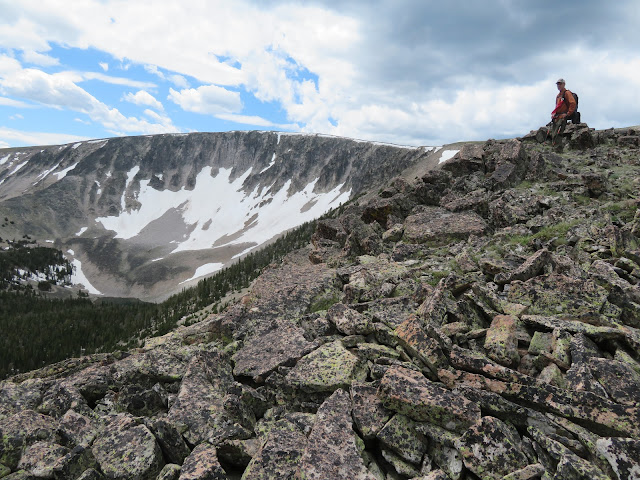
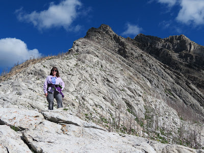
| The lupine bloom at Waterton Lakes (Canada) National Park. Mount Blakiston, the park's highest peak is in the background.Katie on Waterton's Crandell Mountain Bear's Hump |
After a long, cold spring, high summer has finally arrived.
In the past 10 days I did flower walks to Lewis and Clark Pass, Kings Hill Mountain, Rogers Pass, a long and hard traverse and climb of Big Baldy in the Little Belts and returned to Waterton for classic day hikes.
I'll take a pass
 |
| A sandhill crane in a field of Camus flowers on Alice Creek Road |
 |
| A real favorite, the Camas. |
On the way to Lewis and Clark Pass, just off the road, we encountered an exceptionally large Camas bloom, and wandering around in the meadow were five sandhill cranes. On the way out we spotted a cow moose in Alice Creek. The wind was gale force on the pass and nearly blew us off our feet.
 |
| The Jones Columbine bloom on Kings Hill Mountain |
Big Baldy traverse
 |
| Gordon Whirry on the Big Baldy Traverse above Twin Lakes |
Waterton, again
 |
| Katie on Bertha Lake trail with Waterton Lake in background |
 |
| The lupine field on Bellevue Trail |
 |
| Katie and her hiking buddy Linda at Bertha FallsKatie on the Sofa Falls trail |
We try to get out of Great Falls during the 4th of July celebrations because of the fireworks noise.
We've done Waterton Lakes National Park in Canada on a couple of occasions and chose it again this year. We had just been there and stayed at the Prince of Wales Lodge two weeks previously. Our digs this trip were less auspicious --- the Bear Mountain Motel in Waterton --- but very comfortable.
The weather was less than cooperative as it rained fairly hard two of the three days we were there.
Our Canadian friends Laura and Barry Webster, who ranch in Mountain View, Alberta, made sure we were entertained despite the rain. They took us for a wildflower drive up the Chief Mountain Highway toward the U.S. border where they pointed out more Lady Slipper orchids than I had ever seen in one bunch, bright orange Wood Lilies. Then they took us into the Castle Wildland Provincial Park just north of Waterton up Drywood Creek. I was amazed to see an enormous natural gas mining development along the road where sulphur is mined. It was begun by Shell Oil. The area looks like it could have been set near the Calumet Region steelmills where I grew up outside Chicago for its industrialization. It was very interesting to see as the land around it is mountainous wilderness and the development is so close to Waterton and Glacier. But for the work of conservationists on our side of the border, our similar oil and gas resources would have been developed and our Rocky Mountain Front industrialized. I would like to revisit this area in the fall to see the vast aspen covered hillsides ablaze in autumnal splendor.
The following day other of Katie's Canadian hiking friends decided to buck the weather and invited us to join them on a hike to Waterton's Bertha Lake (6.8 miles, 1,700 feet elevation gain and loss). We had done this before, but just after the 2017 Kenow Fire that burned three-quarters of the park. The vegetation in the park has responded like a lush jungle and the fire had cleared out trees that enhanced our views of this steep, narrow valley of waterfalls. It was a delightful hike with terffic company even if some of it was in clouds that had descended into the valley. By the end of the hike the clouds had cleared and we had great views of Waterton Lake.
In the evening we took a drive on the Red Rocks Highway and saw a cinnamon colored black bear on the prairie and reveled in the blue lupine/pink stick geranium bloom in the Bellevue Trail area. We vowed to return in the morning when there was good daylight.
The final day the skies cleared and we hiked up Crandell Mountain's Bear Hump (800 feet, .9 mile) for fabulous view of the lake and surrounding mountains.
Then, it was back to Bellevue where the lupine bloom knocked our eyes out. We had timed this perfectly once before in the past.
Finally, before heading out of the park, we returned to the Chief Mountain Highway and found the (unmarked) Sofa Mountain Falls Trailhead, and hiked a mile in and a mile out, not reaching the falls for fear that we might not make Carway before the border crossing closed for the day. We got the idea on this remote and sparsely used trail where we hiked through thimble berries as tall as we were. We'll return to the fall hike on another trip.


No comments:
Post a Comment