 |
| In the shale headed up to the ridgeline in the Snowies |
 |
| Katie coming out of the ice cave |
 |
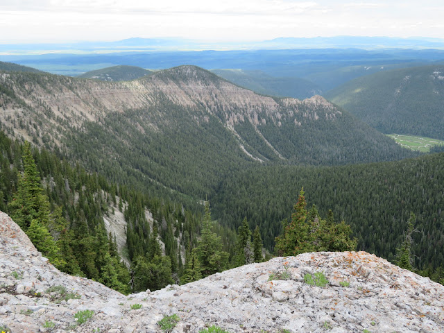
| We walked that ridgeline to the Grandview scenic point at its end |
 |
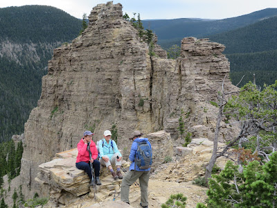
| At Grandview |
 |
| Katie at Grandview with Crystal Lake below |
 |
| Lots of these Lady Slipper orchids on this hike |
This past weekend we returned to two Montana Wilderness Study Areas: the Middle Fork of the Judith River and the Big Snowies, both Island Ranges located east of Great Falls.
These areas have been studied, but not designated by Congress as formal wilderness areas for more than 40 years.
They remain under attack mainly by Montana's Republican congressmen, in this instance particularly Sen. Steve Daines.
I can understand reservations to the Middle Fork designation (in-holdings and a road up the creek), but objections to the Big Snowies is incomprehensible.
Katie and I traveled to the Middle Fork's northwest edge Saturday up the Forest Service Road we refer to as "Cemetery Road" (FS3328) because there's a fenced grave just across U.S.89 from the Silvercrest winter recreation area. It's a bumpy 5 miles to the turnoff to FS251, and then another mile south to the (hard to find) Deer Point/Coyote Peak trailhead.
 |
| Shooting Stars galore at Big Deer Point trailhead |
I took this hike three years ago and it is about 2 miles to the top of Deer Point (8,050 feet) where there are terrific views into the Middle Fork backcountry, Yogo and Big Baldy mountains. The trail can be hard to follow in places because the Forest Service has tried to block off-road vehicles and motorcycles here. You'll have to work your way around barriers of dead timber and look for faint trail tracks. Eventually you should find the way to the top. The open field at the trailhead was ablaze with wildflowers, particularly purple Shooting Stars.
On Sunday we ventured to the Snowies in the center of Montana, where from the high point you can see into Canada to the north and all the way to the Wyoming border to the south. This is one of the three or four best hikes in Central Montana that starts at the Crystal Lake Campground west of Lewistown. This 10-mile loop goes up about 2,200 feet to the ridge line through thick forest and then open shale before coming out on top in an alpine tundra. This year it is especially green from all the rain and the late snow.
We did the full 10 mile loop that took us down a glorious ridge and past the Grandview scenic overlook and then down to the lake. There was a short detour to the Devil's Chute ice cave just off the trail, but it was too full of steep-pitched snow to venture in. Then, at the half-way point a trail comes in from Neil Creek to the south that leads to the main ice cave, which also had a pretty good snow drift and I decided that going in, but not down the drift to the floor of the cave wasn't for me. Katie and Susie Taleff went, though.
The highlight of the second half of this traverse is the descent down a narrow ridgeline that snakes to the Grandview scenic point that offers views of Crystal Lake and a panorama of the full traverse. After Grandview the last three miles consists of long switchbacks through timber until it drops to the lake. There is a confusing, unmarked trail junction just above the lake. Go to the left and look for another trail that goes to a trail just above the lake back to the campground and that trailhead.
Just as I always do Fairview, Patrol and Wright mountains every year, I'm going to add this traverse to my annual list as long as I am able.
No comments:
Post a Comment